
Friday June 12, 2026
As I begin a two-day backpacking stint, I face scorching heat and bugs. I prioritize cutting miles from tomorrow’s hike by staying on track until sunset.
Breakfast at Johns Hollow
FFor a change, I decided to have breakfast on the way to the Johns Hollow Shelter. The 0.7 miles were easy, but I found the shelter to be an ideal spot for bugs. I managed through breakfast, but once I got back on the trail and started sweating, they were relentless. I had learned my lesson two days earlier during the road hike: I needed to start carrying my bug net. I took it out of my bag and put it on. It was effective: a good solution to keep pesky bugs away while still maintaining the airflow I normally lose when I put on my hoodie. I was happy to be able to breathe without feeling like I was going to swallow a bug. The only problem was that beads of sweat tended to accumulate on the mesh. Since the bugs gave up quickly after discovering that they could pollinate me, or whatever they were trying to do, the bug net was able to come off fairly quickly. It is worth the few grams it weighs to scare away flying insects.
on the prowl
From the refuge I would continue climbing. Bluff Mountain is about 4,000 feet above sea level and I was looking at a climb of about 3,000 feet in the first 7 miles of today’s hike. It would be easier from there, just 1,600 feet of climbing over the next 11 miles, but that was a somewhat weak end to the day. Today I had my mind set on doing as many extra miles as I could. I wanted to get back to the van early tomorrow to spend some time in the city and work on the blog. Once I descended Bluff Mountain, I would be looking for good water sources and campsites nearby. So although my itinerary had me stopping at the Brown Mountain Creek Shelter for the night, I saw it more as a placeholder.
There was also the matter of 1.8 miles further north from the refuge to Route 60 that I would have to complete. Once again, my itinerary was safe and assigned those miles for tomorrow. Then I would have a lighter pack and have the benefit of simply needing to get back to the van, not needing time to set up camp. Although I was hot and a little fatigued, especially after all the climbing in the Blue Ridge Mountains yesterday, I was determined to make it at least the 3.6 miles round trip to Route 60 and camp at the shelter. But finding other camping options along the way would help encourage me to stretch even further today.
Climbing Bluff Mountain
It was over 80 degrees before 9:00 a.m. The climb seemed relentless. It wasn’t anything I hadn’t done before, but my legs weren’t at their strongest after yesterday’s equally big climb. The heat was the last straw and I was having a rough start to the day. The trail conditions weren’t too bad, except for a few steep sections that tested how much strength my leg muscles had. It wasn’t much, but it was enough.
The first views came from an overlook a few miles from the top of Bluff Mountain. The view was surreal. As always, the mountains stretched endlessly. It took me a moment to identify the mountains I had been climbing the previous few days. The air traffic tower gave away Apple Orchard Mountain. In the foreground I could make out Thunder Ridge and Highcock Knob. The fact that it was only 10-15 miles of nearly 800 trails made me realize how far I’ve come since I started in Georgia at the end of February.
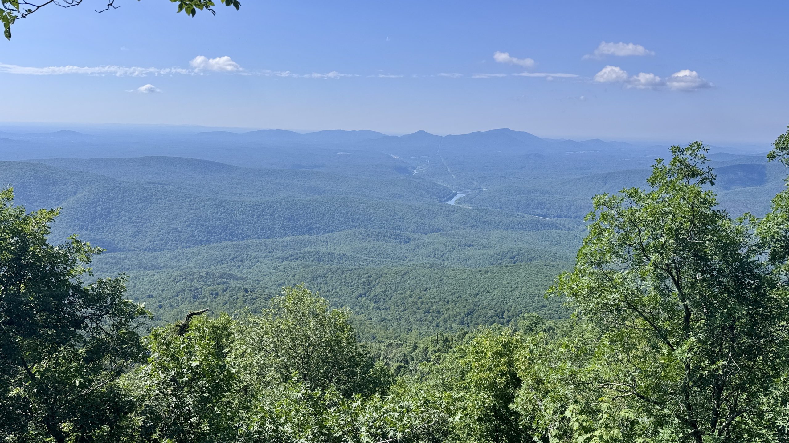
The climb up Bluff Mountain was less technical, but the heat was getting stronger. I knew I had to get to the top and then the rest of the day would be much easier. I poured out energy to continue moving along the path. At 11:30 he had done it. There was a dedication to a child under 5 years old who had left a school and apparently climbed the mountain and sadly died just a few steps from the top. Four concrete pillars were all that remained of a fire tower. There was a northwest view down to the valley far below that seemed like a good reward for the few hours of work required to reach the top.
View of the James River from the trail near the summit of Big Rocky Row.
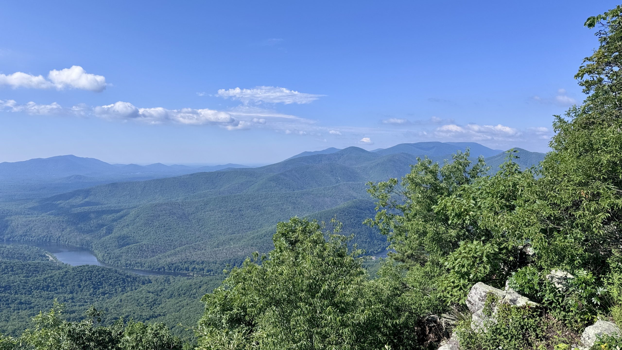
View of the James River, Thunder Ridge, and Apple Orchard Mountain from the trail near the summit of Big Rocky Row.
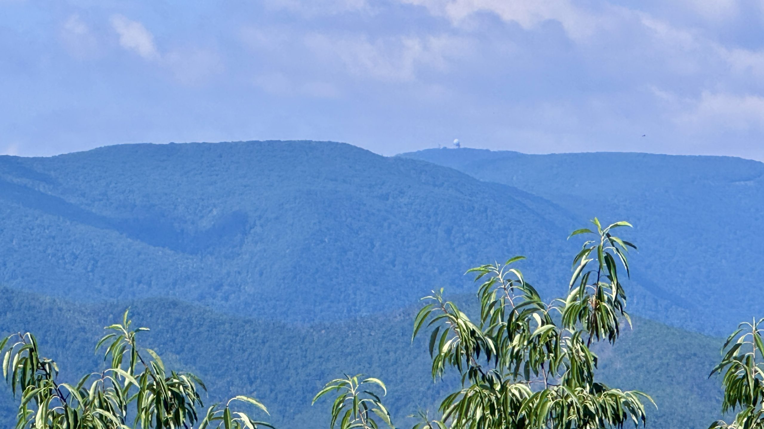
An expanded look at Apple Orchard Mountain. The spherical air traffic control tower is a clear indication.
View of the James River from the trail near the summit of Big Rocky Row.
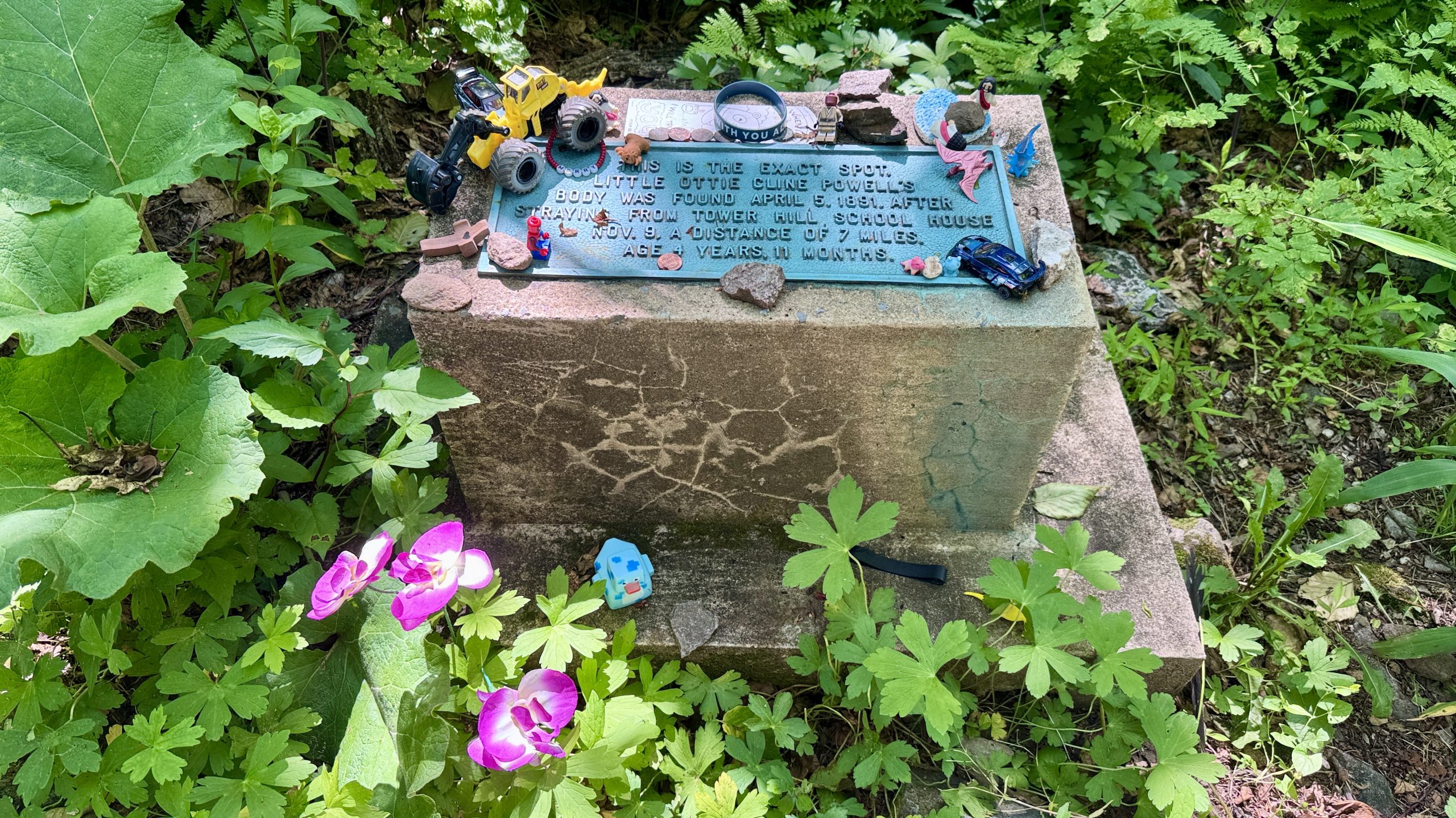
The dedication to Ollie Cline Powell.
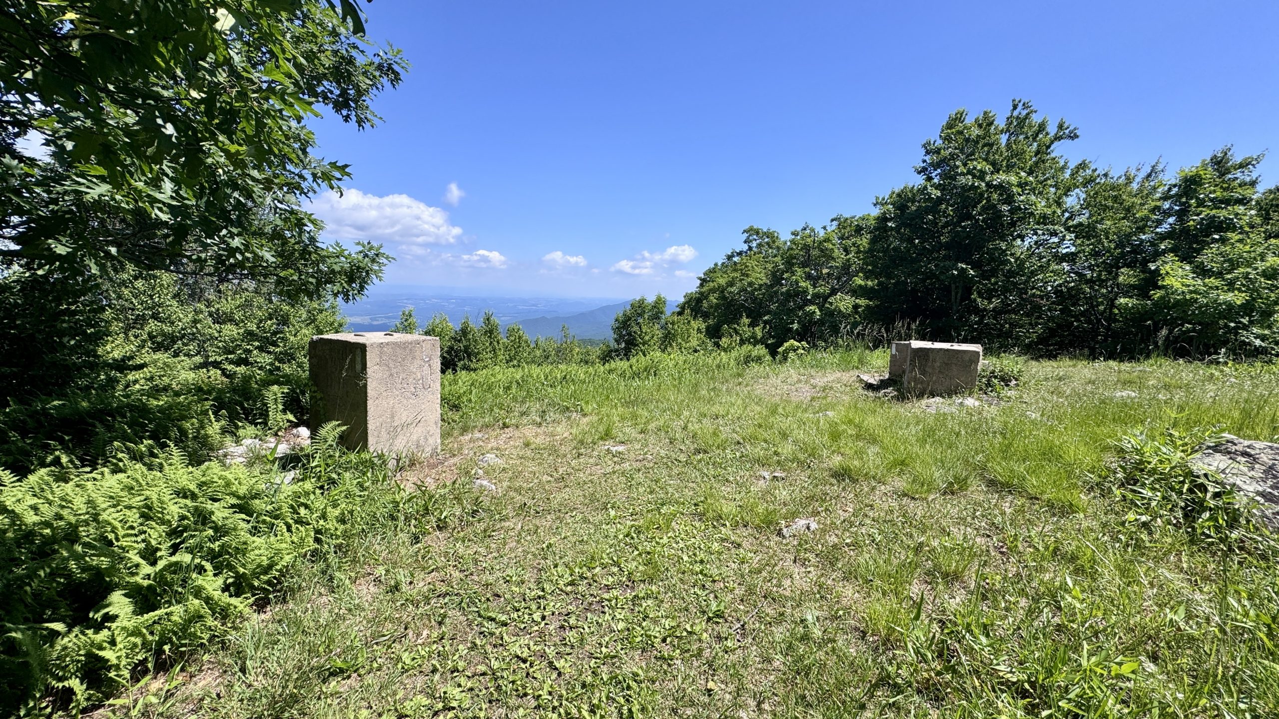
The summit of Bluff Mountain.
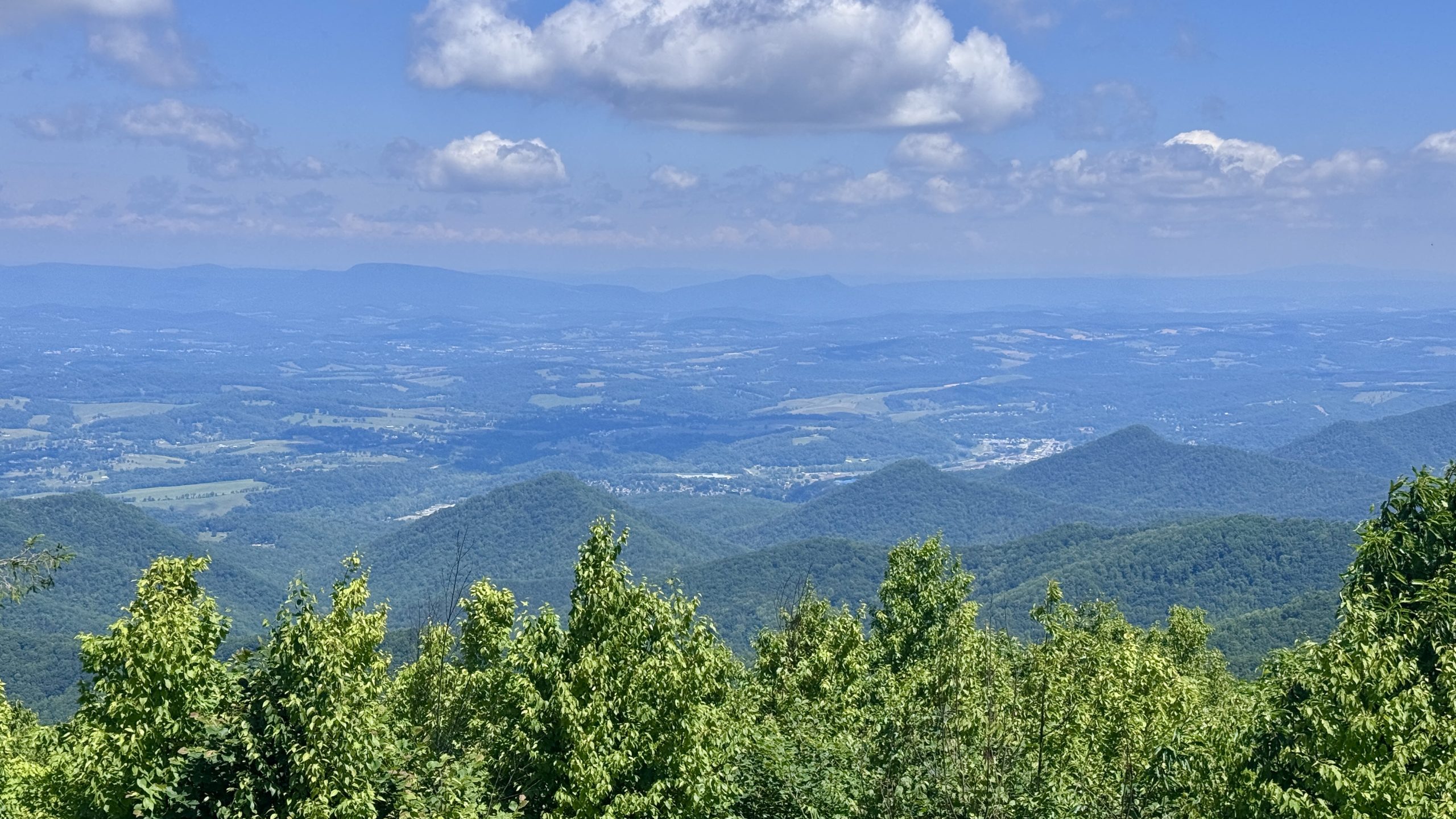
The view from Bluff Mountain.
Exploring the campsites
With the climb behind me, my attention turned to descending the mountain and finding campsites. A few miles later came my first opportunity to explore a potential campsite. There was water at a gravel road junction and at a small campsite just off the trail. It would work well in a pinch. Logistically, I would put myself at the base of Bluff Mountain. An ideal place to start walking tomorrow, as it will be cooler early in the morning. It would also be only an 11 mile hike back to the van. However, going to Route 60 and returning to this campground would add more than 30 miles today. It probably wouldn’t be possible in the heat, and if it was, it would probably mean a bit of a night walk.
I took a short break from exploring campgrounds to explore the 800 mile marker. For once I was on top and was able to catch it on my first pass.
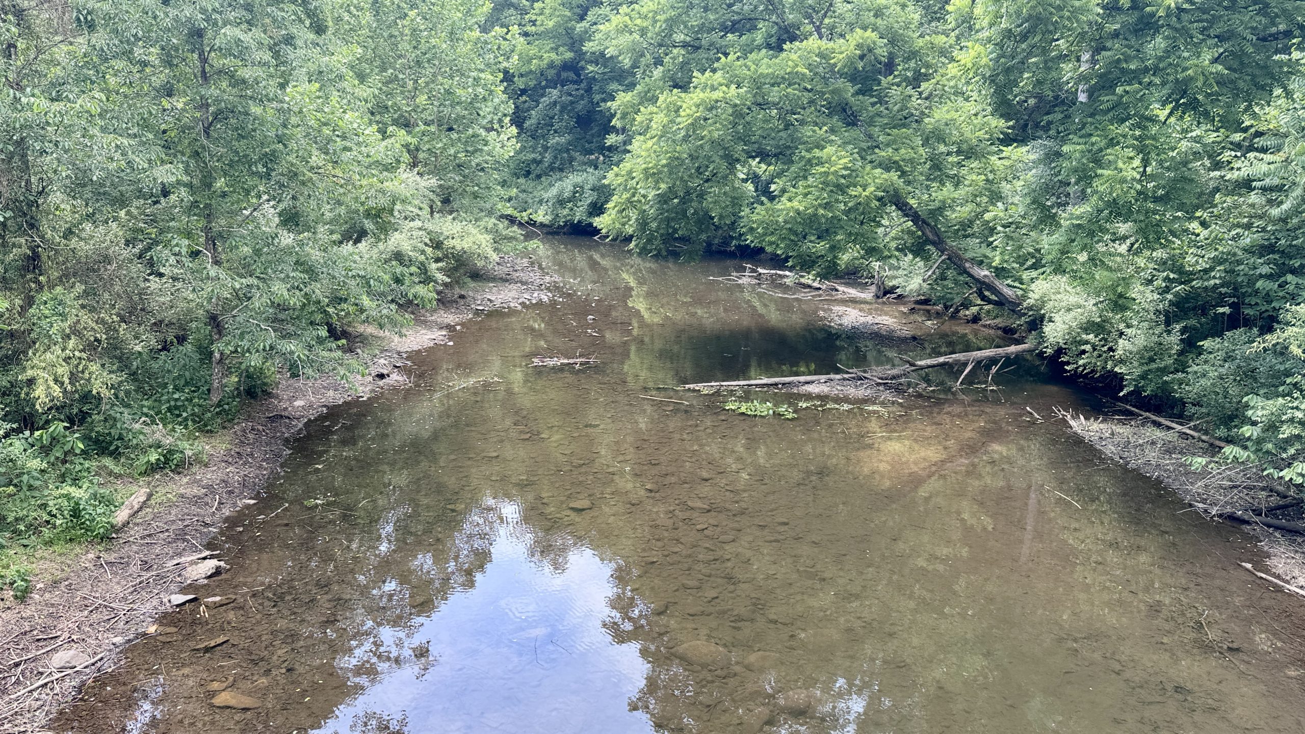
There were several campsites on this section of the trail, but none had access to water. When I got to Reservoir Road there was also lots of water The Pedlar River was wide and stagnant, not ideal for filtering. But I could hear the water moving nearby and found a stream feeding the river. I filtered water and sat under the Pedlar river bridge. Soon after I found some places to camp; this would be a good option. Close to the water, about 14 miles back to the van, but it would be near the upper limit of my walking ability with about 28 miles total for today.
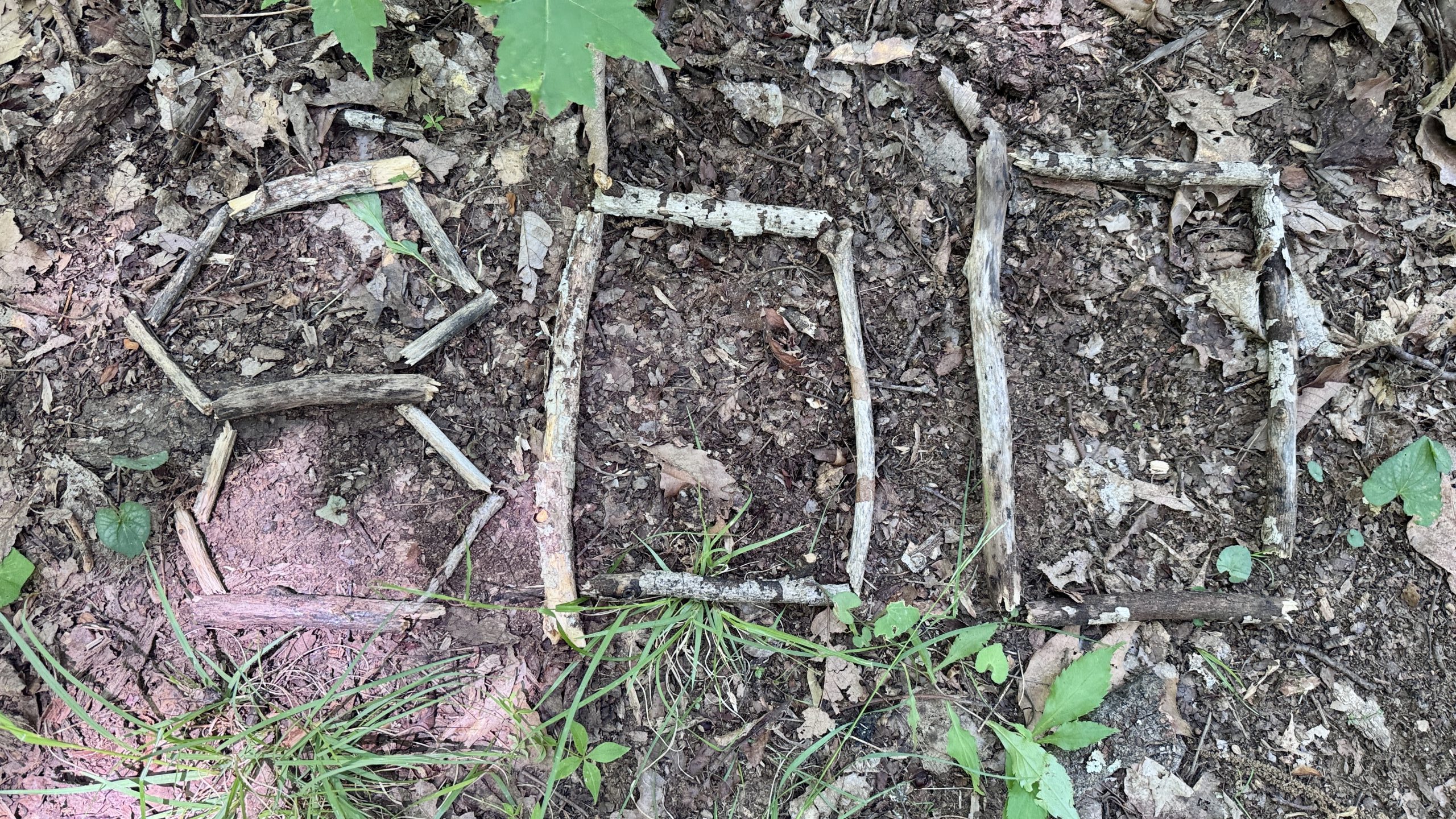
The 800 mile marker.
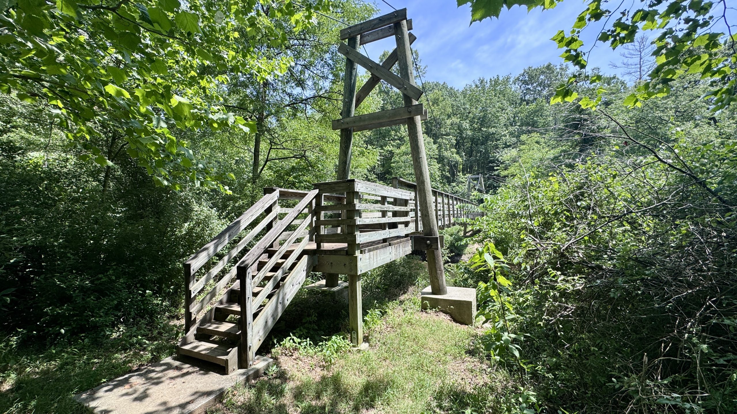
The Pedlar River suspension bridge.
The Buhonero River.
Hard navigation
The next 5 miles of trail were relatively flat, but I didn’t enjoy them much simply because of the unrelenting heat. When I got to the Brown Mountain shelter they beat me. Broken Thumbs and Stix the border collie were there having dinner. I could barely converse as I refilled my water. Stix brought me several sticks and waited patiently for me or Broken Thumbs to start playing fetch, but we were too hot and needed to conserve our energy to walk. The short break had actually done me some good, although something else was helping: the clouds had appeared. I walked to Route 60 noticing the growing darkness of the clouds. On the way I checked the forecast and saw that it would rain in 22 minutes, supposedly lasting an hour. The precipitation map showed a strong storm front approaching. It looked like another storm would hit us.
22 minutes was not enough to cover the 1.8 miles back to the shelter. I was hoping that the forecast data was for a point, a town called Amherst, that might be a few miles closer to the front of the storm, which would buy me some time. I started walking down the trail and soon the wind picked up. I put on my poncho in anticipation of the rain. It started to go down but not much. My concern in some ways was trying to keep my shoes and tent dry. I arrived at the shelter just as the rain curiously stopped. I filtered more water and prepared to hunker down and wait out the storm. I had dinner and checked the forecast. It was still showing a 100% chance of rain at 7:00 pm 7:00 passed and the rain stopped. I started to feel like I should start walking. The brief rain had at least relieved the heat, it was noticeably cooler.
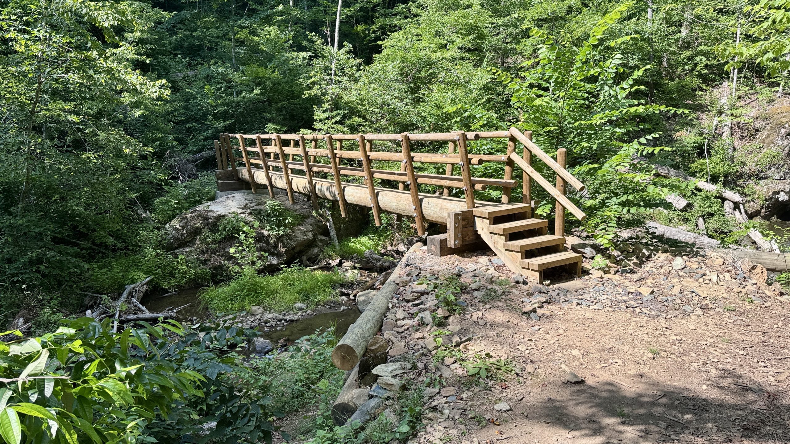
A bridge crossing Brown Mountain Creek.
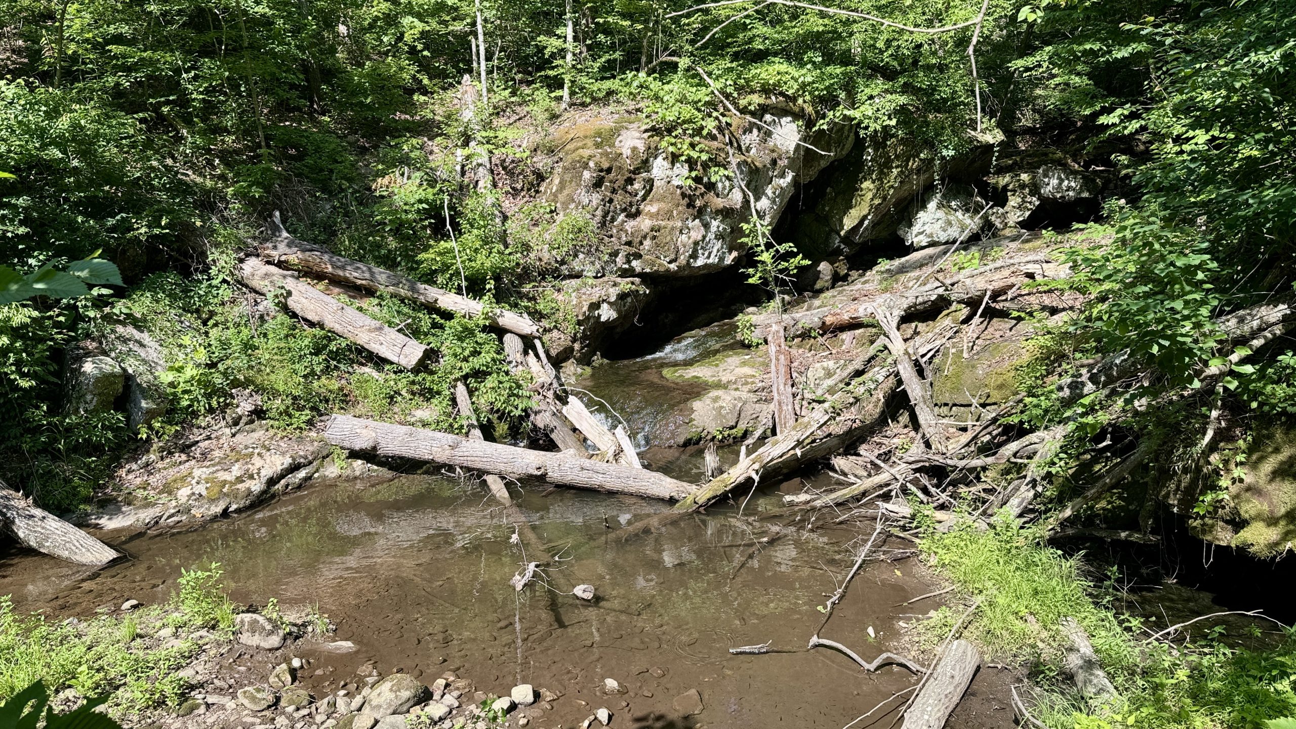
A small waterfall from Brown Mountain Creek.
Overtime walk
I left the shelter with my sights set on returning to the camp at the Pedlar River Bridge. It was almost 9:00 pm when I got to the river, so today was turning into a marathon. With the cooler temperatures, the hike was much more enjoyable than it was a few hours ago. I was cruising but intensely focused on the trail. I was using all the energy I had to keep my pace up. Once the sun set, the sky lit up a beautiful orange-red color. At times color flowed across the trail, highlighting the brown and yellow leaves and red pine needles.
As I approached the camp, the sky darkened. I had moved my headlamp from its usual spot in my bear can to the pocket of my shoulder strap. It was light enough that I didn’t need it until I walked the short trail toward camp. I set up about 12 feet above the Pedlar River and crawled into my tent. Taking off my shoes was an immense relief. The sounds of the nearby river added a nice atmosphere. I started with my tent tarp closed but it was still warm and emanating heat from the hike. I reeled in the fly and enjoyed some fresh air through the inner mesh of my tent. I was interested to see how my summer quilt performed compared to my winter quilt, but maybe I wouldn’t even need it tonight since I was still warm just lying outside. I had prepared well for tomorrow, the place was 22 kilometers from the van. You should consider returning to the van early in the afternoon and giving yourself plenty of time in the city.
-See you tomorrow
| Leg | Begin | Mile | End | Mile | Ascent | Decline | Address |
|---|---|---|---|---|---|---|---|
| 1 | Route 812 | 789.1 | US Route 60 | 809.9 | 5,715 | 4,494 | NOBO |
| 2 | US Route 60 | 809.9 | Reservoir road | 803.0 | 582 | 1,682 | THE ROOM |
Total: 27.7 miles, 60,739 steps
- Hike type: Backpacking
- Camp: tent, road to the reservoir
This website contains affiliate links, which means The Trek may receive a percentage of any products or services you purchase using links in articles or advertisements. The buyer pays the same price they would otherwise pay, and their purchase helps support The Trek’s ongoing goal of bringing you quality backpacking information and advice. Thank you for your support!
For more information, visit the About page of this site.


