
Monday June 15, 2026
Day 100 marks the start of a 4-day backpacking season with a steep climb up Bald Knob. Fortunately, the weather improved and the trail offers some incredible views.
Car Camping on the AT
hHopes of troubleshooting my warm minivan were dashed when my new battery-powered fan did little to control the temperature. I couldn’t fall asleep anyway, so I didn’t feel miserable, just a little disappointed. I think the entire mass, a mattress, equipment, moldings, etc. It retains heat, so although I can cool down quickly with the air conditioning on, the vehicle heats up quickly once I turn it off. I woke up early, but that was less because I had gotten a good night’s sleep and more because the traffic flowing up and down Route 60 started fairly early on Monday. About 5:30 am early. That’s the price you pay for car camping. I’ll gladly accept calls to wake up early if it means having a comfortable mattress a few nights a week.
Although the heat was intense last night, it was cool this morning. Once I got outside, the temperature was confirmed to be between 60 and 65 degrees. I skipped breakfast, still full of food from the previous day’s banquet. Today’s hike was a 2000 foot climb from the start. About 18 miles of climbs and descents between 3,200 and 4,000 feet above sea level followed. At the end of the ups and downs was a 4 mile, 3000 foot descent to my planned overnight camping spot along the River Tye.
There are no elevators here
I was glad to have mild temperatures for the initial climb. Last Friday it was boiling hot before 9:00 am. It was downright comforting to be on the road. Days like this won’t happen often over the next couple of months, so I made sure to enjoy the miles. My body and feet felt great, although my calves had become very tight after using them sparingly for most of the last 48 hours. It took them almost an hour to warm up, but once they did everything was fine.
The free time seemed to do wonders for my leg muscles. Although I carried three days’ worth of food in my bear can, as well as my 20,000 mAh power bank, my backpack felt easier to carry and safer than Saturday without food.
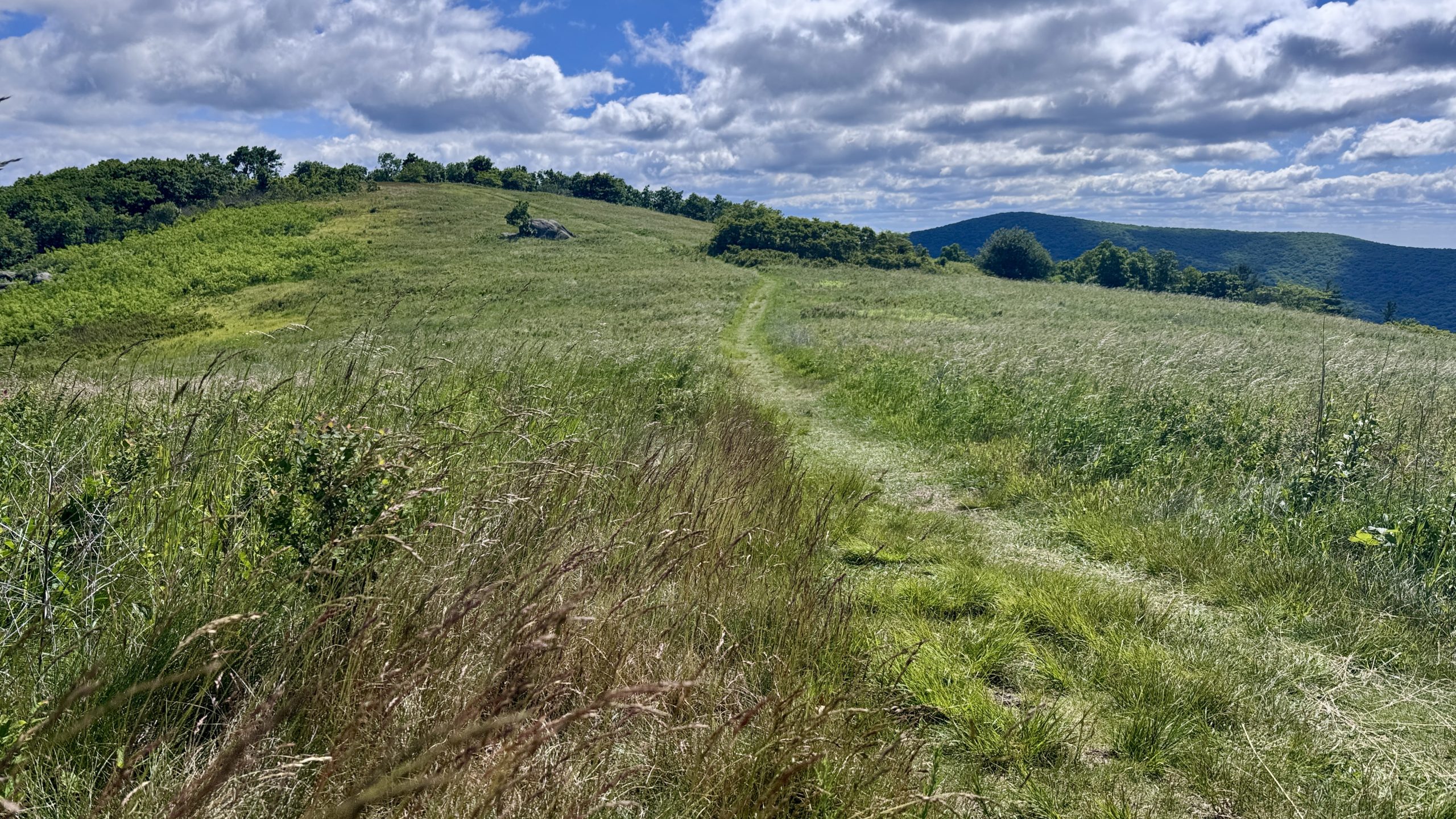
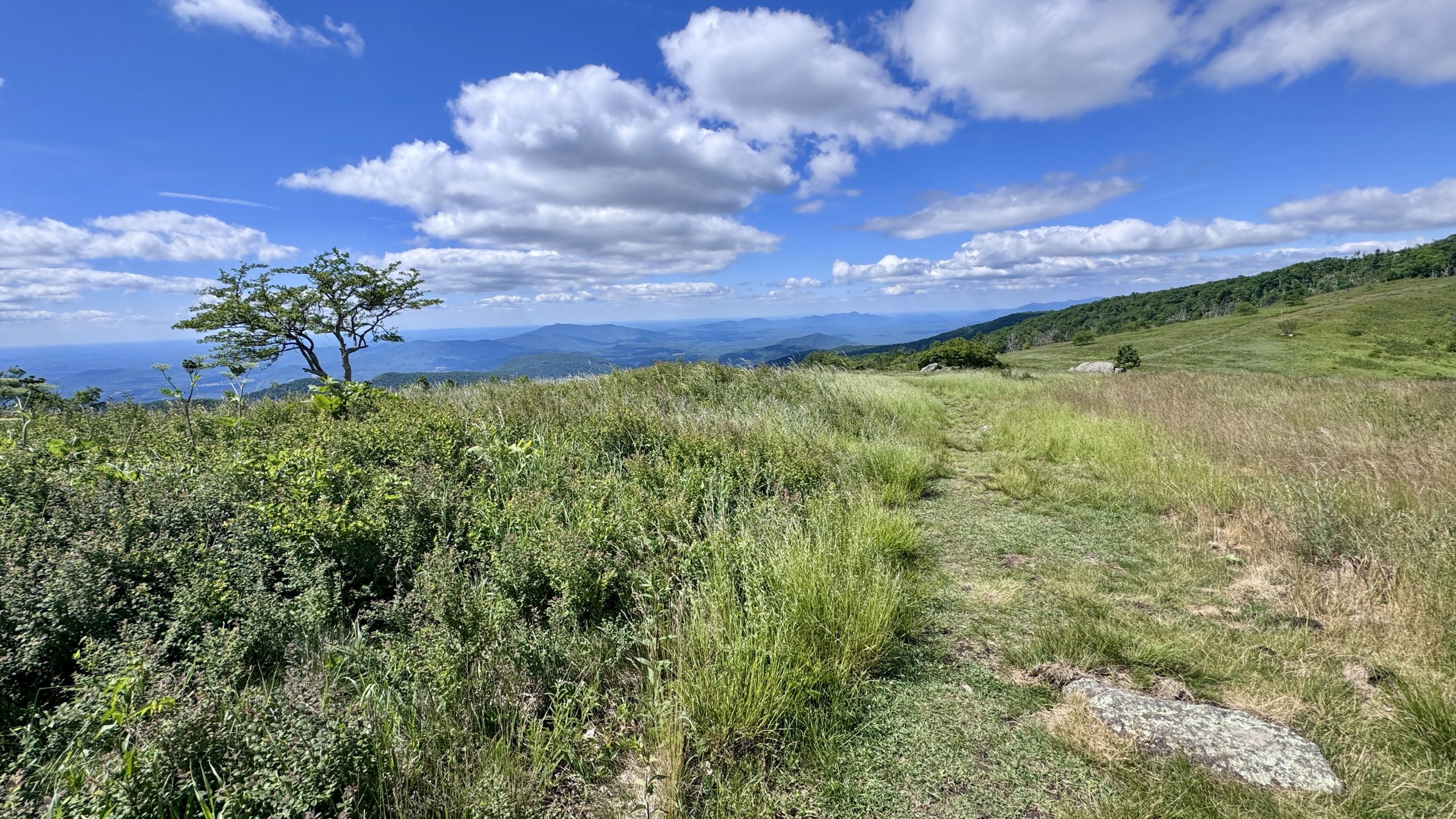
high meadow
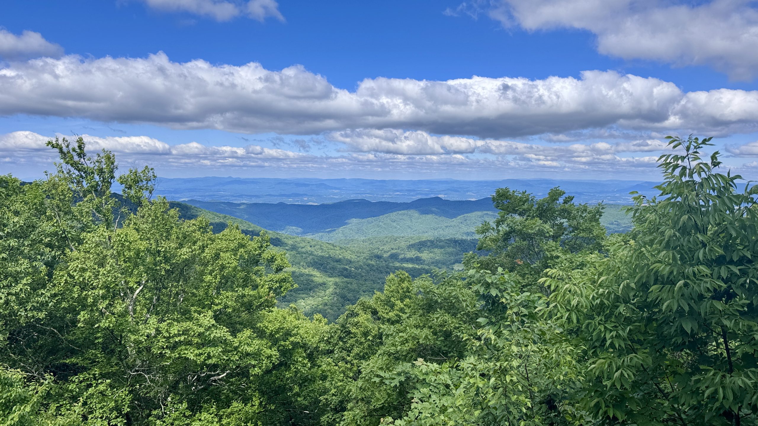
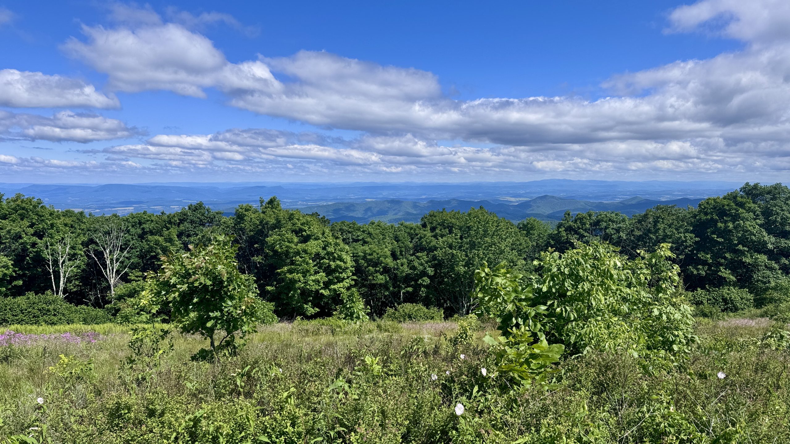
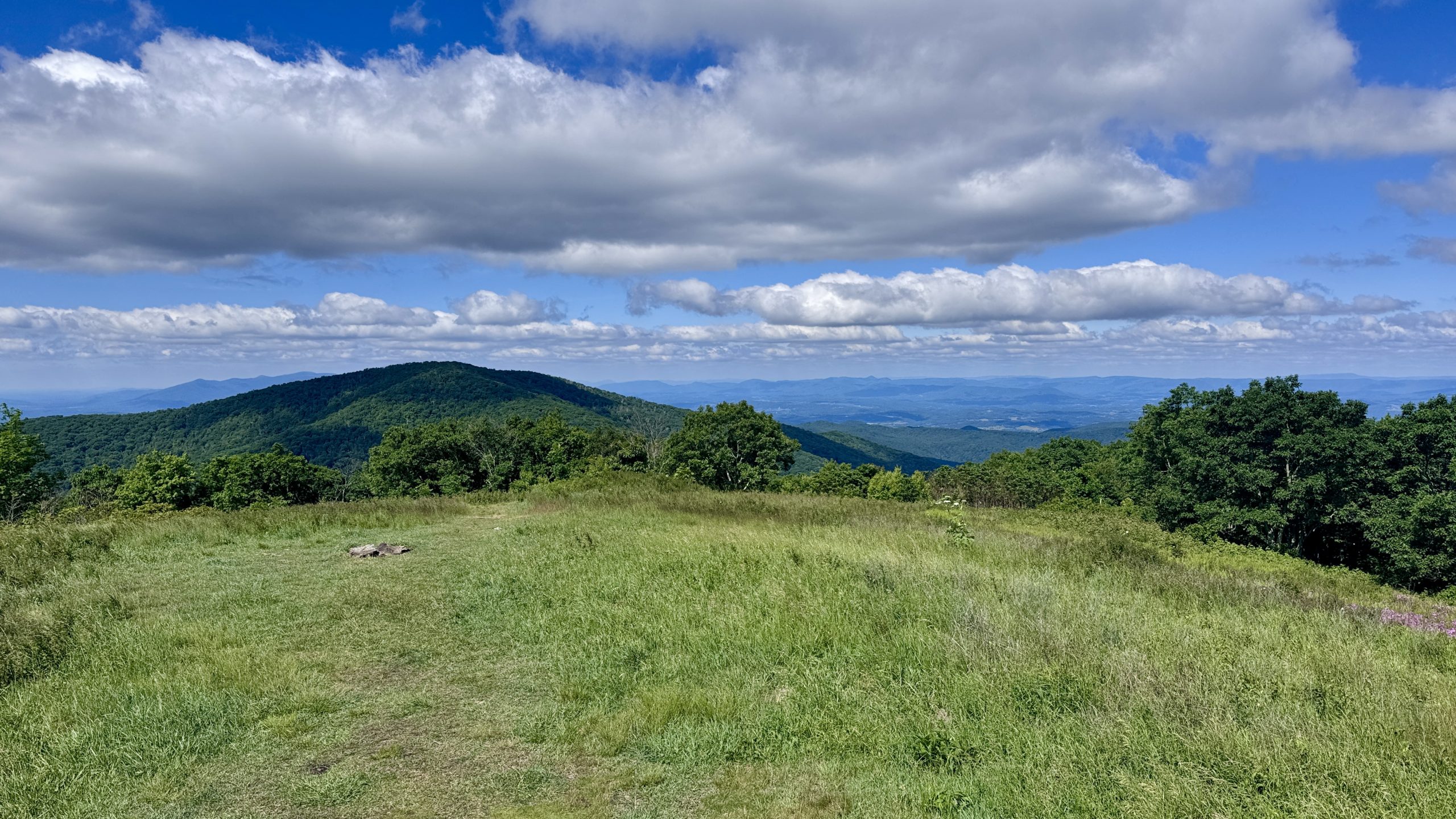
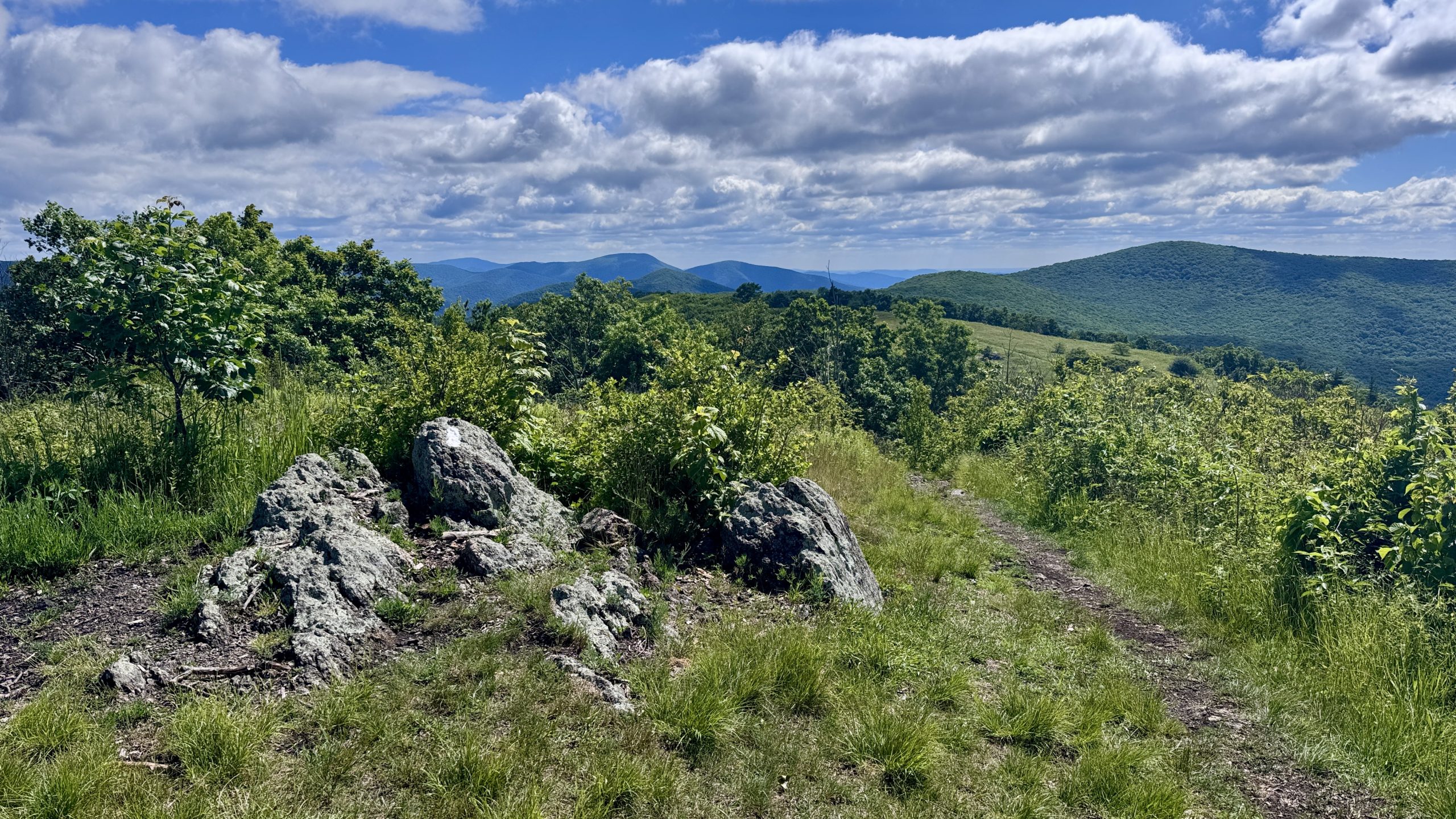
The summit of Bald Knob reminded me a little of Bluff Mountain. There were many trees at the top and there were better views on the way than on the top of the mountain. The trail then descended to Cow Camp Gap and then began to climb Cole Mountain. Again, it initially looked like the views would be better below the summit, which was packed with trees and some large rocks. However, north of the summit, the trail opened up to a meadow with expansive views to the northwest and southeast. Combined with the mild temperatures and gentle summer breezes, it felt like walking through Nirvana. The scene reminded me of the Grayson and Roan Highland trail areas, hundreds of miles to the south. Come to think of it, it had been a fairly long stretch of trail with limited views.
Fugitive, a hiker I had met earlier at the top of Bluff Mountain and a veteran of the Pacific Crest Trail, was admiring the views from Cole Mountain. We agreed that it was a perfect day for hiking and were glad to have views as we hiked.
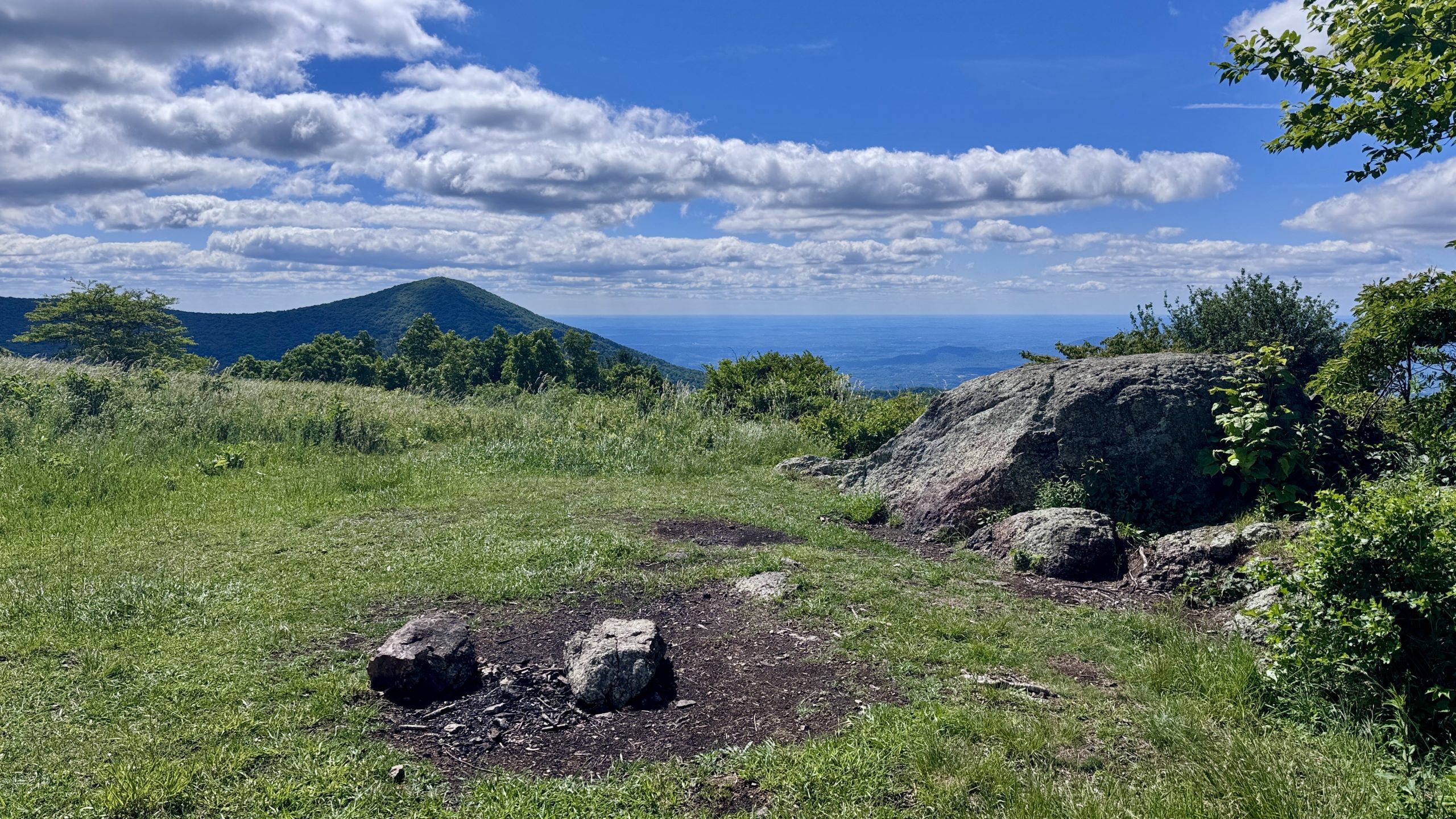
View from near the summit of Bald Knob.
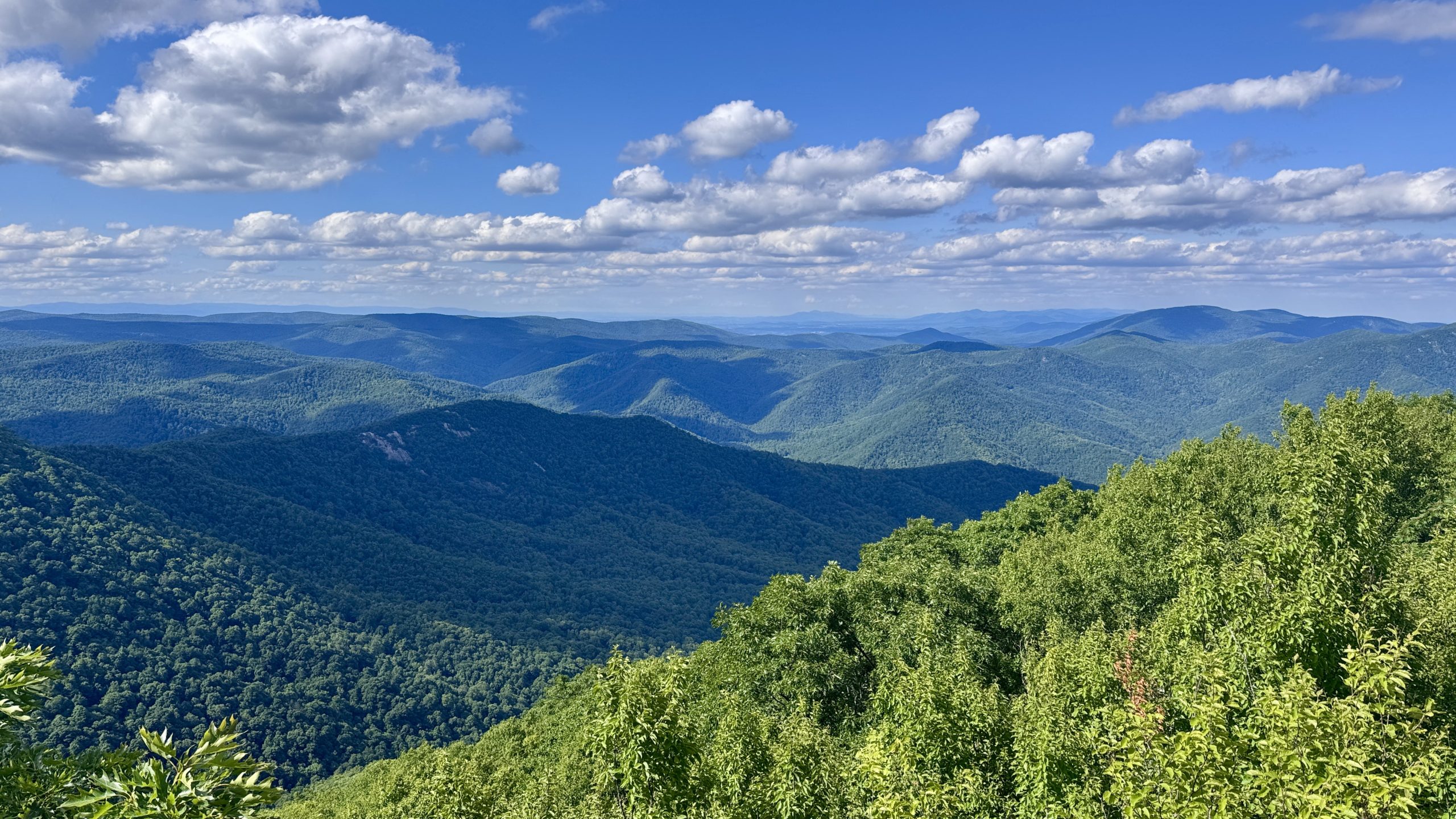
View from the trail along Cole Mountain.
View from the trail along Cole Mountain.
View from the trail along Cole Mountain.

View from the trail along Cole Mountain.
View from the trail along Cole Mountain.
View from the trail along Cole Mountain.
View from the trail along Cole Mountain.
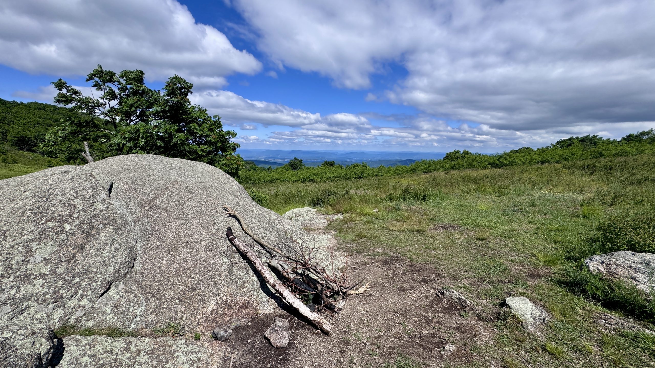
View from the trail along Cole Mountain.
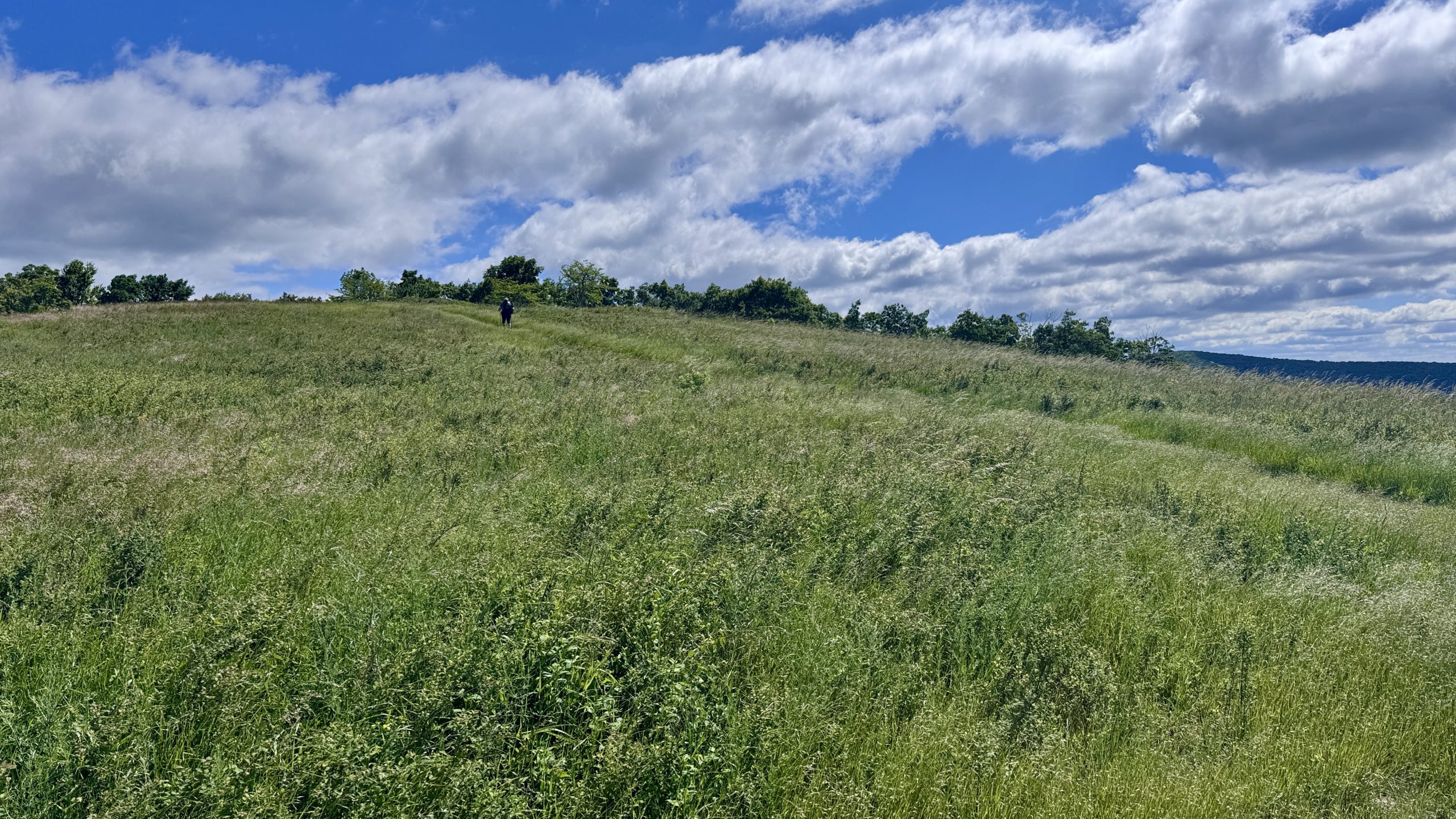
The fugitive heads up the Cole Mountain trail.
View from the trail along Cole Mountain.

See you tomorrow appreciate the scenery and great hiking weather at Cole Mountain.

View from the trail along Cole Mountain.
the priest
The meadow section only lasted a few hundred meters before the trail headed into the forest. It was not a notable stretch of trail. It was rocky but not too terrible for my ankles. There were groves of ferns. The next viewpoint wasn’t until mile 20.9 from the top of The Priest, a mountain that towers above most of the area. The rocky ledges had a stunning view to the west, but I still had a few more kilometers to walk, luckily I had reached my final descent to the River Tye.
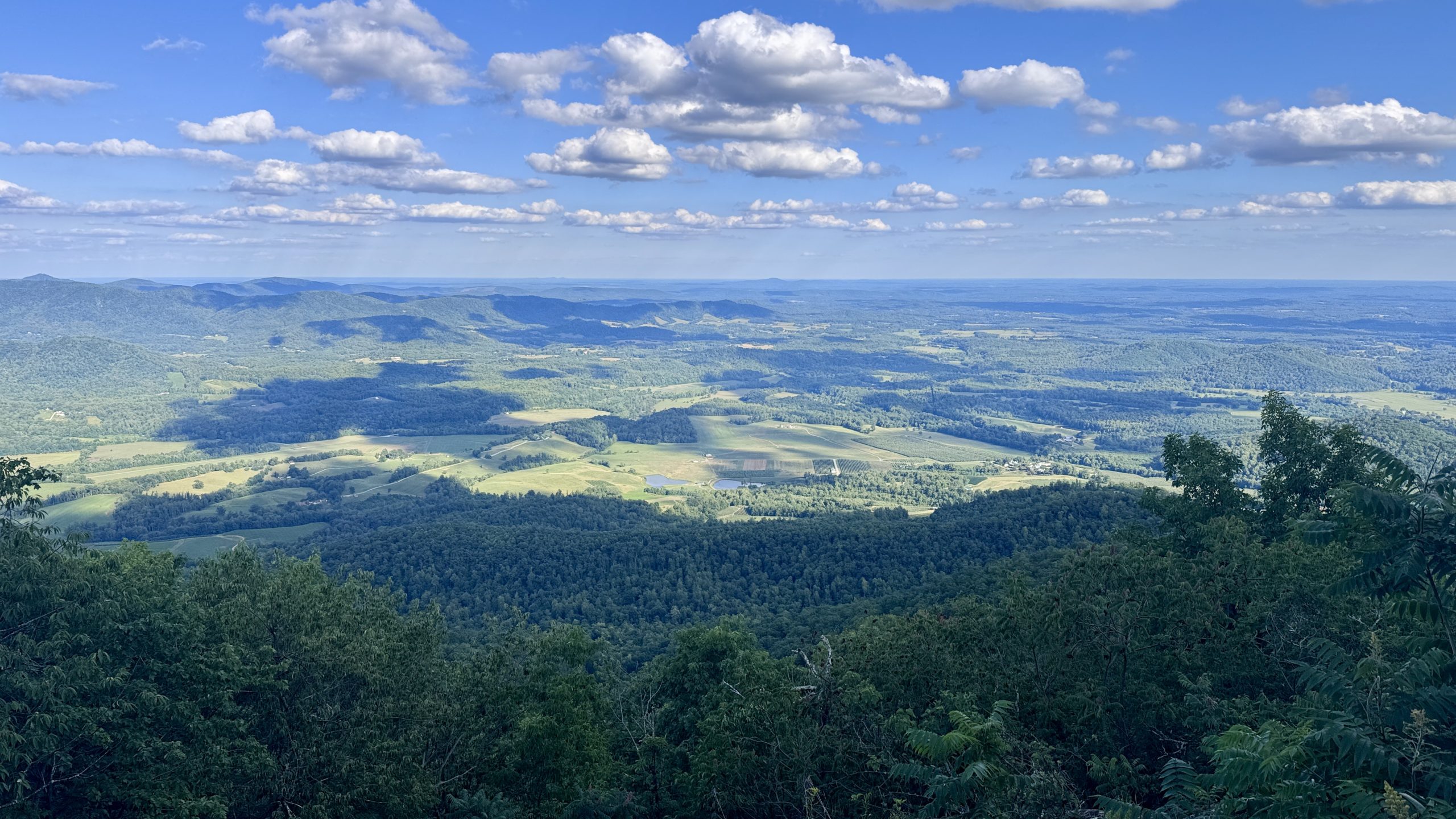
However, before reaching Tye, there was another overlook along the trail that I fell in love with. I love seeing the busy farms and cars driving by from the top of the trail. This lookout had that in abundance. Beyond the valley, you could see as far east as your eyes would allow. It was a good place for a momentary rest to protect my knees during the 4.5 mile descent.

A flat, cruising section of the AT.
View from the trail near The Priest.
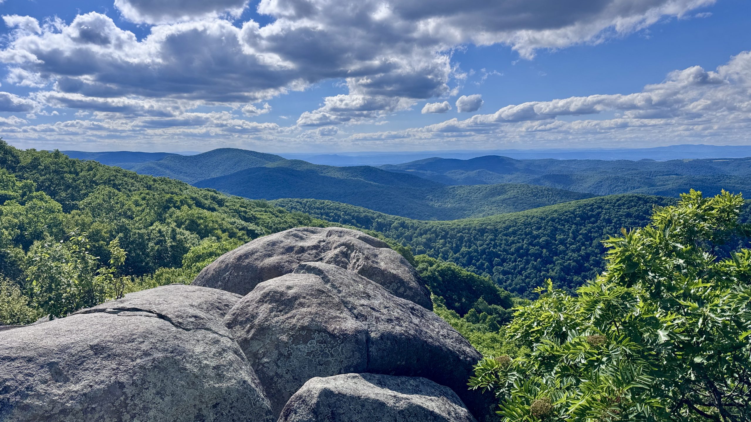
View from the trail near The Priest.
View from the trail near The Priest.
Toe problem
Last week I wrote about a blister on the pinky toe of my left foot. I thought I had addressed it on the Saturday after my shower in Glasgow, but it was bothering me again. I take some of the blame because I’d rather not buy finger guards that cost a pretty penny. I don’t like the idea of extra material making my feet warmer than wool socks. I understand the logic of spending money to keep your feet happy on the trail, and from what I’ve heard from other hikers, toe protectors seem to be effective.
My problem is that I have had 3 blisters in 1,600 miles. The first two were my feet acclimating to my Topo shoes. They weren’t horrible and now my feet are well adapted to those shoes and I was fine until I switched to the Altras. Even though these shoes have a wide toe box, I feel like my left toe curls slightly when I walk. It could be my imagination and even the swelling of the blister. My right pinky toe, and all the other toes on my feet, are absolutely fine. Why is one toe struggling with a big blister that lasts for days when everyone else is happy?
I was hoping to fix the problem, but the fact that it was bothering me again after doing the same thing on Friday and Saturday prompted an inspection 20 miles into the day at The Priest’s ledges. Sure enough, a similar looking blister had appeared. First aid arrived and an unpleasant procedure.
I immediately regretted it, now my toe was just itchy. He had chosen the worst possible moment, just before a long descent. All the emphasis falls on the forefoot and toes to contain my weight as I move down the trail. He was descending with a slight limp, trying to keep his weight off his little toe. It wasn’t easy and I alternated between keeping most of the weight but still feeling a stinging sensation and not being able to unload the finger and have it take its normal weight load. I went through the list of things I should have done, but I don’t think applying a blister pad would have been feasible given the location of the blister on the tip of the toe. I’ve been wearing laces with a heel lock since I started wearing the Topo shoes. If it were a shoe fit issue, I would think the other foot would have issues as well. For now I’m going to keep walking with him and see if he heals and stops.
The Tye River
Once I finished limping down The Priest, I came to another impressive suspension bridge, I had reached the River Tye. The bridge bounced up and down as I crossed it. The river was shallow and rocky, but the fish were having fun with the current. On the other side of the bridge I saw Open Mind and Not Yet, both hikers I had seen several times in the past few days. It was almost 8:00 pm. I had walked a full day and was ready to rest as soon as possible. I found a small tent a short distance from theirs, just a few meters from the river. Definitely one of my most interesting campaign sites so far. I would have the river flowing in the background all night. I figured I should get a little more sleep after being a bit let down last night, plus the 25 miles I had ridden. Tomorrow would be a relatively short 21 mile day that I was looking forward to.

The Tye River.
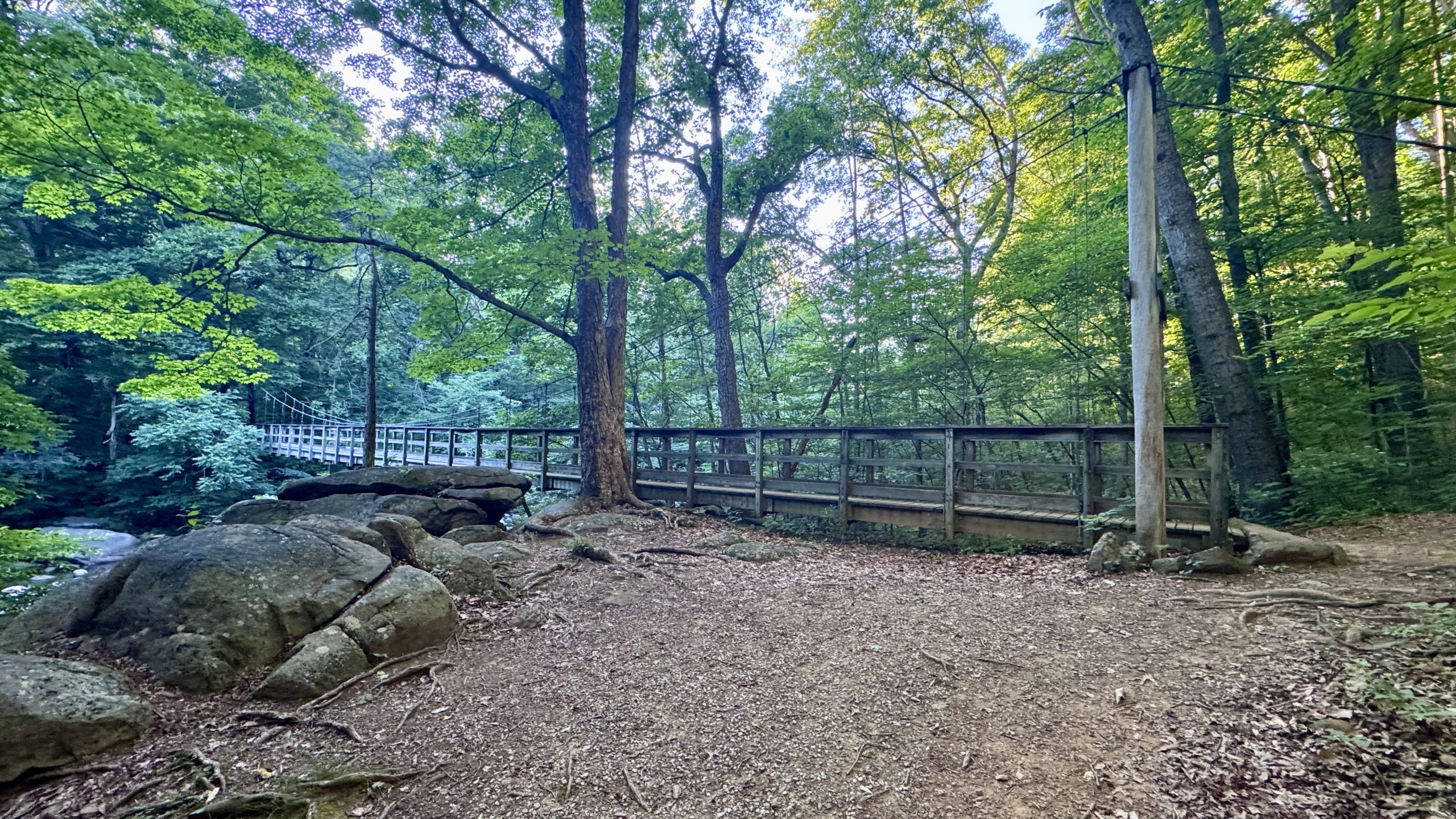
The suspension bridge over the River Tye.
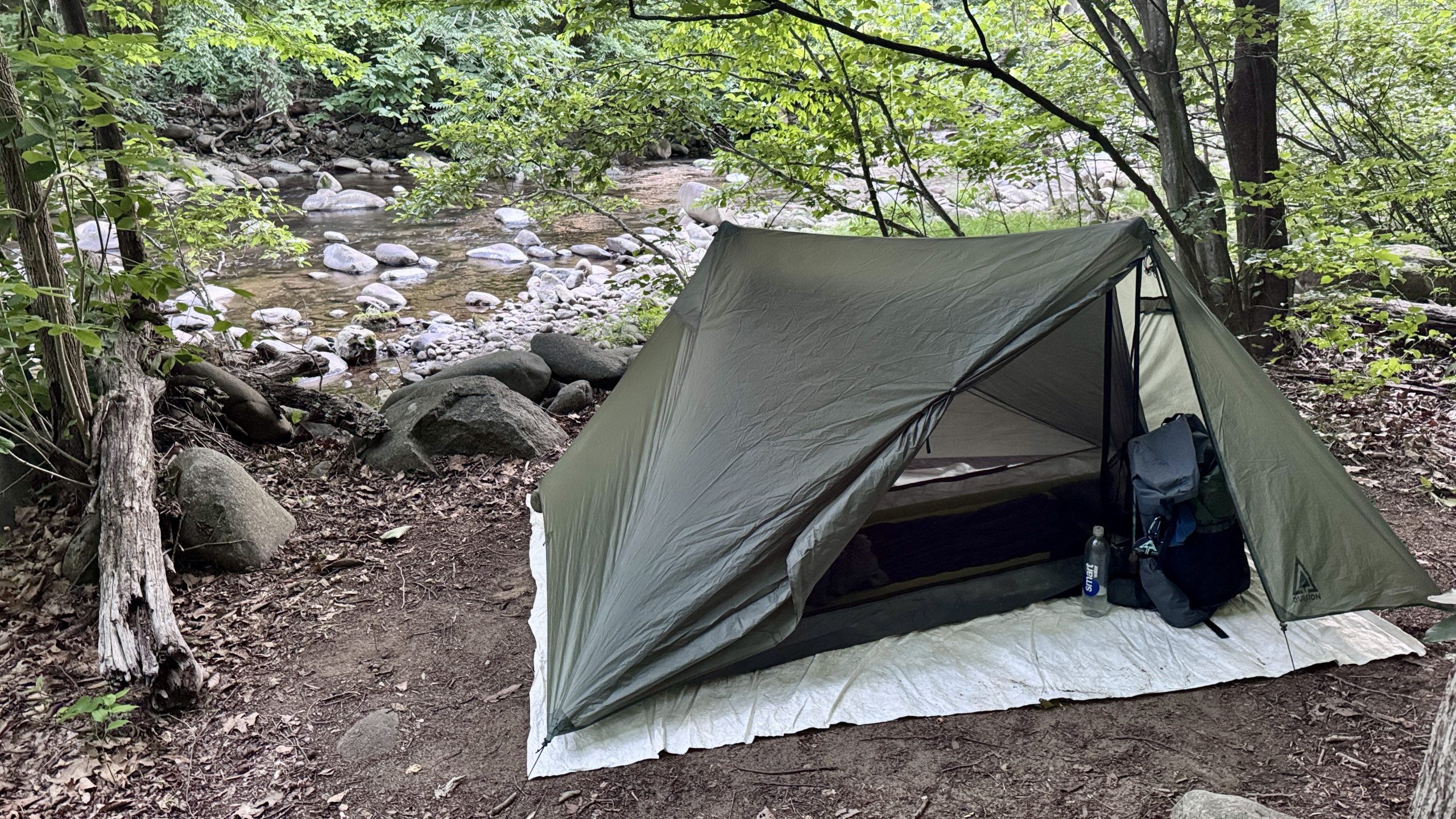
My tent was pitched along the bank of the River Tye.
-See you tomorrow
| Leg | Begin | Mile | End | Mile | Ascent | Decline | Address |
|---|---|---|---|---|---|---|---|
| 1 | US Route 60 | 809.9 | Tye River | 835.3 | 5,976 | 7,111 | NOBO |
Total: 25.4 miles, 57,124 steps
- Hike type: Backpacking
- Camp: Tent, Tye River
This website contains affiliate links, which means The Trek may receive a percentage of any products or services you purchase using links in articles or advertisements. The buyer pays the same price they would otherwise pay, and their purchase helps support The Trek’s ongoing goal of bringing you quality backpacking information and advice. Thank you for your support!
For more information, visit the About page of this site.

:max_bytes(150000):strip_icc():format(jpeg)/Mariah-the-Scientist-tout61726-448f8d2a6ba94ef3876c147c2ce183cc.jpg?w=238&resize=238,178&ssl=1 "Mariah the Scientist habla sobre ‘Cutthroat Love’, ‘Hearts Sold Separated’ y sus nominaciones a los premios BET 2026 (exclusivo)")


:max_bytes(150000):strip_icc():format(jpeg)/Mariah-the-Scientist-tout61726-448f8d2a6ba94ef3876c147c2ce183cc.jpg?w=100&resize=100,75&ssl=1 "Mariah the Scientist habla sobre ‘Cutthroat Love’, ‘Hearts Sold Separated’ y sus nominaciones a los premios BET 2026 (exclusivo)")


