
Day 3 – August 10 – 21 Miles
Mile 505.6 -> 531.4
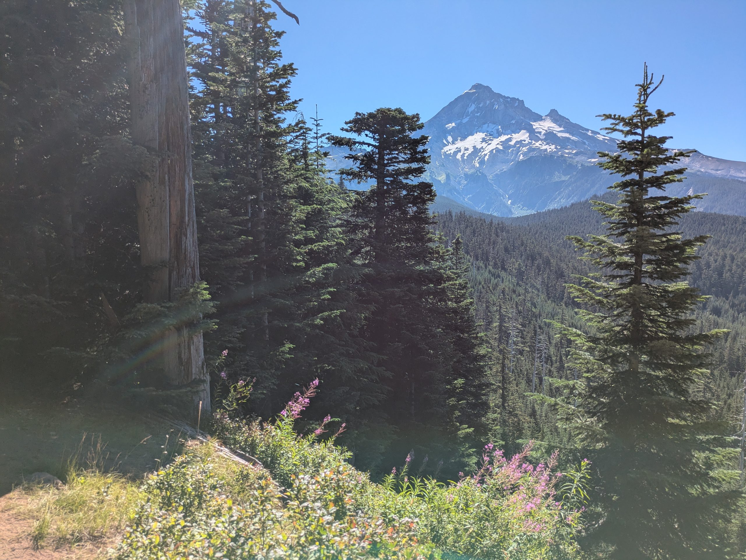
I woke up around 7 am at the Cascade Locks hotel, Emma was already usual and preparing myself. Her parents stayed with us, so she went with them for breakfast in the same coffee we went yesterday while I finished packing for approximately half an hour, and then left the keys and addressed them eating my chimichanga that I get yesterday at Walmart for breakfast. We left at 8 am to the alternative we were going to take in the morning. This alternative is found on the Eagle Creek path that is carried along the absolutely impressive Eagle Creek, as well as through Tunnel Falls, an iconic oregon milestone. We listen to most hikers that this was the way to follow! However, what we did not realize was that the first miles were just along the road (although on a good path) and we could have been driven there. Oh good. But we arrived at Eagle Creek around 9 am, we walked a few miles, and then Emma’s parents who had been walking along with us turned to return. And then he really began to warm up. It was a slightly inclined rise, quite easy, during the first 10 miles more or less, but I think it reached around 95 degrees and there were no clouds at all. So we stopped for lunch earlier than planned, around 12 pm to a very pleasant part of the stream with natural pools and soft rocks. We stayed there for an hour trying to stay in the shade, and I got into the water, which felt great. Then, as the path continued (all today, of varying degrees, because we had to get up and leave the cascade locks that were around sea level) and we passed through a small area of burns and some very exposed areas. At this point it was having a very bad time. I had received water at lunch, but I drank a lot very fast, so it was working quite low without access to get more for many miles. In the small shadow patches available, I stopped and took a break, cleaning the dripping sweat of my face and constantly checking the map. Then I arrived at a cross around 3 pm, where I had to take a stimulus trace (Indian springs) to return to the PCT that was 2 miles and 2000 feet of elevation gain. If you don’t know, 1000 feet of gain in more than one mile is a lot. At most. Very steep. Those 2 miles took me about 2 hours because I was really going through it. Finally, however, I returned to the real path and continued to our place agreed in the camp, obtaining the sight of Mount Hood along the way. I arrived there just before 8 pm, where Emma was installed along with 4 other hikers (Northbounders). This was the last thing I arrived at the camp to this point, which is a bit wild. I saw the sunset while I quickly prepared my store and dinner (suddenly salad, incredible) and put myself in my store just after 9 pm it was strange to be awake and do things after dusk, especially because I was trying to be really quiet so as not to disturb the others that camp around me have already settled.
Falls tunnel!
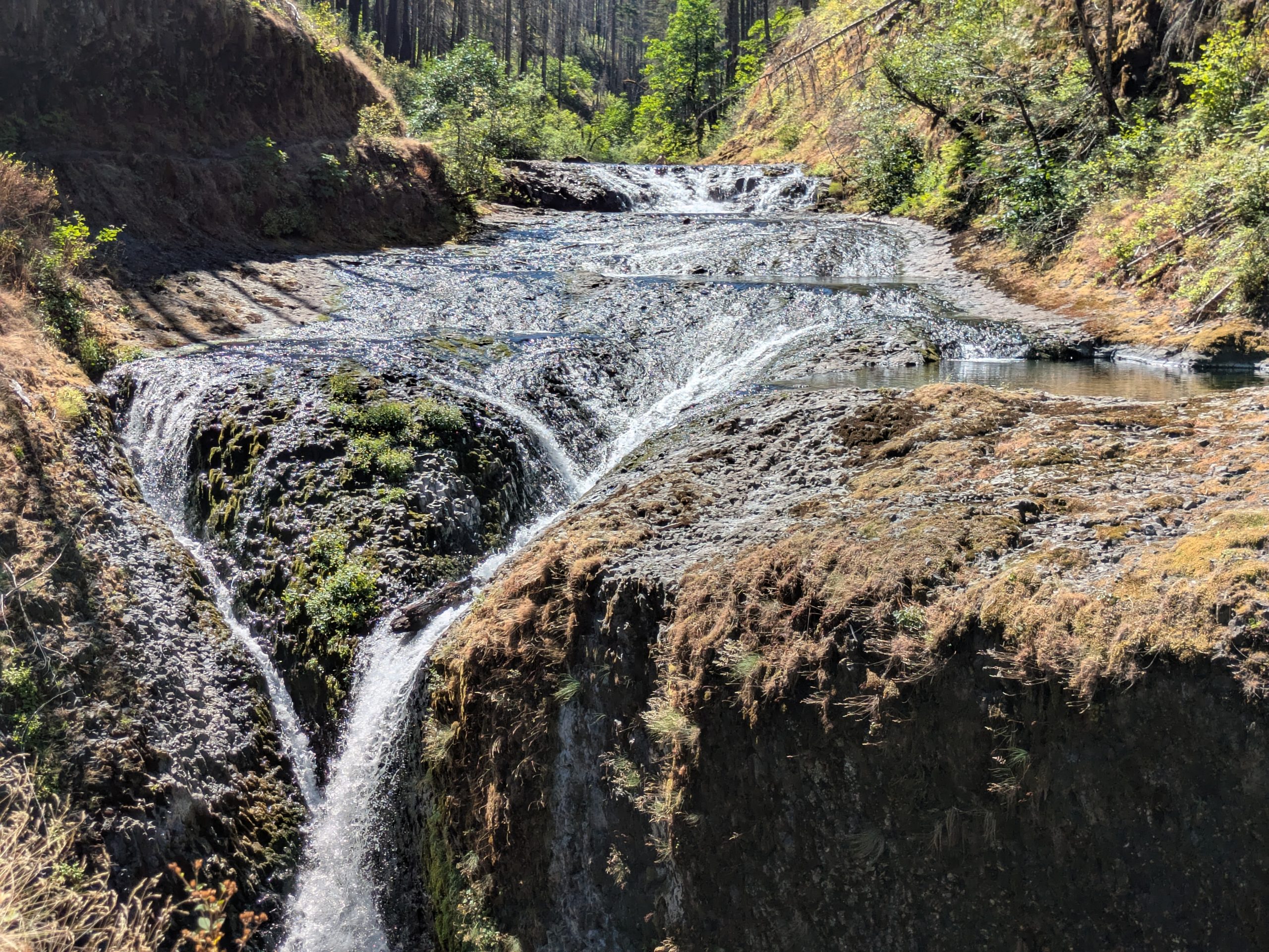
The impressive stream
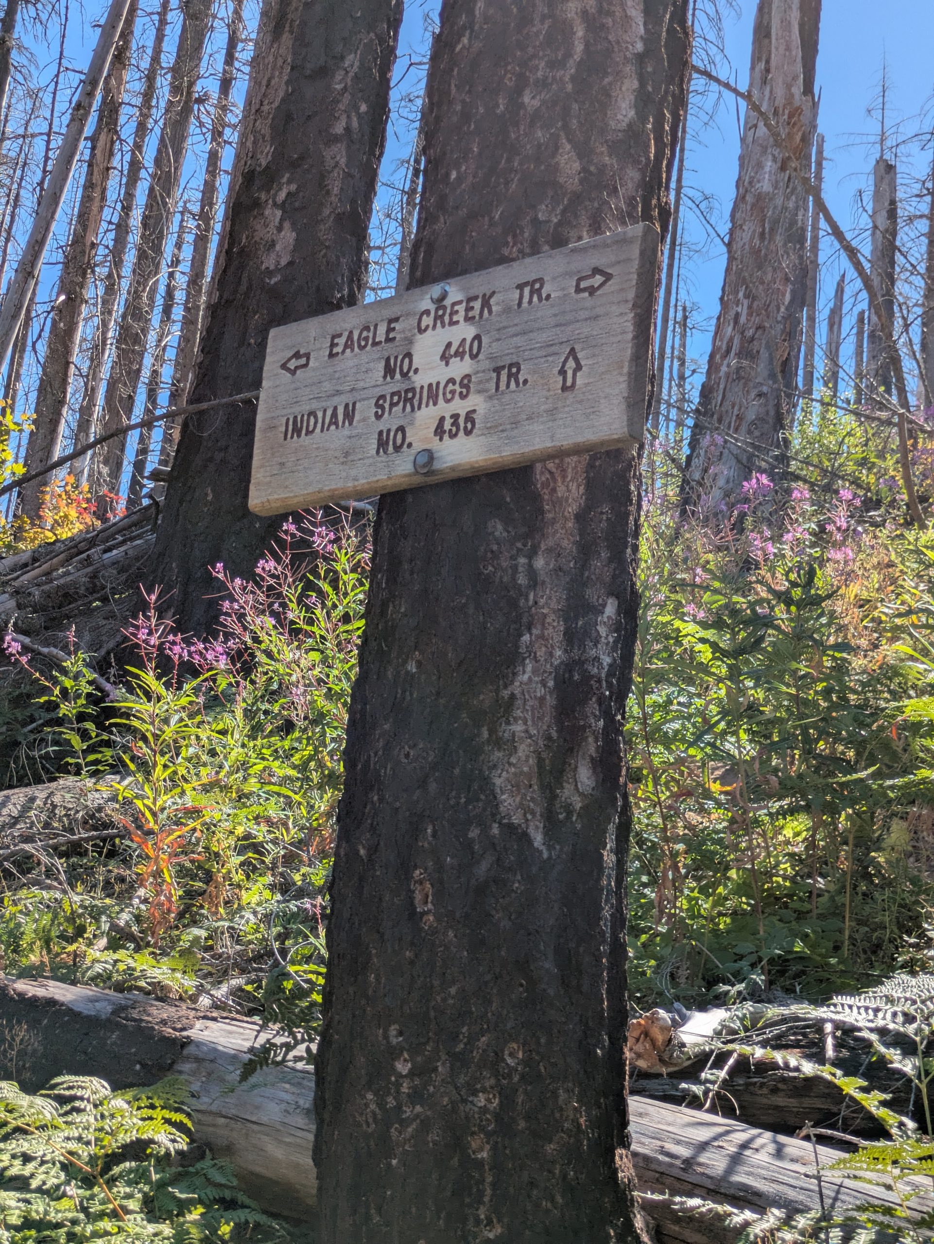
I would not recommend Indian Springs Trail in this type of heat!
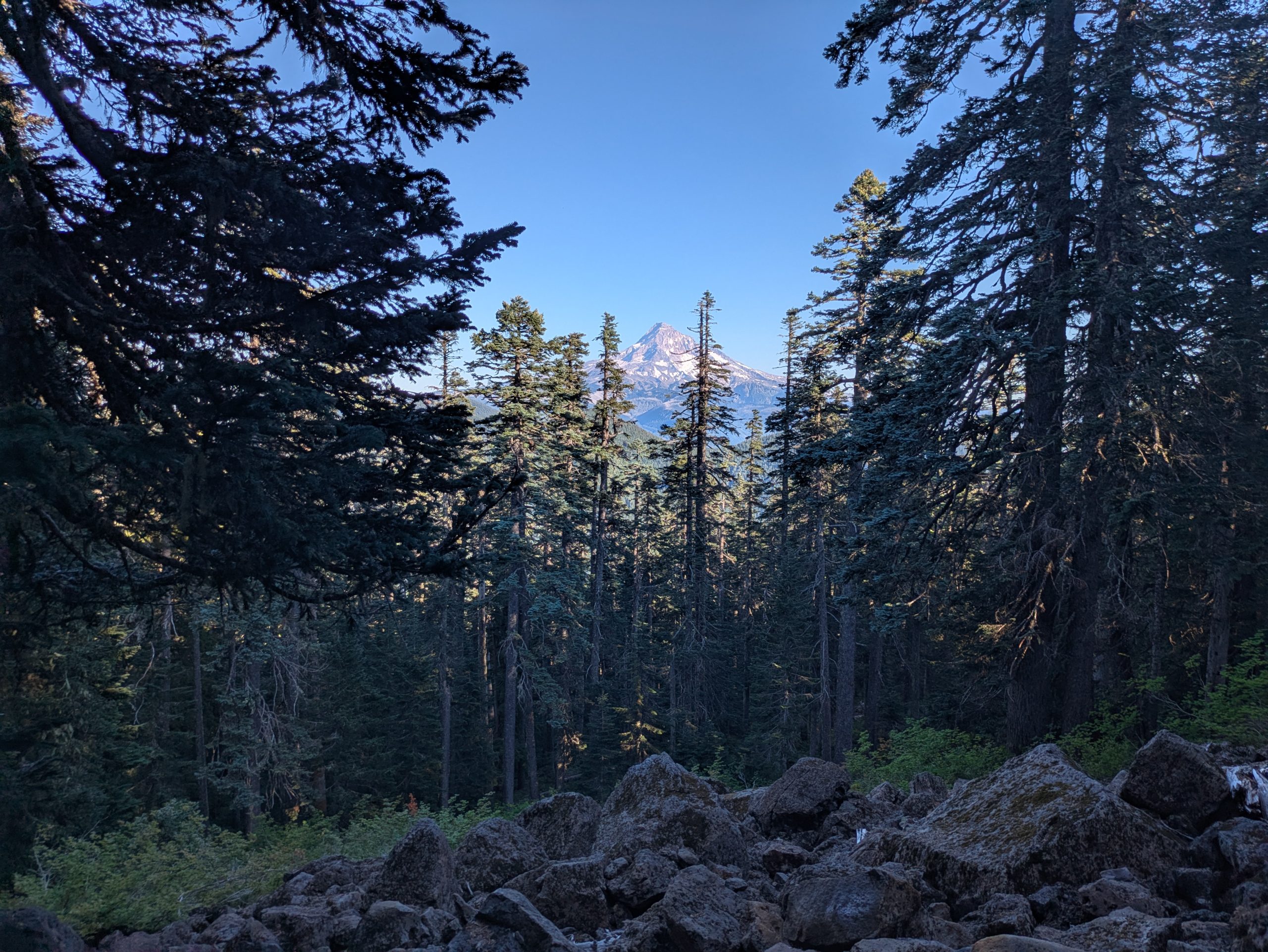
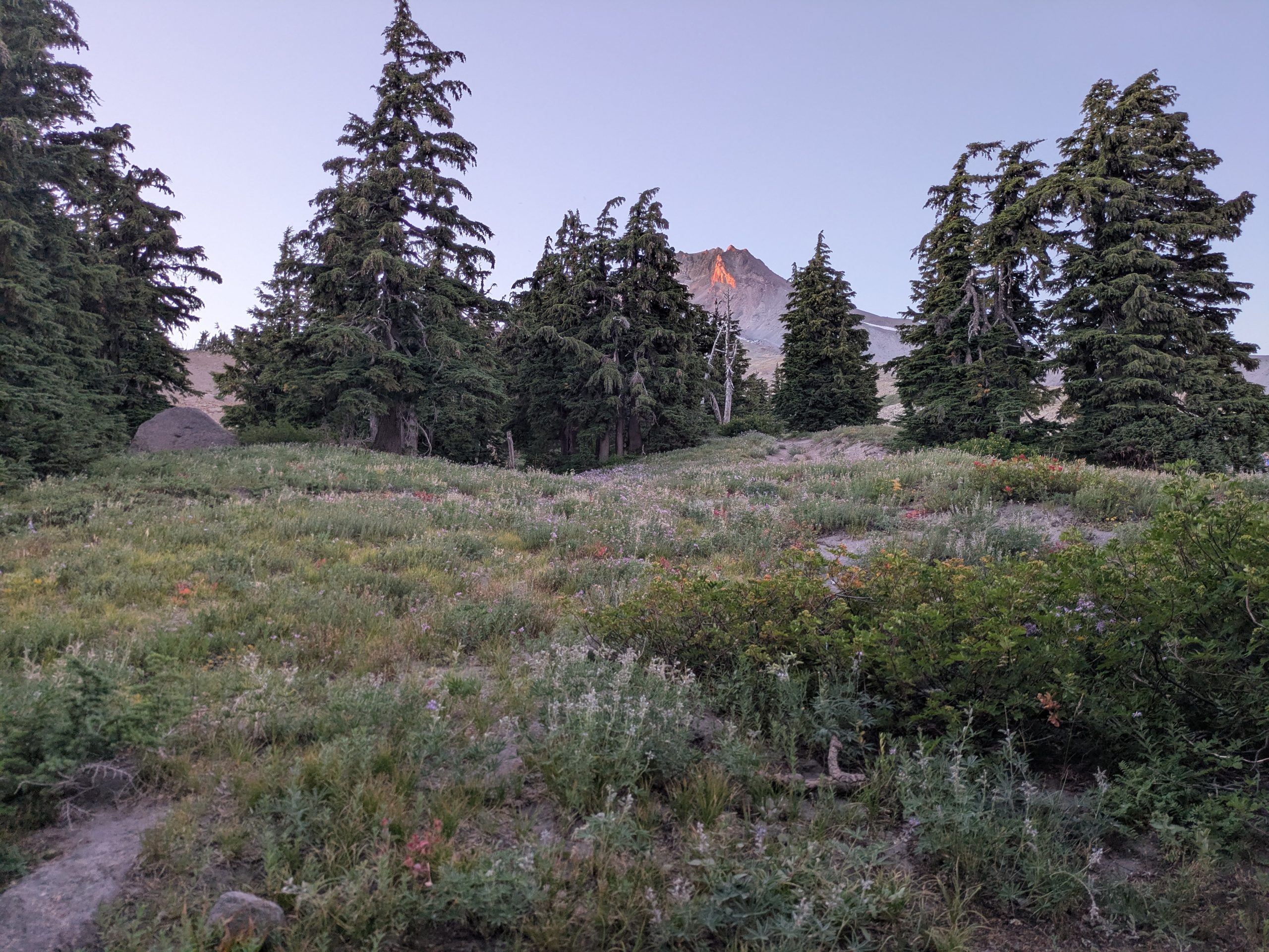
Mount Hood
Day 34 – August 11 – 24.6 miles
Mile 531.4 -> 555.8
I woke up around 5:40 am to a beautiful orange dawn, my store permeated and covered everything in light. We left around 6:30 am when the air already began to heat up. Again, it must have been at least 90 degrees, without clouds and some significant portions of the path just in the sun. Puaj. We talked about how our days were yesterday because we really didn’t have time last night and we realized that we both had the same problems. He ran out of water, taking some of another kind hiker he offered, and was also really going through those really steep miles. I think it was also really difficult because his family had to leave his family and, although he was not so extreme for me, I really missed my people after having service for a while and talking to them. It is really difficult to get out of the city after that. But we advance, reaching an excellent place for lunch around 11:30 am in an alternative that was highly recommended because it went through Ramona Falls. He felt like 15 degrees cooler for the stream in the shadow that was incredible, so we spent an hour and a half there. I also took a little midday nap, which was the first for me along the way, so it was really pleasant. We continue in the alternative that followed an absolutely impressive stream, shaded water and moss cover with deep pools, and a lot of campsites along the stream where I really wanted to stop. But we had to continue pressing, it was just like the 2pm. In the upper part of our climbing for the day in the afternoon, we stopped to get more water, something that we would not do, but the heat was really draining and we needed to continue moisturizing more than usual. Then, finally, I arrived at Timberline Lodge around 6:30 pm! I used the bathroom, I filled my water, and then we went to look for a camp nearby to spend the night. There were many other hikers here (and not through hikers, the hostel was jumping!) So we separated into two places, but we had dinner together (Knorr Pesto pasta, quite well, I could use some chicken or something) and then I saw the sunset. Then I will lie around 9 pm, excited for my refueling and buffet breakfast tomorrow!
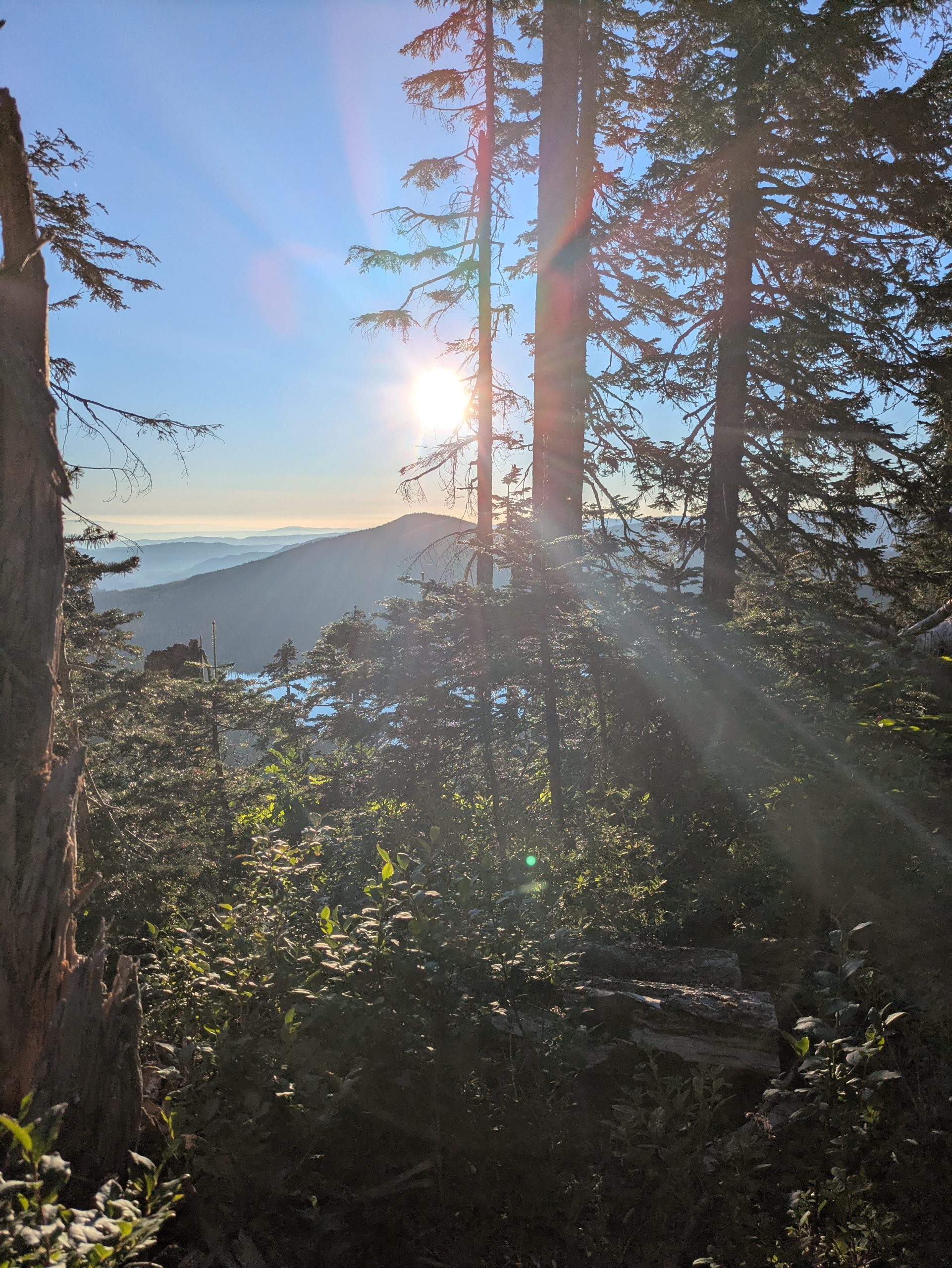
I love morning sun
So many views!
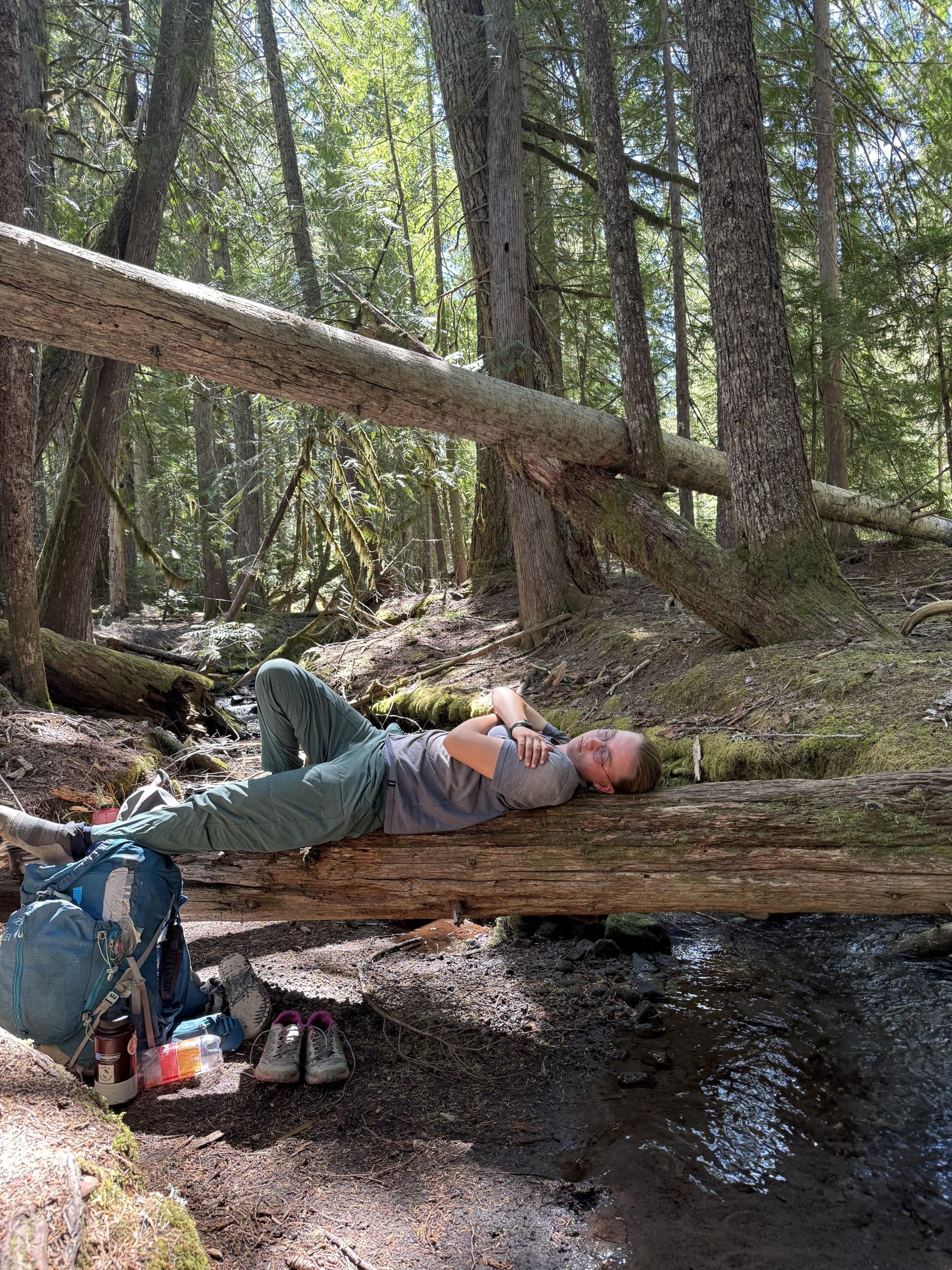
Taking a little nap at lunch. In fact, I almost fell from this record in the water because I left consciousness and my body simply rolled aside, fortunately I was surprised and woke up! After that I went and put myself on the floor.
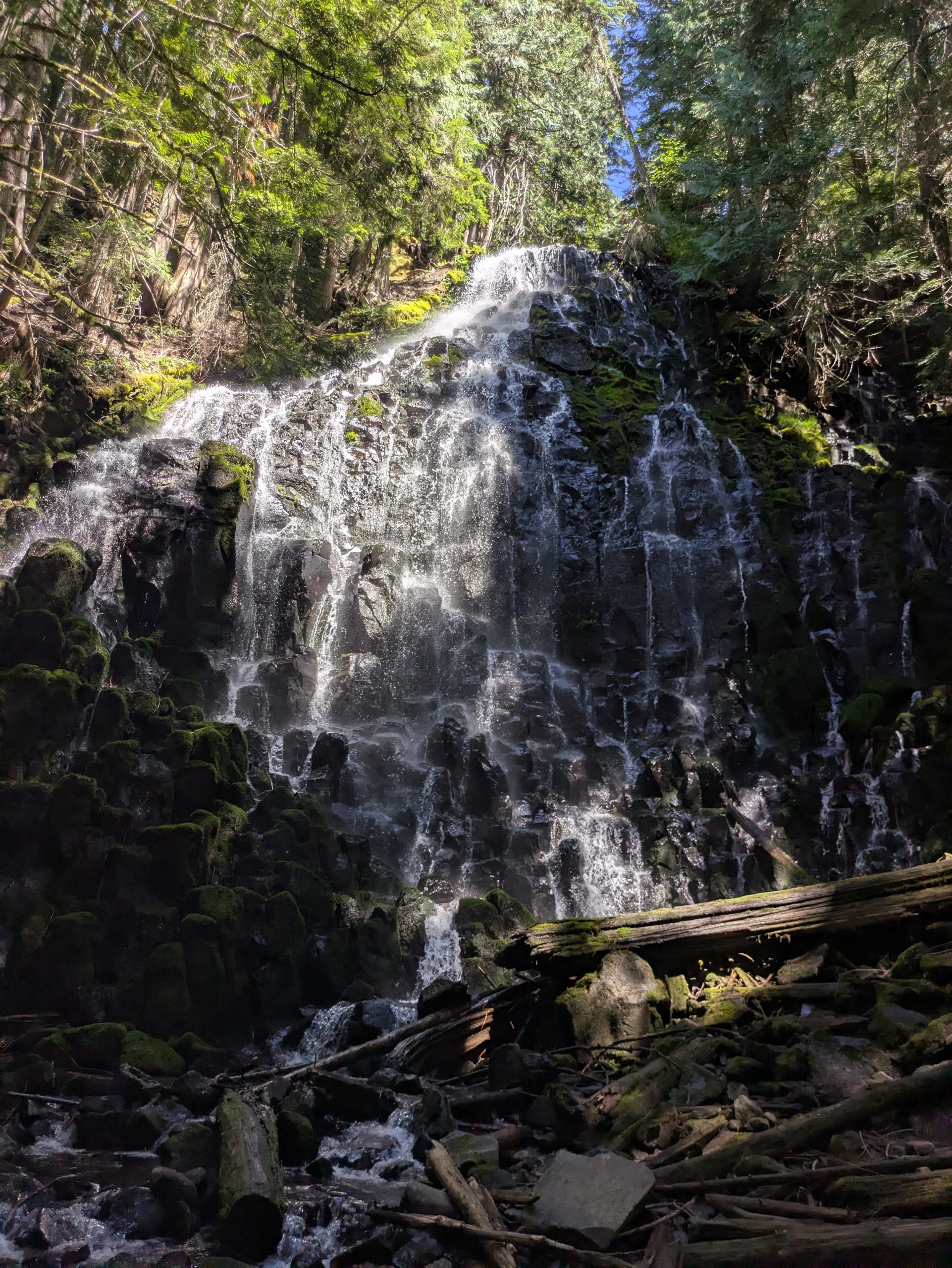
Ramona Falls, which is worth the .2 additional miles
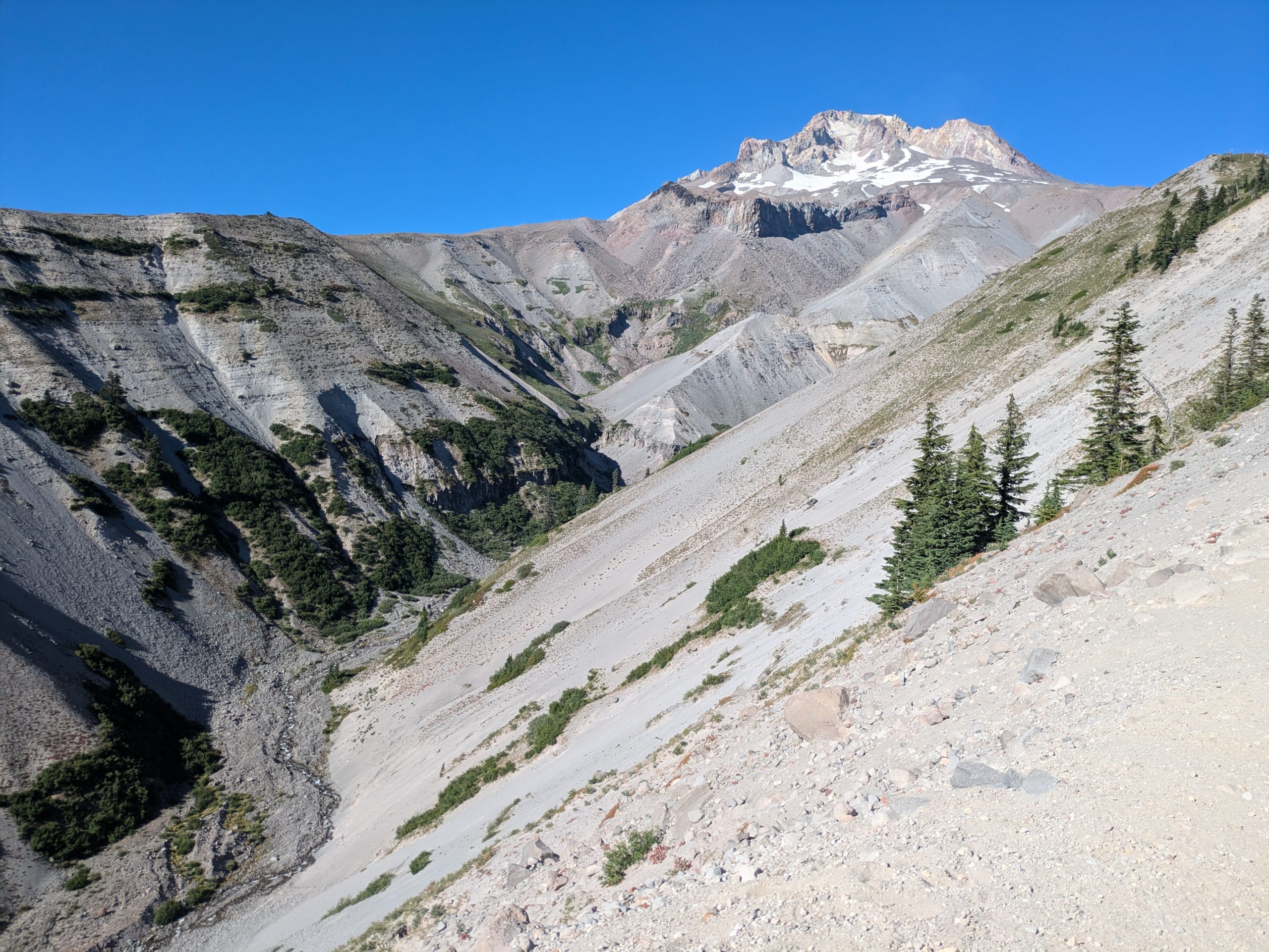
A different land interesting so far in Oregon!
View from the camp in Timberline Lodge
Alternatives
To be honest, this is just for me to remember. Hyoy!
- He omitted Mile 505.6 – 525.1 to take the Eagle Creek alternative and see the Falls, shortening our day in 4.8 miles
- He omitted Mile 543.8-545.8 to see Ramona Falls, adding .2 miles a day
45.6 miles
12,572 feet of ascent
6,634 feet of descent
A super short, but very steep section. More than 12,000 miles of profit for two days was difficult and I think the most I have done on the road so far. However, the views were great and it was nice to see some more vast views after the last days in Washington that were not so spectacular. Tunnel Falls and the entire Eagle Creel alternative was also great to experiment. But it was really difficult. The heat exhausted me more than I thought, I walked some of these miles slower than ever before, and I really needed to be in the city and have access to those comfortable comforts and cell service. However, I was able to have good conversations with some north hikers and hikers of a day, obtaining some interesting tips and stories!
Thanks for reading and see you in the next section!
– View
Total: 576 miles
This website contains affiliate links, which means that the walk can receive a percentage of any product or service that you buy using the links in the items or ads. The buyer pays the same price that would do it differently, and his purchase helps to support the continuous objective of the walk to address his quality backpack advice and information. Thanks for your support!
For more information, visit the page about this site.
:max_bytes(150000):strip_icc():format(jpeg)/kirsten-dunst-jesse-plemmons-kids-main-2ba4e39a3c954c2b9dd0f1b27a7a7e49.jpg?w=238&resize=238,178&ssl=1 "Todo sobre los 2 hijos de Kirsten Dunst y Jesse Plemons, Ennis y James")

