
It’s time to get to the road!
Today I started the KangerusSuaq Ridge Trail and tomorrow I will connect to the Arctic Circle Trail.
The Kanggerusuaq Ridge Trail (KRT) is an extension of 12 miles (19 km) that can add to the Arctic Circle Trail. Instead of walking 7.5 miles (12 km) along a gravel path, salales of Kanggerussuaq to the crest and connects you with the Arctic Circle Trail in Kellyville. The path includes approximately 1,083 feet (330 meters) altitude gain, mostly just at the beginning.
From now on, I will call the path the KRT 😊
Hot hot hot 🥵
I left the city later than planned after tightening in some last tasks of Wi-Fi, once you have no more than 6 miles (10 km), you go completely out of the network.
And it’s hot! It is not exactly what I expected in Greenland!
The climb feels a long time in this heat. I started on a muddy track with a good amount of mosquitoes buzzing around my ears. Then comes the point where the track turns off on an almost invisible path that is the KRT.
To be fair, there is a small path, which becomes a track of a path, for no path at all. And that establishes the tone for the rest of the KRT.
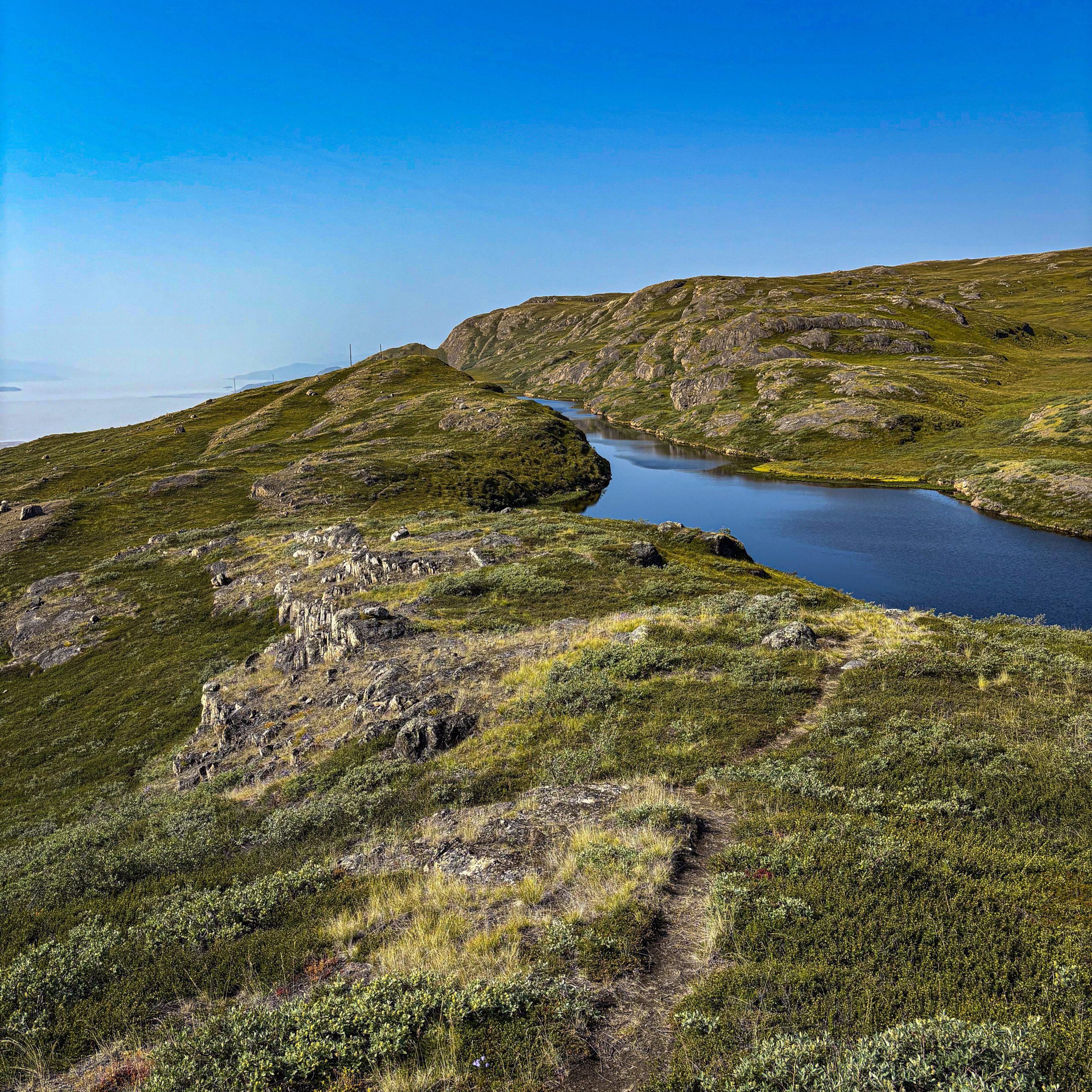
But when you look back towards Kanggerusuaq, you can see to the ice layer on a clear day. What was it! What an amazing view.
There are many antlers of reindeer along the way.
Sweets of Nature
Scattered along the way, I kept seeing small blue Arctic bells. The ICE Camp tour guide (see previous publications) had told me that they are edible, as small sweets of nature. The flower itself is a bit sweet, but the true sweetness is in the flower crown. The flavor is difficult to describe, a little like vanilla. Together with blueberries, they are good snacks (although not very filling 😉)
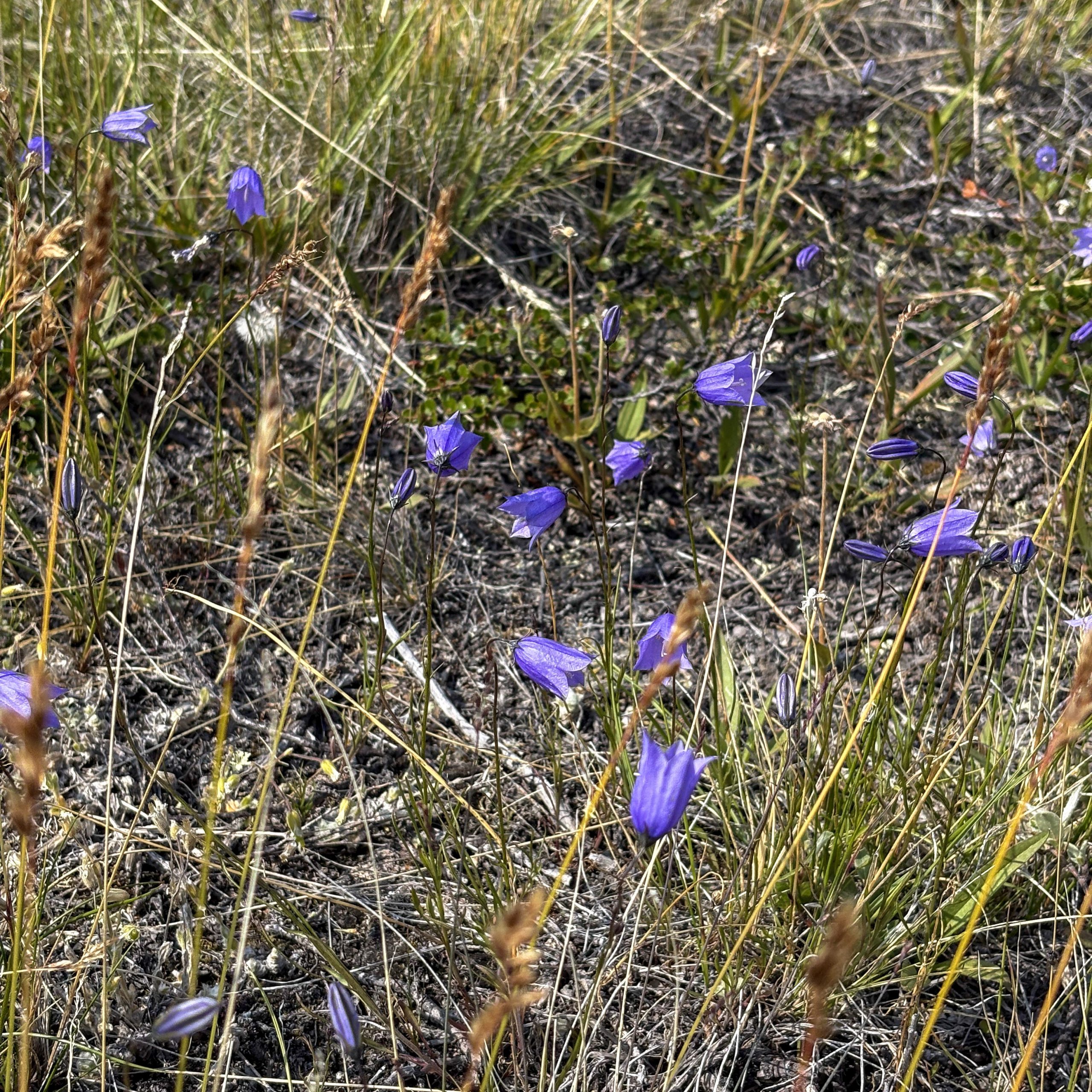
Backpack sweets 🙂
Trust what?
The KRT is not a well traveled path and the more it advances, the more invisible it becomes. At some point, you are just walking on the tundra without competition. That is very soft and unequal. I need to be careful not to twist my ankle. It is an exhausting way to walk.
At this point, the paths of paths (described as markers of «trust» in hiking. Gl) become very scarce. I have downloaded the GPX tracks on my phone to be able to follow the trail. I would point it out in one direction; Try to remember what great rock I must sign up and start walking. In some places it is very difficult to find markers, I am checking my GPS every 5 minutes, since it is easy to get out of the way.
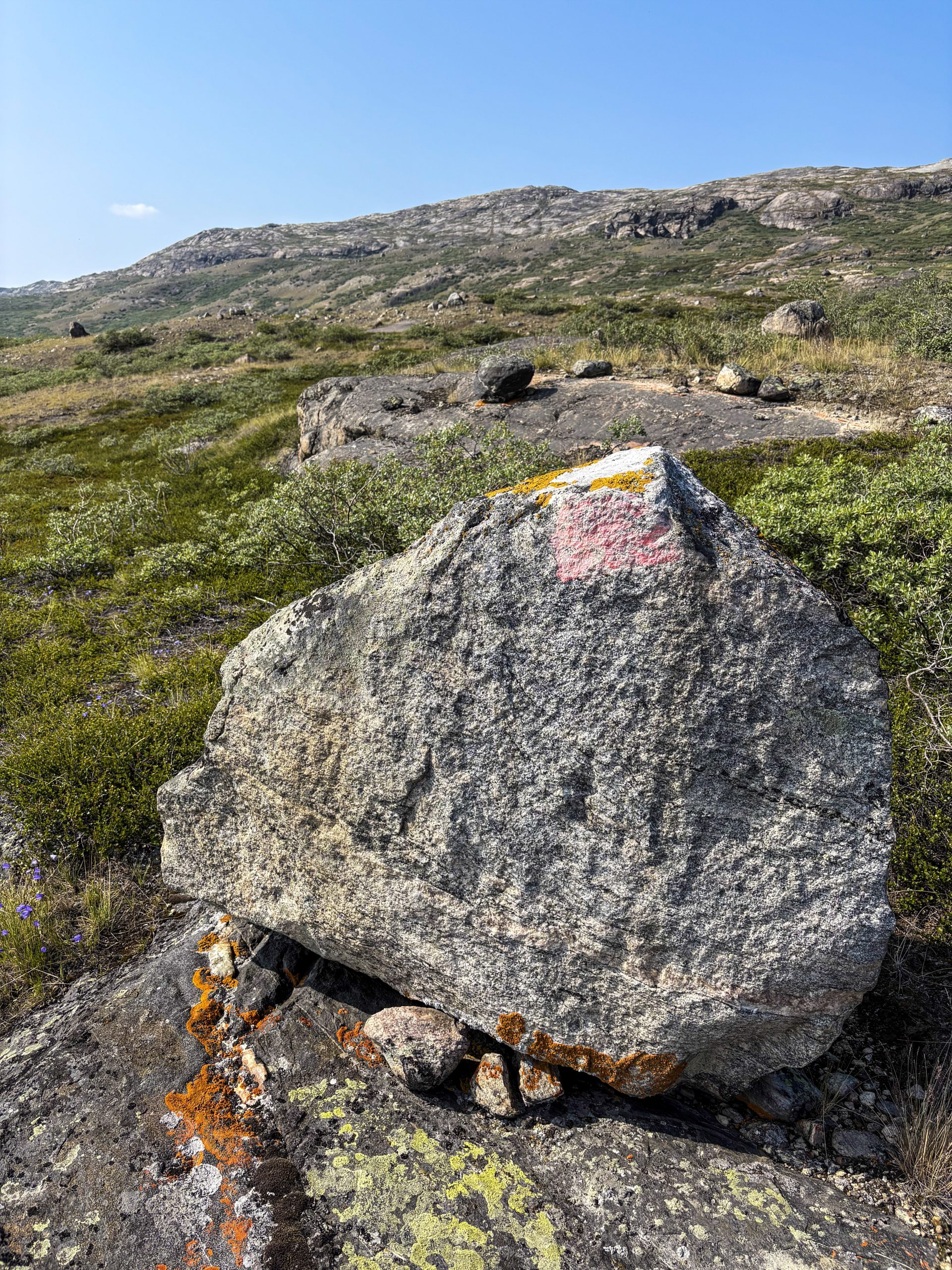
«Trust» path marker
I was an idiot …
Because unfortunately, I made a rookie mistake: not bringing enough water. Which is stupid, because I’m not a rookie …
The description of the path had warned that there were not many water sources along the crest. What makes sense, you are on a crest … but I didn’t think that is very ahead.
When I reached some small lakes above, the water seemed orange and stagnant. I didn’t trust that, so I decided to move forward to try to find a better source.
It usually does not need to filter water in Greenland, it is very clean. But, of course, you must still use common sense and be careful when you don’t trust it.
Lakes on the crest. Up, the water was orange, not very attractive.
Sorry Future Me …
The path continues, thirst. I have been keeping my water and when I take a sip, I let it stay in my mouth before swallowing. I have brought some apples for the next few days, but my desire for something juicy wins the desire for future to something fresh after several days of dehydrated media.
I checked the map and continued for a few miles towards the next lakes. Once I get there, I leave my package in the perfect place for the camp and I have to get water. But this water looks even worse than before and the lakes seem too small. More like ponds. Then I realized that I have not yet reached the lakes, and in fact they are ponds.
More orange water
So I’m leaving. Goodbye, goodbye.
When I finally get to the lake, the water is also very orange. But at this point he will have to do. I collect water, I decide to boil it just to be sure and get to work. Once boiled, I transfer it to a cup and boil a little more water to eat. Hoping that water cooling enough to drink … it felt as if it were an eternity!
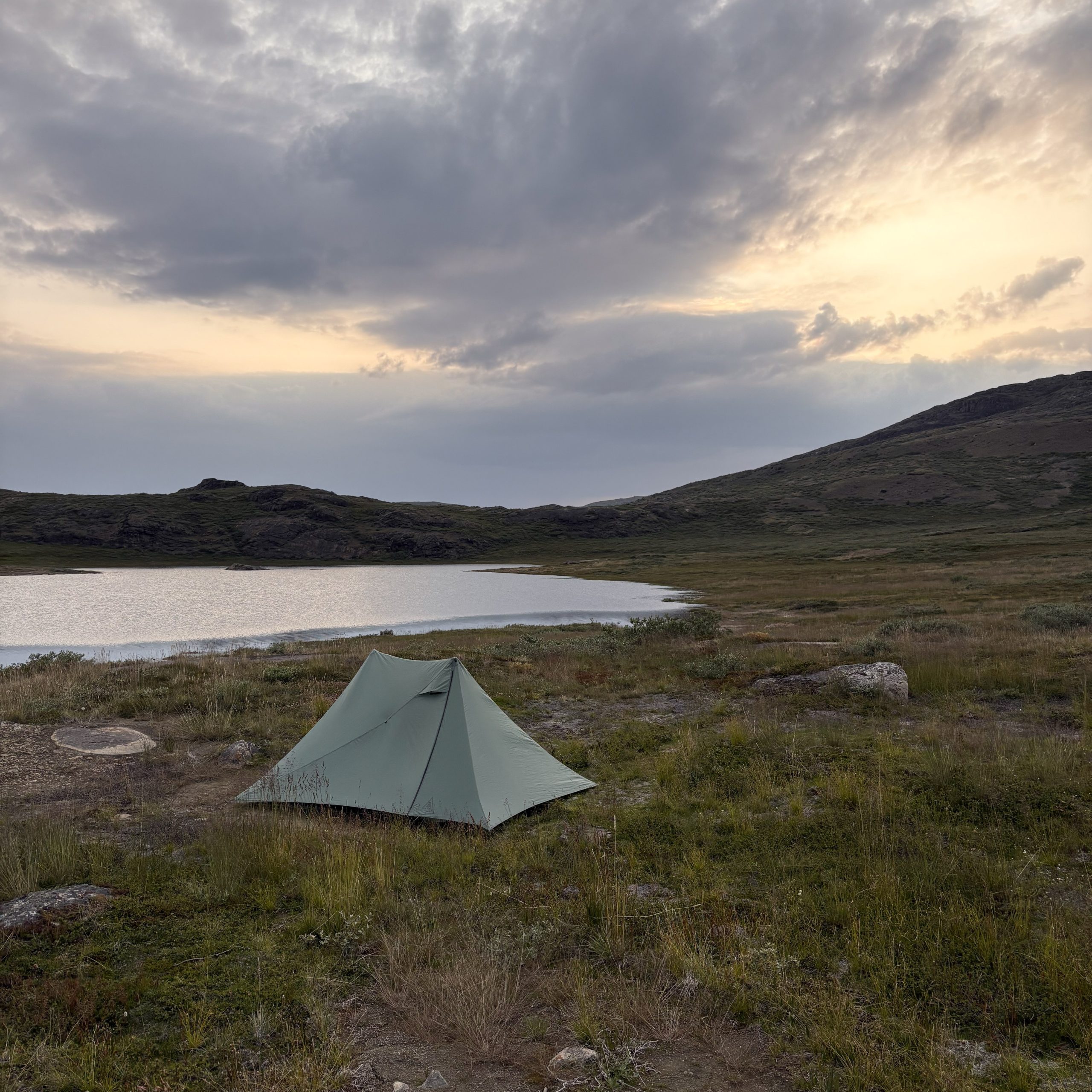
Once hydrated and fed, it was time to find a new place in the camp. I was a little round trip and found the perfect place, almost without mosquitoes.
But when you stay still for 30 seconds, a swarm enters them. And they were big. And strong! So to another place. But the same continued to happen everywhere. After moving my things several times at different points, I ended up in the first place and decided to move on.
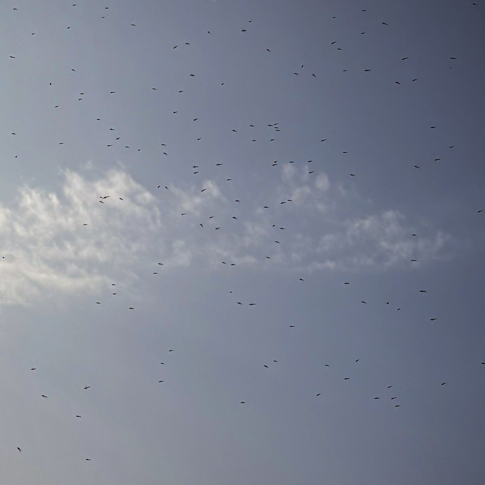
The biggest mosquitoes I’ve seen.
In excess
The store was raised and was boiling more water while trying to relax a little. Then, the Air Groenland search and rescue helicopter passed over and returned a little later. I am not sure what is happening later along the way, but I hope everyone is fine. There is no way out of the path between Kanggerussuaq and Sisimiut, except helicopter (since there are no paths between cities in Greenland).
Then I start feeling bad … A little nausea, my stomach was not happy. This cannot be happening! I had assured me that it became a lot for at least a minute … I took some tea, although I was a little worried about drinking more water, in case it was the problem. Then, another piece of fruit, trying to calm the stomach.
I went to bed, a little worried and very tired.
I hope there are no surprises, at any end 😉
Of course, a lake view comes with mosquitoes 🙂
This website contains affiliate links, which means that the walk can receive a percentage of any product or service that you buy using the links in the items or ads. The buyer pays the same price that would do it differently, and his purchase helps to support the continuous objective of the walk to address his quality backpack advice and information. Thanks for your support!
For more information, visit the page about this site.


