
Wednesday, June 10, 2026
On day 2 of my 3-day backpacking stint, a sudden storm threatens to disrupt my plans. Then I do my first road hike, but it’s not as easy as I thought it would be.
Bound for Wilson Creek
tAll night long, the wind blew through my tent. Several times the sound of the tent fly flapping in the wind and various pieces of leaves hitting the tent made it sound like rain. I expected to wake up in a wet forest, but when dawn broke, I could see that my tent was actually dry. The forecast had called for a 30% chance of rain during most of the morning hours, but the storm should have abated. I got ready to pack my things and eat breakfast and was on my way before 8:00 am.
It was a warm and mostly cloudy morning. I expected rain at any moment, but from time to time the sun peeked through the clouds. The AT follows the Blue Ridge Parkway for most of my itinerary today. Other than the first descent from Cove Mountain, the trail had no significant climbs. Since it was the middle day of a three-day backpacking season, I would hike 13.7 miles to the Wilson Creek shelter and then turn around. I would need to find a place to camp on my way back. You could return to the same area on Cover Mountain, but that would mean hiking more than 27 miles. Since that would leave me just under 19 miles to hike tomorrow, I was checking the first few miles of the trail to see if there was a suitable campsite so I could trade some of today’s miles for tomorrow’s.
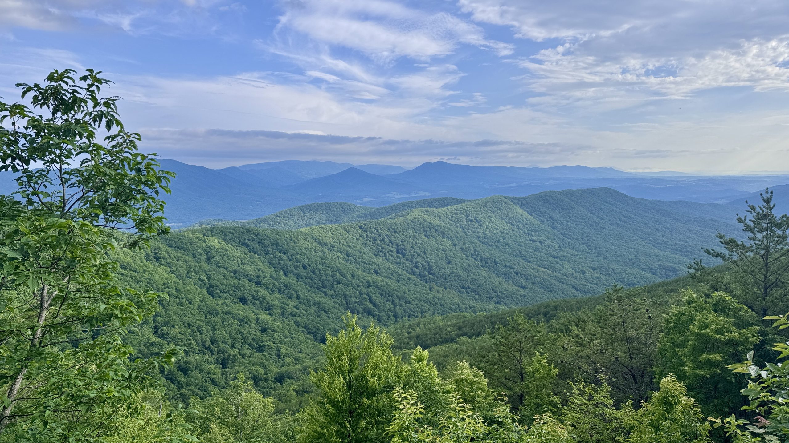
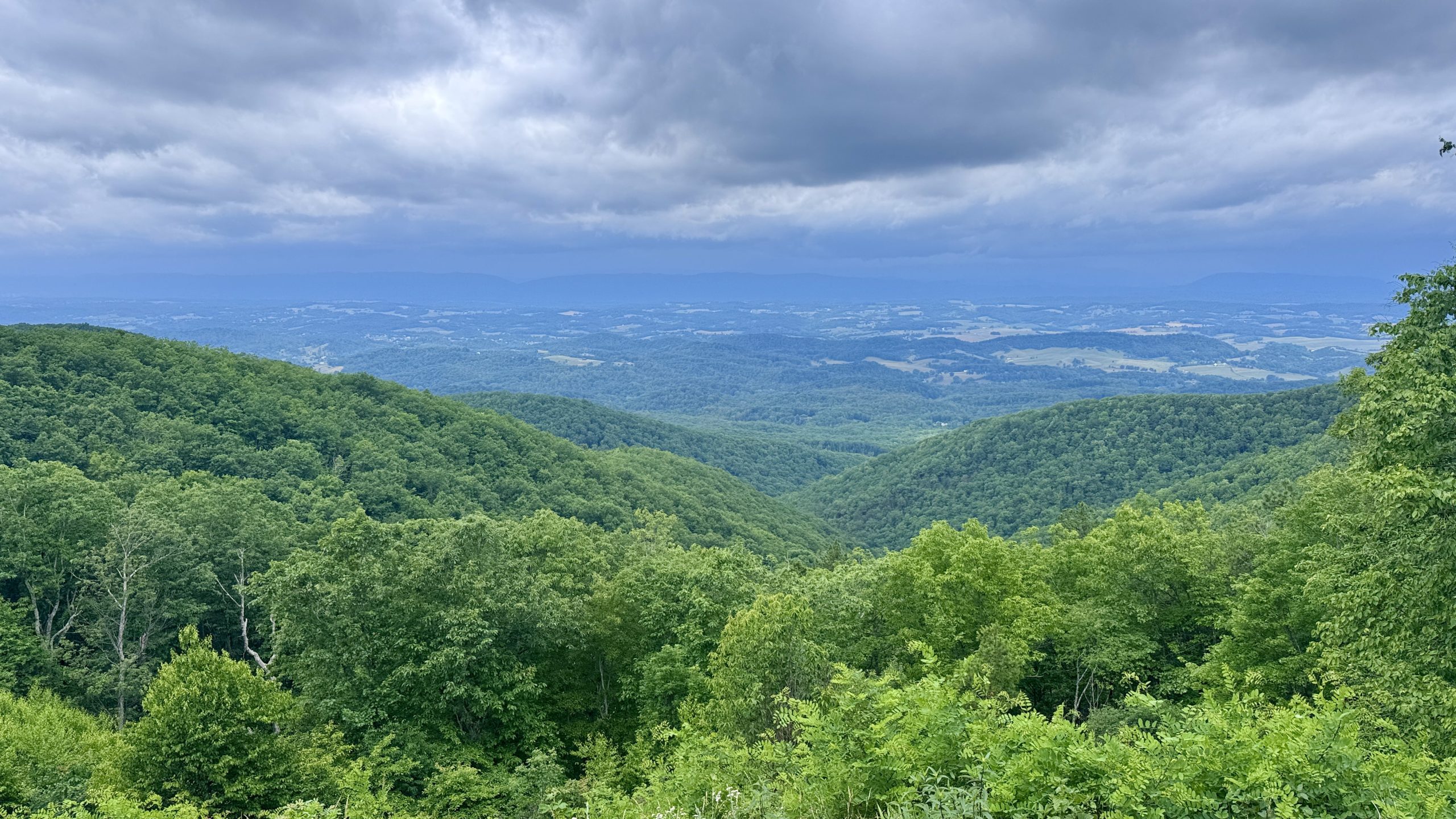
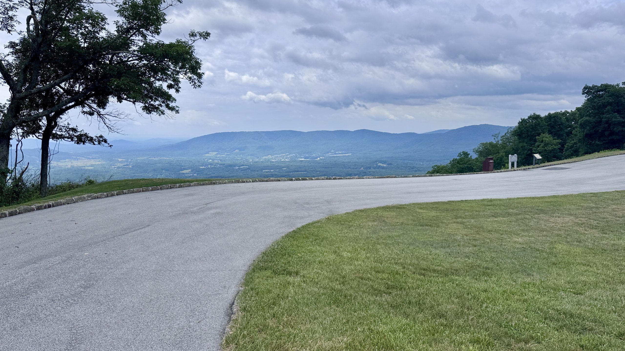
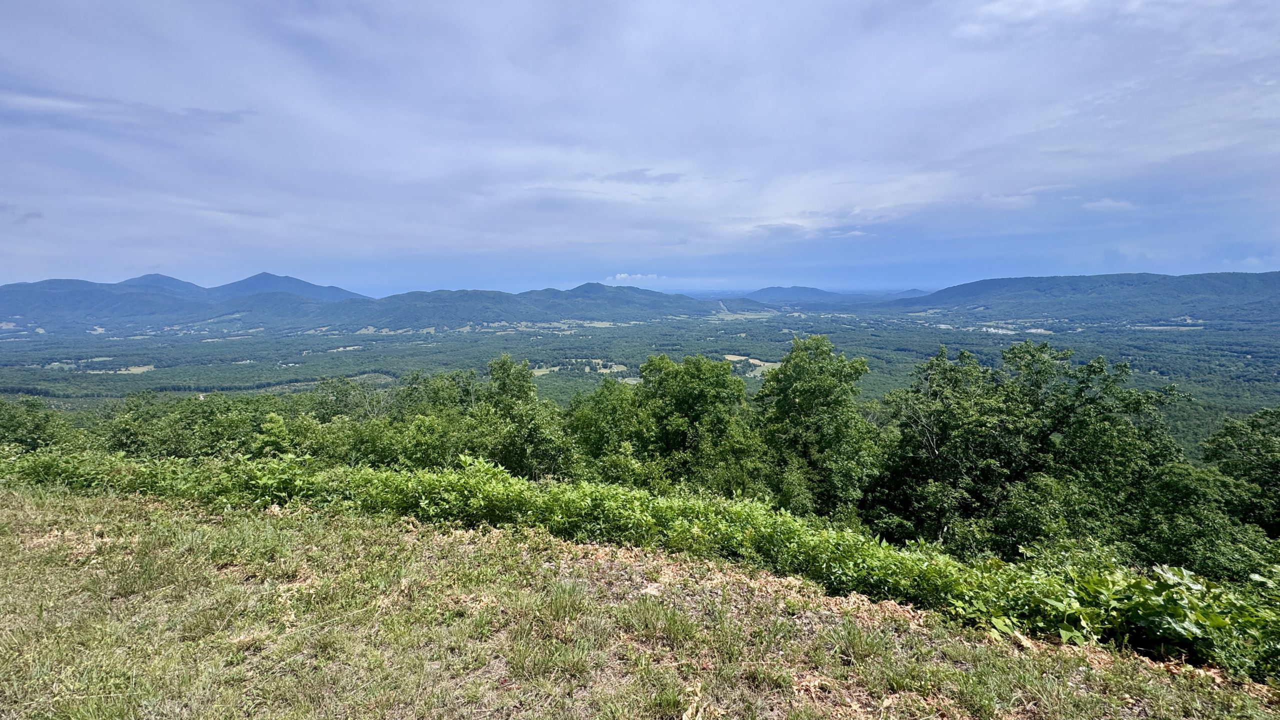
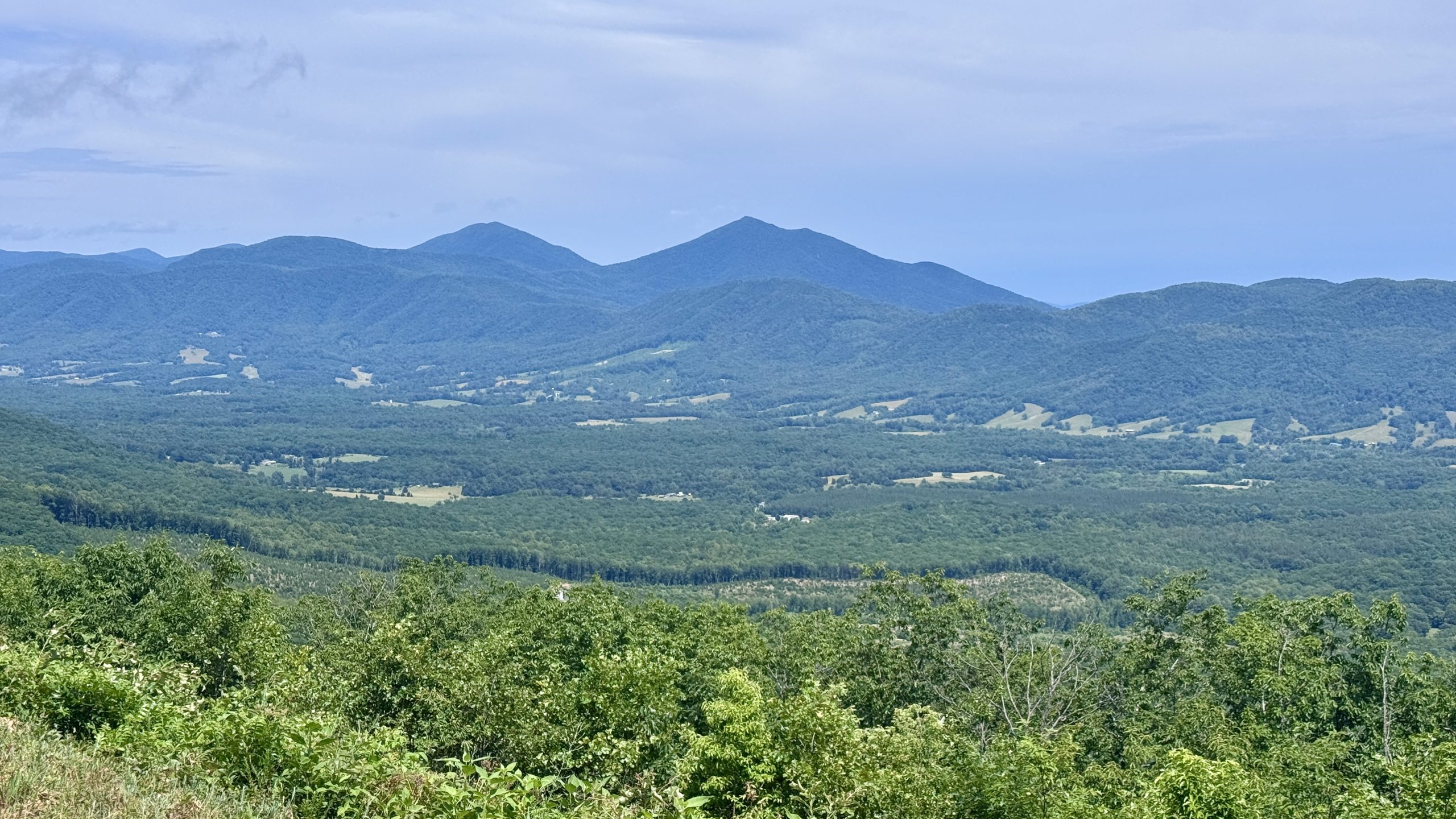
View from Buchanan Overlook.
Changing conditions
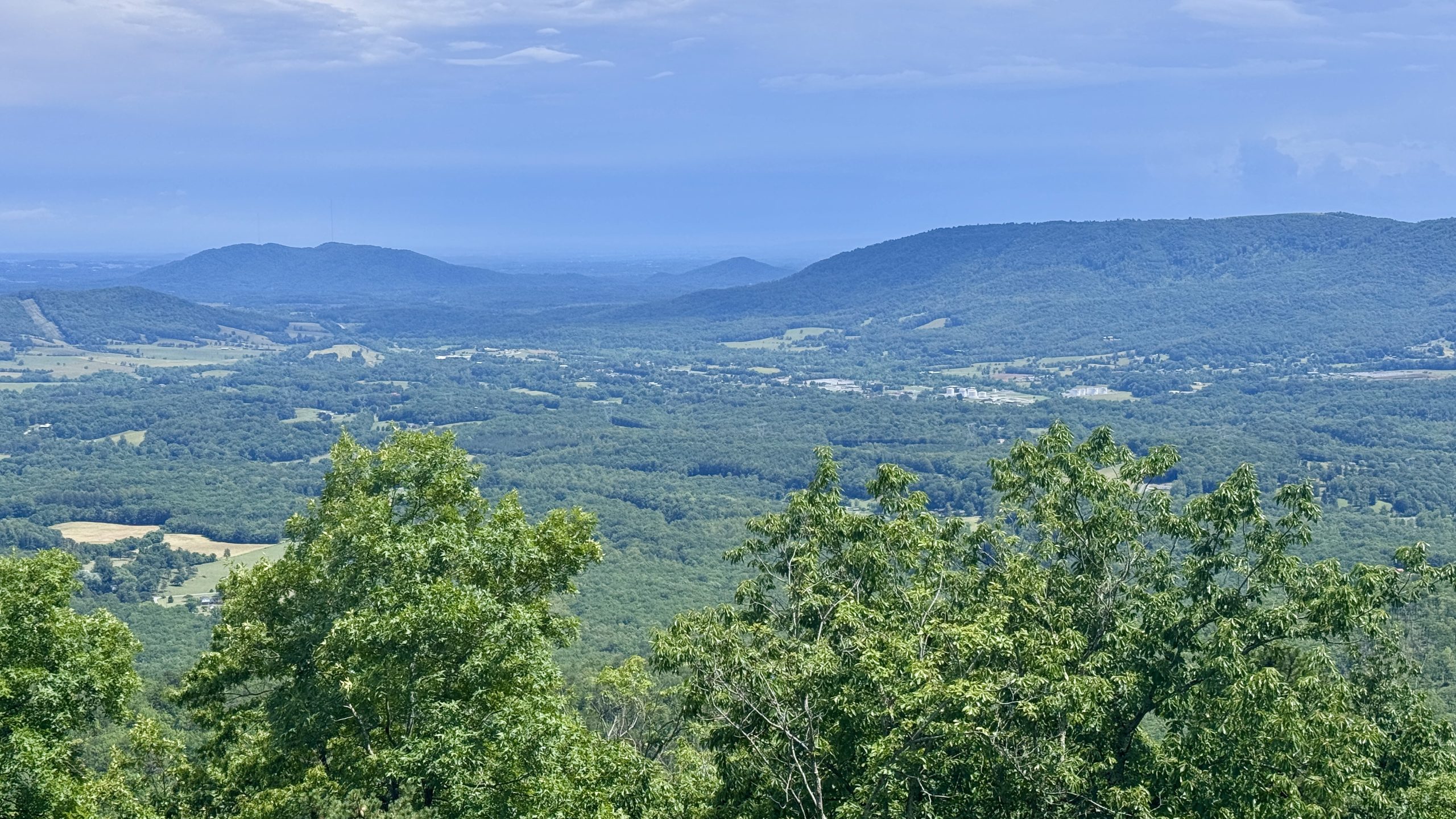
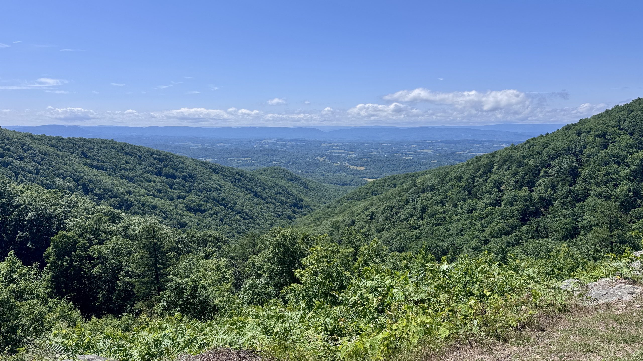
The first crossing of the Blue Ridge Parkway was at Mills Gap. The ridge is only about 100 feet wide at this point and much of it is dedicated to road. There were open views to the north and south. I could see all the way to the James River and beyond. This was probably the point where NOBO hikers who opted to hike the Blue Ridge Parkway would rejoin the AT. I made a mental note of the location in case I decided to walk along the road on my return trip.
Around 10:00 am was the first time I heard thunder in the distance. My brain immediately queued up the various tasks I would need to do to prepare for a sudden rain. The first would be to find a place to leave my backpack. I would then have to move my tent from the top of my backpack down using the two bungee cords I had brought. Then I put on my backpack and covered myself with the poncho. This would ensure that I didn’t make the mistake I had made during a previous storm where my poncho wasn’t low enough to keep my shorts dry. That happens when I tie my tent to the top of my backpack, which is how I prefer to carry it in dry conditions.
A few moments after the thunder, the clouds to my left parted and the trail lit up with the sun. I had a feeling I would need to be prepared to adapt to changing conditions at any time of the day.
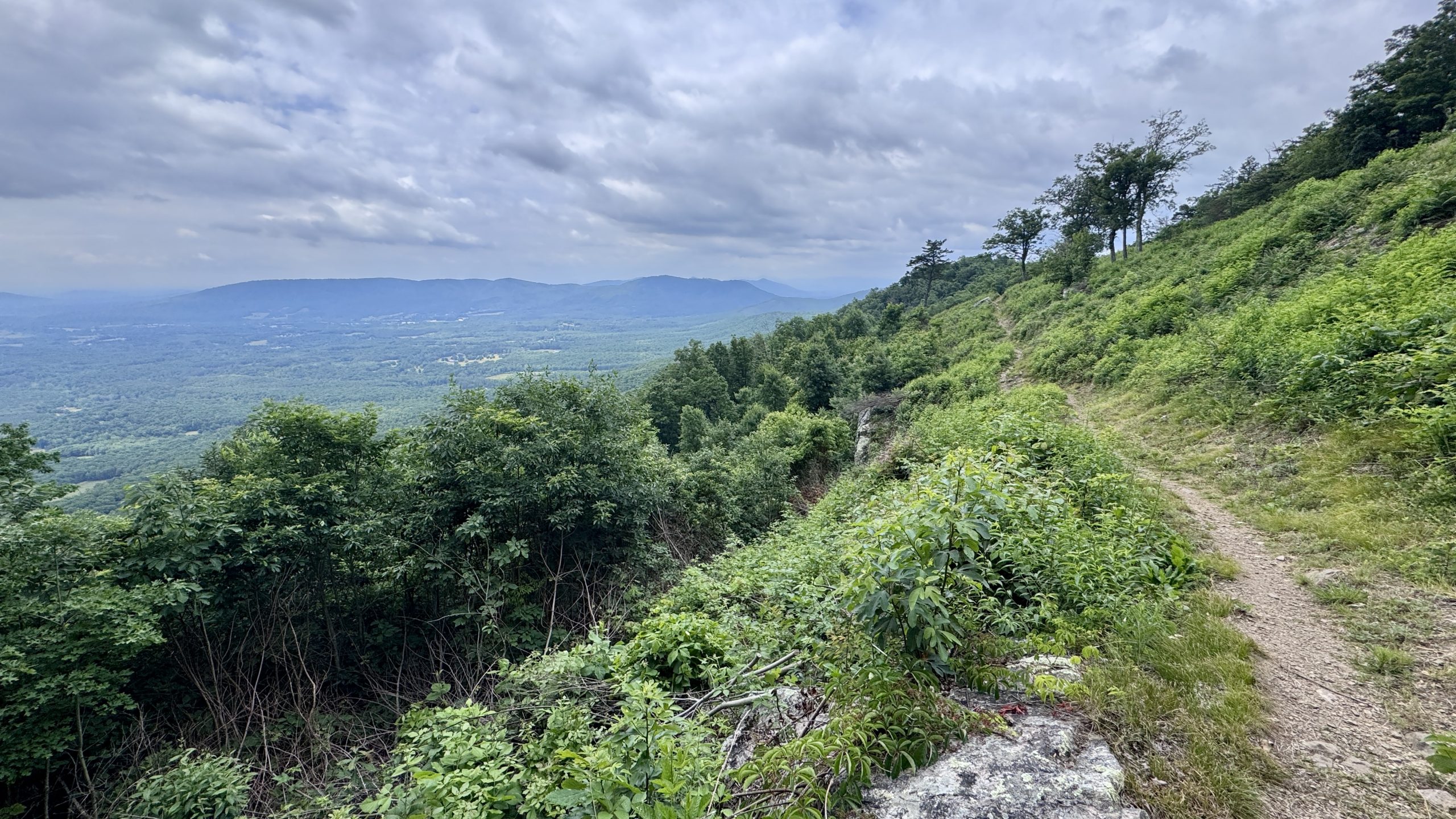
View from the trail near Cove Mountain.
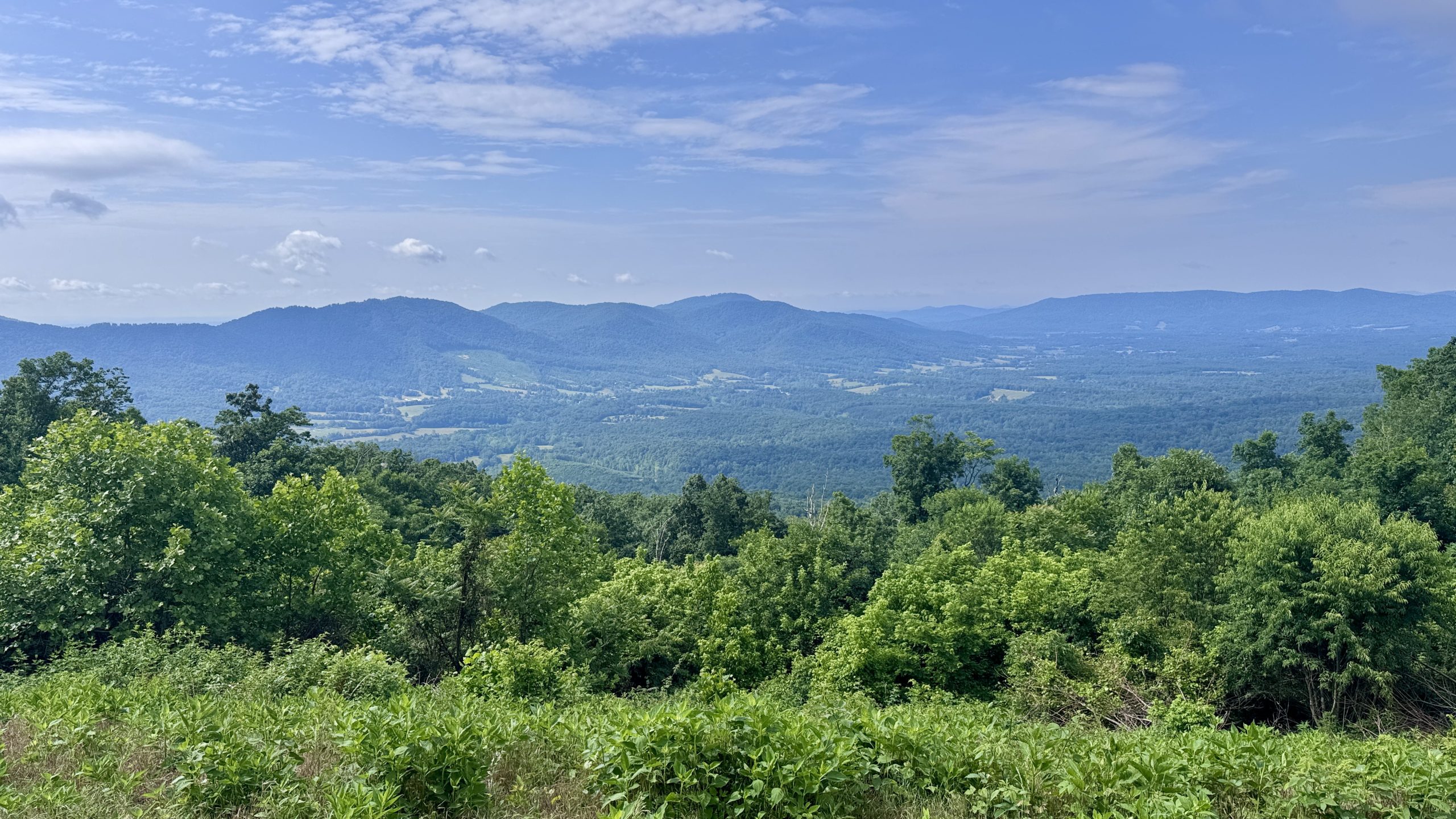
View from the trail near Mills Gap.
View from the trail near Mills Gap.
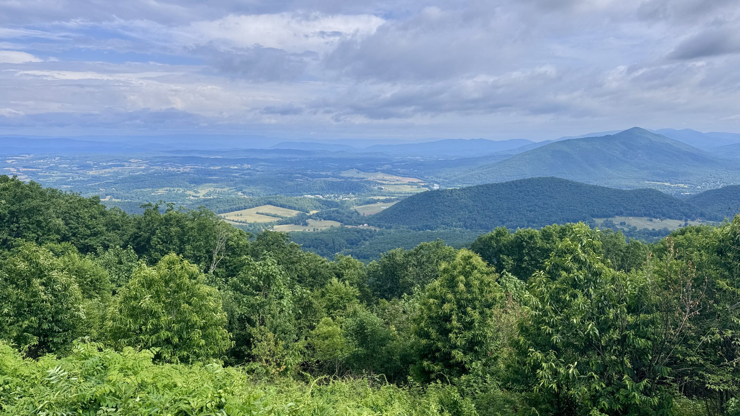
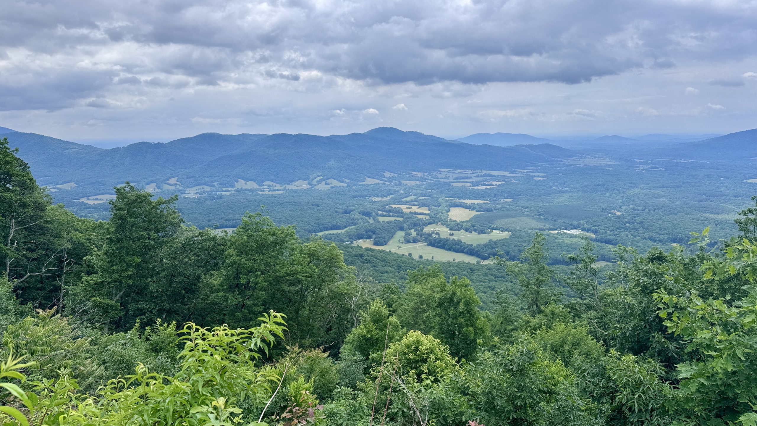
View from the trail near Peaks of Otter.
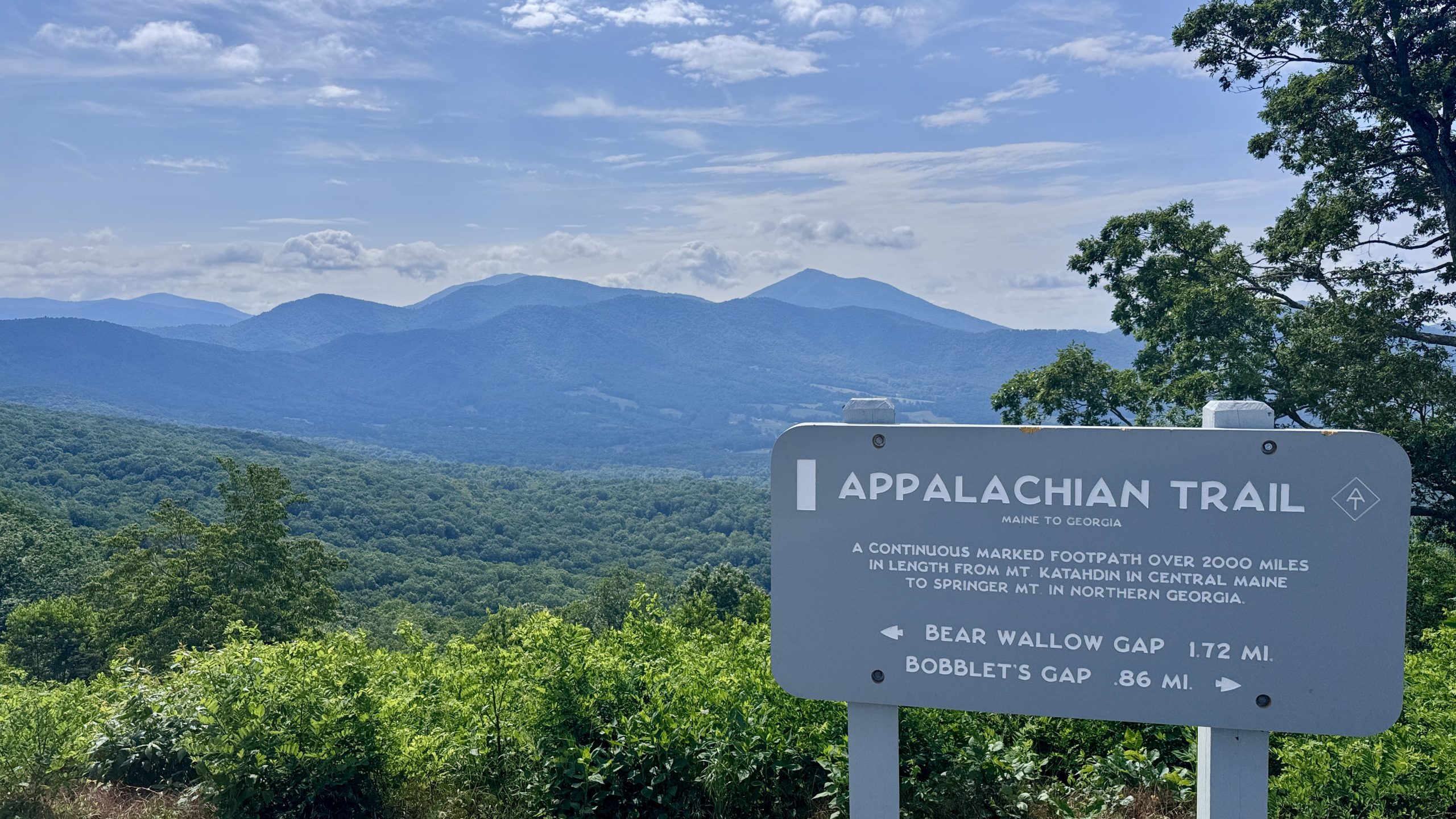
View from the trail near Harveys Knob overlook.
View from the trail near Harveys Knob overlook.
View from the trail near Harveys Knob overlook.
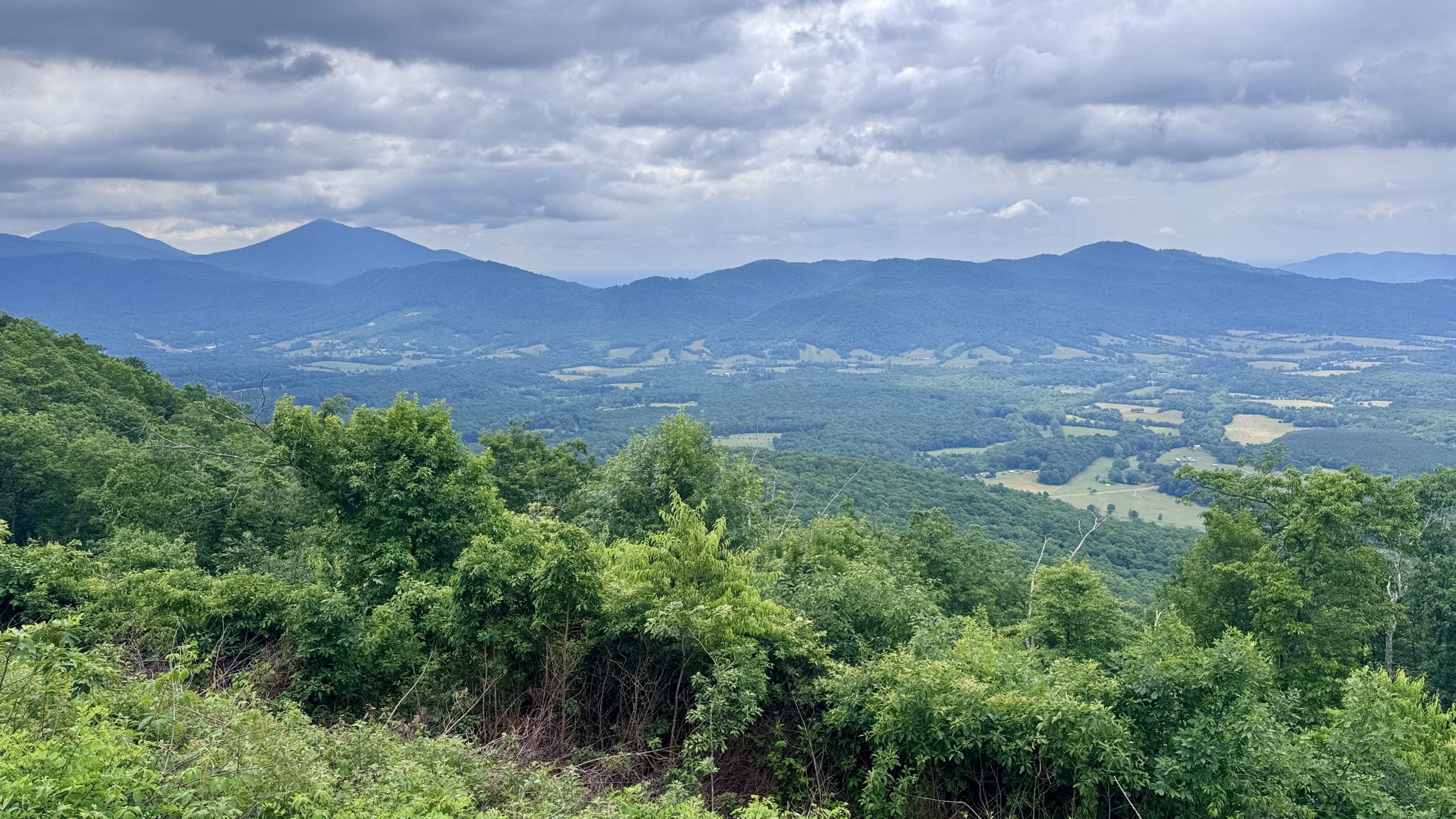
View from the trail near Harveys Knob overlook.
Getting ready for the rain
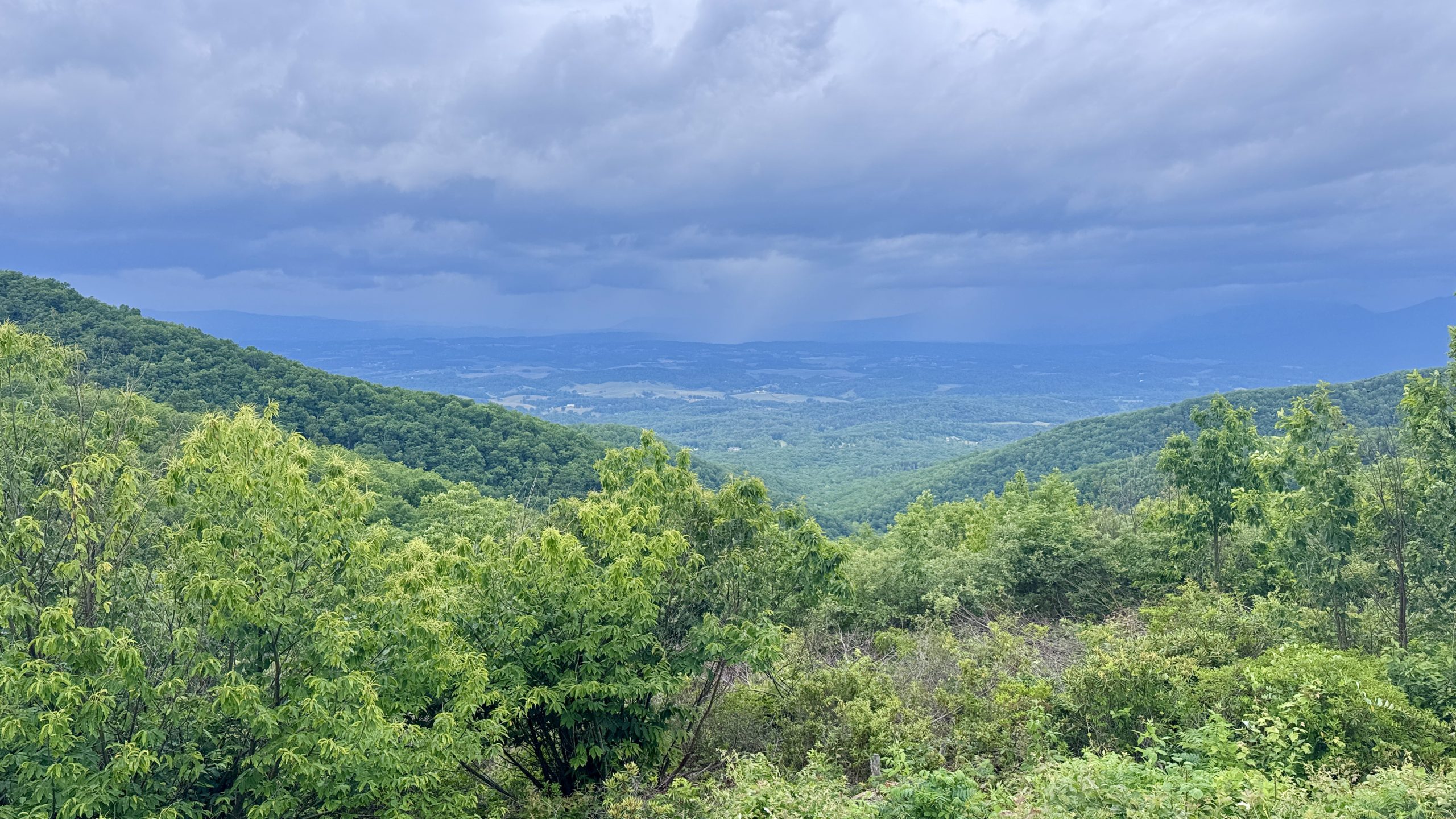
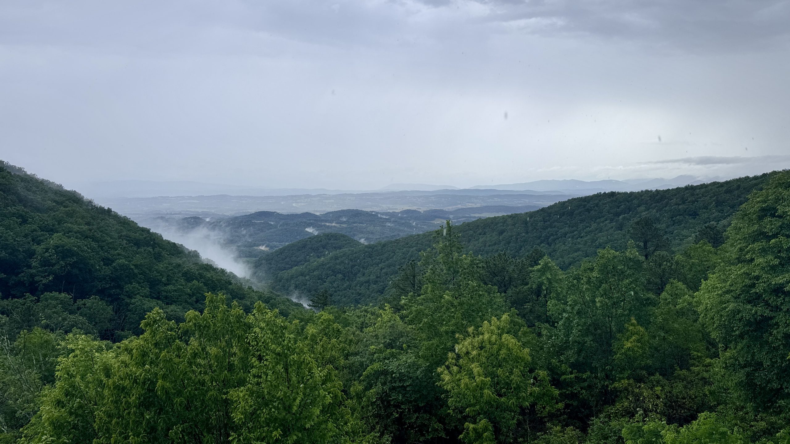
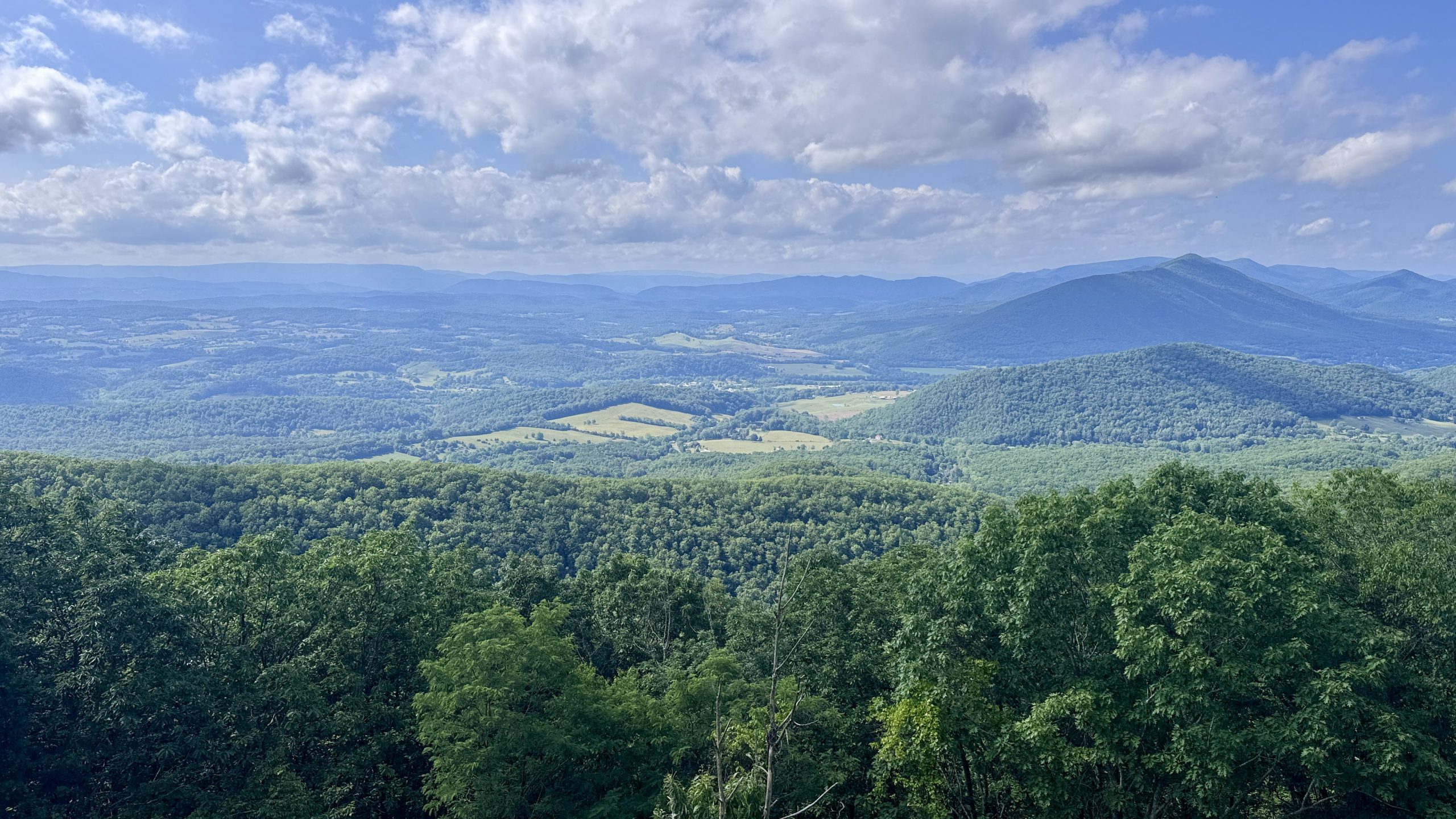
Following the Blue Ridge Parkway not only meant the trail was relatively flat, but it also meant the views were plentiful. It was not a clear day by any means, but the clouds had the means to stay high in the sky, allowing for beautiful views of the valleys on both sides of the avenue throughout the morning. Towards the south, I could see pockets of sun shining over some lucky areas of the valley. Towards the north there was no sun, but there were unmistakable signs of some scattered showers in the area.
Around 11:45 am I heard a much louder and closer thunderclap. The clouds to the west had become darker and denser. I expected it to start pouring rain at any moment. I proactively moved my tent to the bottom of my backpack and made sure my poncho was accessible and prepared for the worst.
View from the trail near Montvale Overlook.
View from the trail near Montvale Overlook.
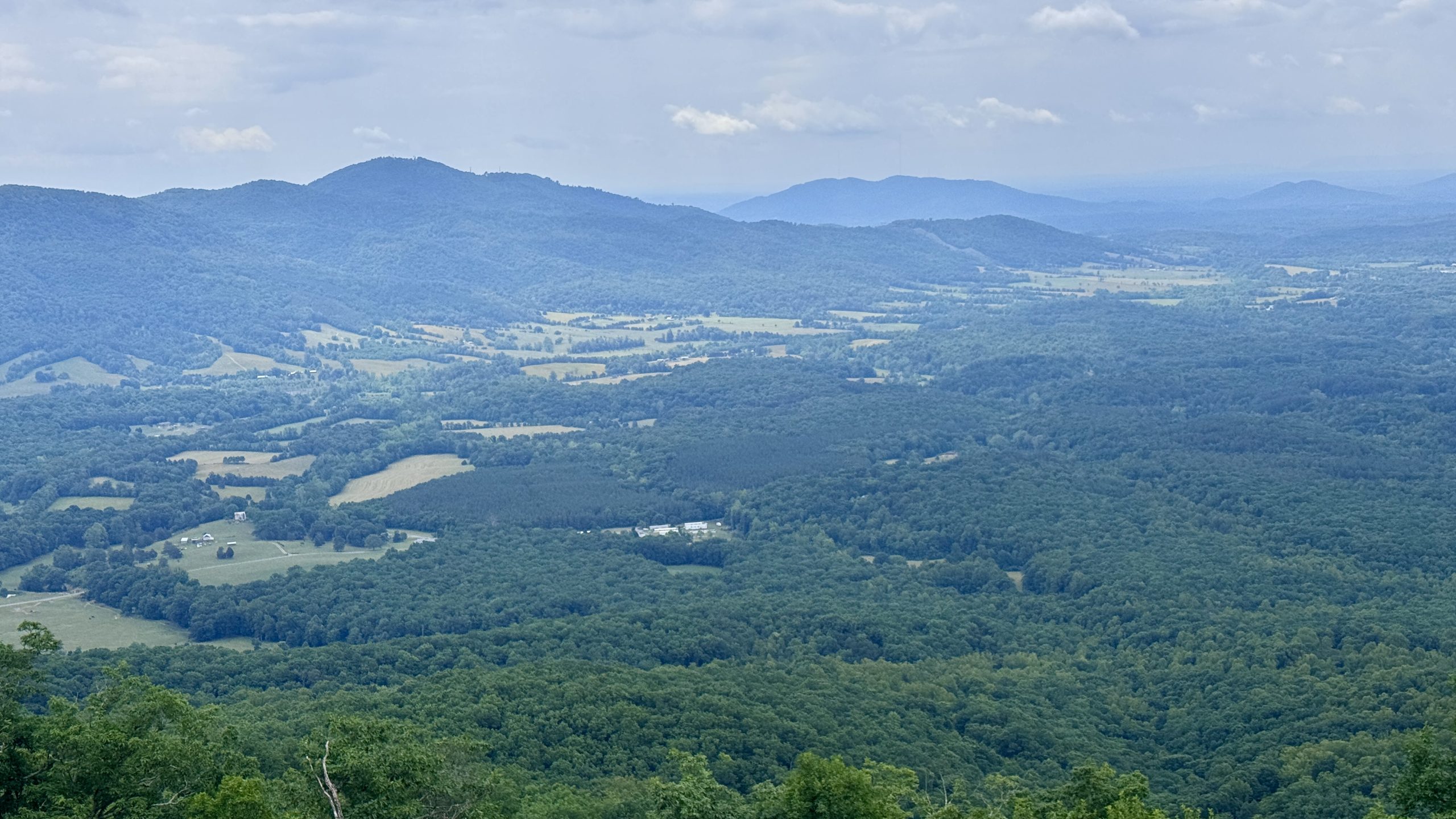
View from the trail near Montvale Overlook.
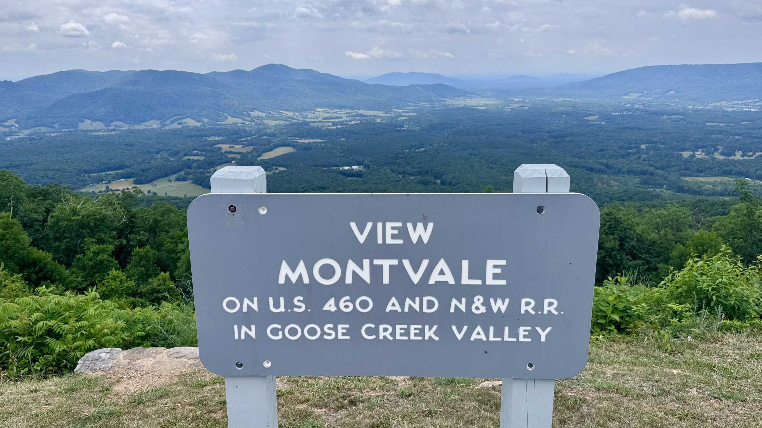
View from the trail near Montvale Overlook.
The storm comes
A sustained gust of wind heralded the storm’s arrival just at noon. It was at the top of a narrow section of the ridge. I took my poncho out of my backpack and the wind caught it like a windsock. The wind brought horizontal raindrops, which slowly straightened out, forming a diagonal stream. Leaves fluttered in the wind as the trees swayed back and forth. It looked like a scene you’d see on the weather channel where a reporter is in the field, giving an update on a tropical storm. Several flashes of lightning illuminated the gray, cloudy sky followed by thunder. Things were getting serious.
I was walking on the north side of the ridge so I was out of the strongest wind. In front of me was a small depression in the path, followed by an embankment leading to the avenue. I thought it was as good a place as any to shelter while the storm lasted.
I had nowhere to sit, so I stood up and hoped my poncho was enough to keep me dry. It did a decent job, but the water ran down the front of the poncho and directly onto my shoes. More water ran down the back of the poncho and down the back of my legs. I waited 20 minutes, watching the rain and hoping the storm would pass soon. Around 12:20 pm it finally subsided enough for me to continue walking. When the rain let up enough, I sat on a rock to take off my socks and insoles. This at least kept my feet from getting crushed inside my shoes.

Telltale signs of the storm on the Blue Ridge Parkway.
Looking north from the Blue Ridge Parkway just after the storm.
walk down the road
The storm moved slowly but surely. A box turtle momentarily blocked my progress on the trail. He had wisely given up walking along the road, which probably wouldn’t have ended well for him. I soon arrived at the Wilson Creek Shelter, completing the southbound component of my three-day backpacking stint. After stopping at a spring to filter water, I continued about 2 miles to where the trail meets the Blue Ridge Parkway. It was time to experience a ride on the road.
The first thing I noticed was that the storm was nowhere to be found. The sky was blue and the sun was coming out. Water vapor rose from the road as the sun burned it.
I expected the road to be relatively smooth, but I was quickly proven wrong. Walking on the north side of the road against traffic, as the law here states, seemed to be the least friendly side for hikers. The strip of grass next to the road was narrower and almost always sloped down. Both of my feet were angled with each step and my left foot always hit a few inches lower than the right. My ankles quickly began to hurt. I continued forward knowing I was still moving faster than I would on the AT.
I noticed another problem that seems to be unique to road walking. I was gathering a swarm of mosquitoes as I walked. It started with a few and then grew to more than a dozen. In the end, I had over 30 bugs flying around my head, occasionally swooping down towards my face. It wasn’t pleasant, but I kept my head down and kept going.
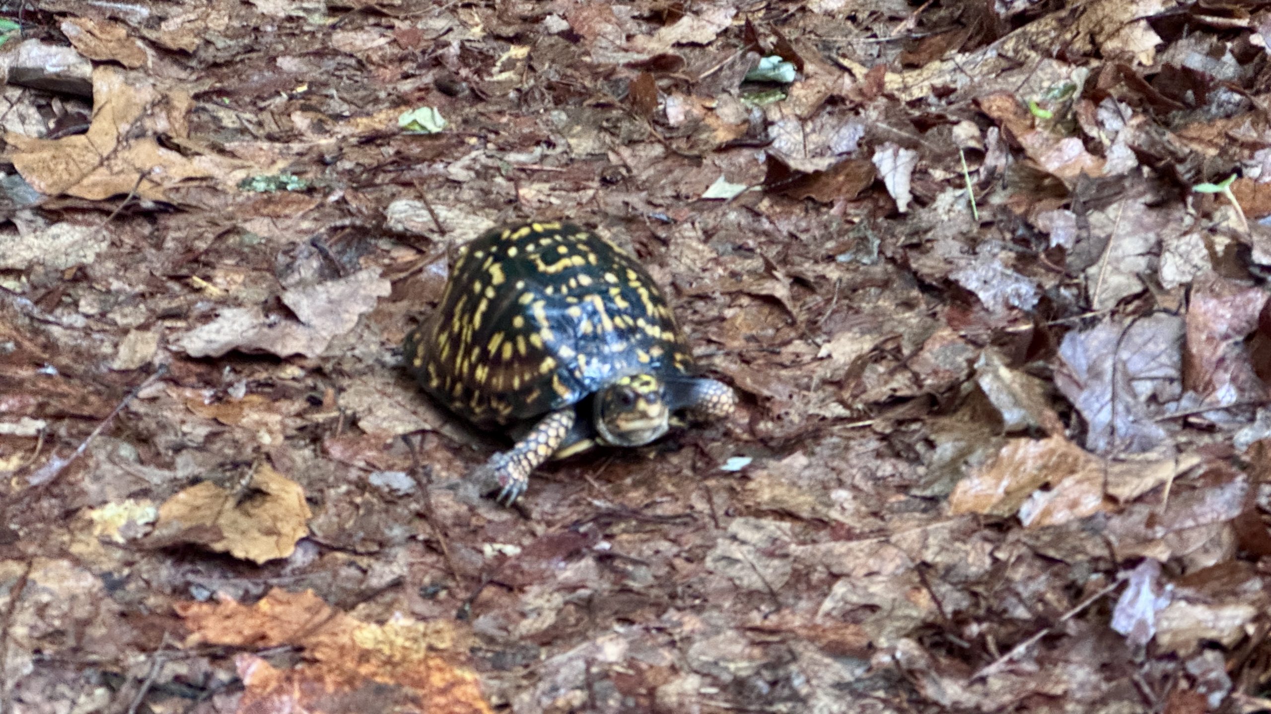
A box turtle walks the Appalachian Trail.
View from the road near Blackhorse Gap.
View from the road near Blackhorse Gap.
View from the road near Blackhorse Gap.
View from the road along the Blue Ridge Parkway.
View from the road near Peaks of Otter.
Return to Mountain Cove
The unpleasantness of the situation was at least a good motivation to move at a fast pace towards my camp. I had decided I wanted to spend another night near the Cove Mountain shelter. Instead of carrying 2 liters of water up the mountain I decided to carry only one. This morning I had enough water left over and had to drink almost a liter before leaving. I figured I could finish dinner and breakfast with 1 liter and then walk down the mountain to Jennings Creek to filter more.
Finishing my hike at Cove Mountain exceeded my expectations considering a storm stopped me for about 30 minutes. Somehow, I had still managed to cover just under 45 kilometers. I didn’t feel like I had done that much, the road hike may have saved me a small amount of wear and tear that I would have felt along the way.
Going up the south side of Cove Mountain was much easier than going up the north. I also had less food and water in my backpack. When I got to the shelter, I could see that I was the only person there, so I took over the picnic table, picked a spot for my tent, and then had dinner. It was just before dawn and I knew Buchanan Overlook was just a two-minute walk away. I walked to the viewpoint to watch the sunset and put the finishing touches on today’s blog. Tomorrow would be a less than 19 mile hike back to the van with a fairly light backpack. I’m considering a short out-and-back hike near the James River to shave a few miles off my itinerary for Friday and Saturday. Ideally, I could have a few hours free on Saturday to drive into town for an evening treat and prepare my blog posts for publication. That would create more downtime on Sunday. First things first, I need to fall asleep and hope I get lucky again and it doesn’t rain during the night.
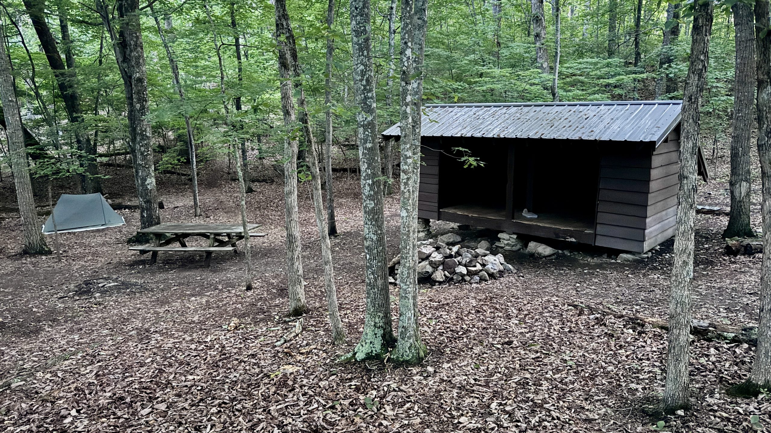
The only camper at the Cove Mountain Shelter.
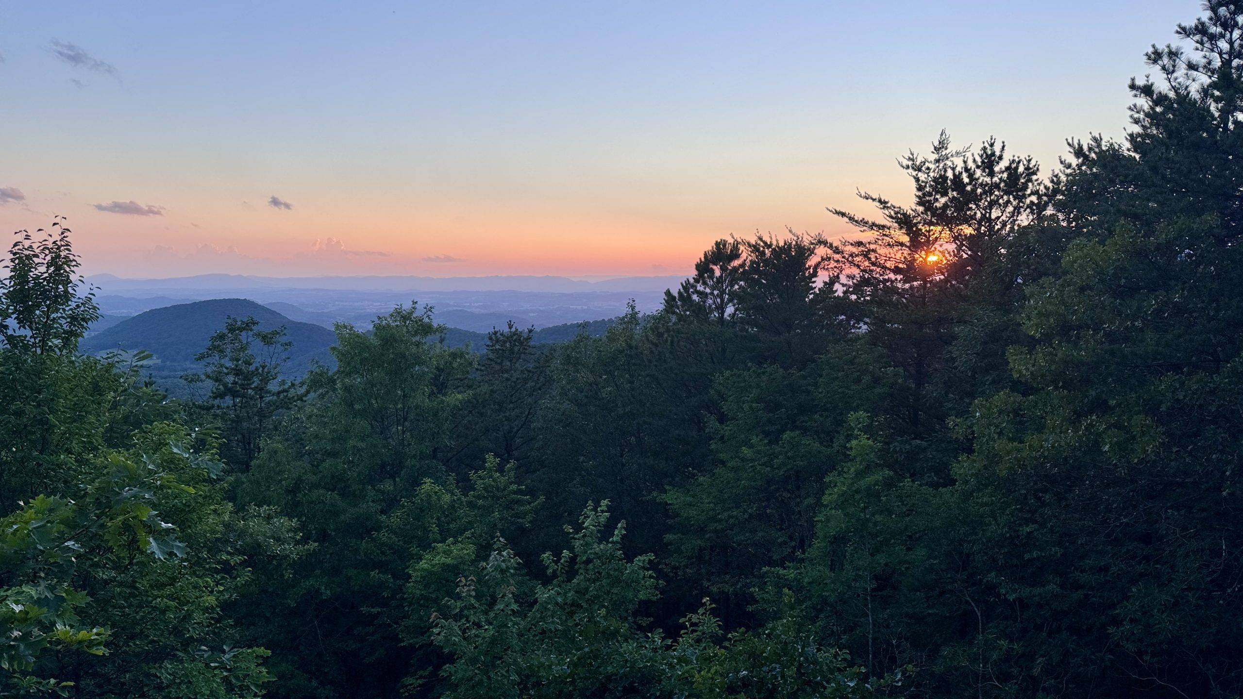
Sunset at Buchanan Lookout.
-See you tomorrow
| Leg | Begin | Mile | End | Mile | Ascent | Decline | Address |
|---|---|---|---|---|---|---|---|
| 1 | Camping MM 756.3 | 756.3 | Wilson Creek Shelter | 742.3 | 2,488 | 2,631 | THE ROOM |
| 2 | Wilson Creek Shelter | 742.3 | Cove Mountain Shelter | 756.1 | 2,577 | 2,474 | NOBO |
Total: 27.8 miles, 57,532 steps
- Hike type: Backpacking
- Camp: Tent, Mountain Shelter Coverage
This website contains affiliate links, which means The Trek may receive a percentage of any products or services you purchase using links in articles or advertisements. The buyer pays the same price they would otherwise pay, and their purchase helps support The Trek’s ongoing goal of bringing you quality backpacking information and advice. Thank you for your support!
For more information, visit the About page of this site.
:max_bytes(150000):strip_icc():format(jpeg)/James-Marsden-Jack-Marsden-Macallan-061626-9a55b89725f04222885715bb999eedee.jpg?w=238&resize=238,178&ssl=1 "James Marsden y Son Jack, de 25 años, hacen una rara aparición juntos en su primera colaboración de marca conjunta")


:max_bytes(150000):strip_icc():format(jpeg)/James-Marsden-Jack-Marsden-Macallan-061626-9a55b89725f04222885715bb999eedee.jpg?w=100&resize=100,75&ssl=1 "James Marsden y Son Jack, de 25 años, hacen una rara aparición juntos en su primera colaboración de marca conjunta")


:max_bytes(150000):strip_icc():format(jpeg)/celebrity-couple-split-061626-00d4cc022db24c259e5f0777ccbd2739.jpg?w=100&resize=100,75&ssl=1 "8 parejas de famosos que se separaron tras 30 años juntas")