
The Great Smoky Mountains National Park is the most visited national park. Located on the border of North Carolina and Tennessee, it is home to the third highest mountain east of the Mississippi and is home to the greatest biodiversity of any national park. From the natives who have lived in the area for centuries to the settlers who made it their home, these mountains are steeped in history.
“Don’t give up backpacking”: an ordinary hiker and my first Trail Angel.
The Plan
61.24 miles 10,102 feet elevation. Seven days of walking, but the first and last would be mainly travel days. Our five main days would average 12 miles per day. The trail would include parts of the Benton Mackaye Trail and the Appalachian Trail. I’m using this to test myself and see what I can do comfortably. I don’t want to sign my body up for miles it can’t yet cover, but I also don’t want to carry unnecessary weight by doing more days just because my mileage is too short. It will just be me and Side Miles, as 2 Speed has decided he will no longer be joining us.
The walk
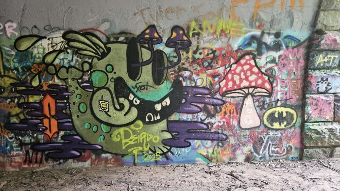
The first day started with an 8 hour drive to Bryson City from Nags Head. I got the idea that I’m basically driving the Mountains To Sea trail in reverse. We arrived in Bryson City around 6pm and had dinner. After going up the Road to Nowhere, a road once promised to locals when the Fontana Dam was built to replace the old road that was going to flood. The path ends at a tunnel that had been dug through the mountain, with about 100 meters of path on the other side. This tunnel is the beginning of our trail. Inside the tunnel there are tons of Graffiti. In the past when I walked through this tunnel I saw a lot of really interesting artwork labeled on the wall. This time most of it has been covered up by sloppy labeling. We went down to the Lower Forney Creek campground, set up the tents and went to bed.
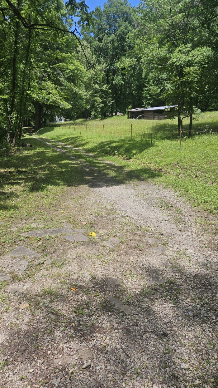
The second and third day we followed the Lake Shore Trail. Quite quiet and contrary to the name, the lake shore is not where you walk. Instead, you are several hundred meters away at all times from the lake, so there are no views. The only fauna worth mentioning was a young rattlesnake and a copperhead. On the third day our lunch spot ended up being the old abandoned town of Proctor NC. It started out as a small farming village before the logging company came, turning it into a small boom town and it became a small farming community again after they left. The flooding of the valley by the Fontana Dam and the lack of a road to the city caused it to gradually disappear. From there we had several nice easy miles following the creek to an old railroad line. The last kilometer was an old forestry road.
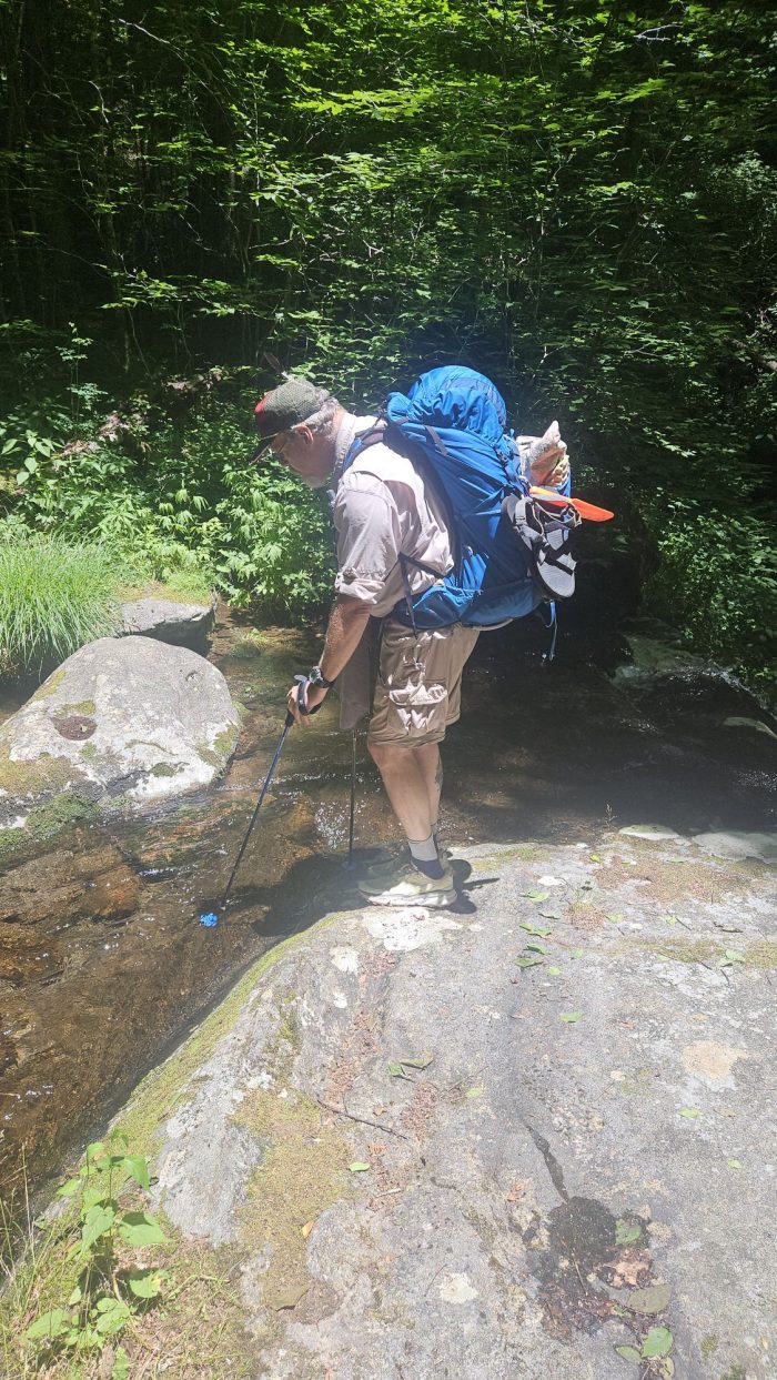
Fourth day, the climbing day. The day started similar to how the last day ended, but it changed quickly. Turns out this trail had a lot of wet crossings. We lost count around the tenth of the day. The first three were close together, so I put on my water crossing shoes and walked in them for about 0.2 miles. The fourth had a bridge so there was hope, until the fifth didn’t. The time it took to change my shoes was too much, so I decided to just splash around. My now waterlogged boots felt twice as heavy on my feet and the trail began to become very thick and overgrown. The nettle was so bad in some places. We finally finished Hazel Creek and began the mile long climb up 1000 feet to Welch Ridge. Surprisingly, this would be the best part of my day. The climb itself wasn’t too hard and went by quite quickly. The ridge, on the other hand, was exactly as I remember it from 2 years earlier, after having climbed the other side. What starts out as a nice trail soon becomes filled with blackberries so thick that you have to physically separate them as you walk along them. We finished the day with 2 guys doing an AT section.
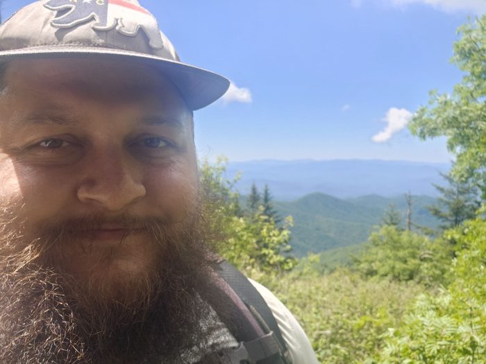
A short day for our fifth day after all the climbing yesterday, we started with, you guessed it, more climbing. This time it’s to Kuwahai, formerly known as Clingmans Dome. The only difference is that this one is on the Appalachian Trail, and anyone who has hiked that trail knows that it is direct. We stopped at the Doulble Spring shelter where we met Firewalker, a fellow AT class thruhiker of the 23rd, now a Trail Ambassador. We sat and talked with him for way too long, but it was worth it. After climbing the cutoff trail, we both decided not to go to the top because it would probably be crowded and we had both been there before. As we go down the cutting path we see a lot of freshly cut grass…. So they do have herbicides! We had lunch next to the gift shop on soft, freshly cut grass and talked to a few people. On our way to the Forney Creek Trail, we see some of the park team who were doing maintenance and talked to them about our experience with Welch Ridge. They told us “good news, that is on the agenda….For the summer of 2027.” Fair enough, I guess. They are still fixing trails damaged by Hurricane Helene. We thank them for their work and descend to our camp to spend the night. We found several prices for railroad rails and some thick steel cable.
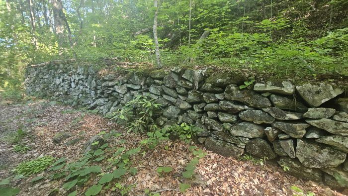
Our last planned full day in the Smokies is downhill *wink wink*. To our surprise, it is another cruise walk along an old railroad track. We see a lot of cool stone retaining walls and discuss a lot of nerdy things about trains. There are some bridges over the small streams, but the large ones are wet crossings, at least knee-deep in places. At our planned lunch spot, we decided to save a few miles by just walking today, since we are making up the miles quickly and can make the 6 hour trip today. This also means Bojangles for lunch! The walk is good, but when I enter the tunnel, my legs are ready. Echoing through the tunnel, my feet drag along the entire path. We got to the car and it was all over.
This website contains affiliate links, which means The Trek may receive a percentage of any products or services you purchase using links in articles or advertisements. The buyer pays the same price they would otherwise pay, and their purchase helps support The Trek’s ongoing goal of bringing you quality backpacking information and advice. Thank you for your support!
For more information, visit the About page of this site.
:max_bytes(150000):strip_icc():format(jpeg)/the-way-home-61-10292024-0f396958729a488da940cc789631d540.jpg?w=238&resize=238,178&ssl=1 "¿Por qué termina “El Camino a Casa”? En la decisión de detener el drama después de 4 temporadas")

:max_bytes(150000):strip_icc():format(jpeg)/Christine-Kesteloo-and-husband-041026-d7f17944ab5b4af897b34cd002ad8772.jpg?w=238&resize=238,178&ssl=1 "No lleves estos artículos en un crucero: un experto que vive en el mar la mitad del año revela qué llevar en su lugar")

:max_bytes(150000):strip_icc():format(jpeg)/the-way-home-61-10292024-0f396958729a488da940cc789631d540.jpg?w=100&resize=100,75&ssl=1 "¿Por qué termina “El Camino a Casa”? En la decisión de detener el drama después de 4 temporadas")


:max_bytes(150000):strip_icc():format(jpeg)/Christine-Kesteloo-and-husband-041026-d7f17944ab5b4af897b34cd002ad8772.jpg?w=100&resize=100,75&ssl=1 "No lleves estos artículos en un crucero: un experto que vive en el mar la mitad del año revela qué llevar en su lugar")

