
Leaving Kennedy Meadows was bittersweet. The team, food and overall atmosphere were without a doubt top notch. We arrived at 9:00 am the day before yesterday, enjoying a pleasant and long “nero” that took us to the “zero” day that we took yesterday. It gave us the perfect opportunity to catch up with our trail friends and make our plans for the Sierra.
Kennedy Meadows South really feels like a base camp for the Sierra, much like Mount Everest Base Camp. There is a fantastic general store for supplies, a kitchen that stays open until the last hiker is well fed, an outdoor terrace with picnic tables, showers and flushing toilets. We spent hours eating, sharing great conversations with new hikers, laughing, and taking a much-needed break from the daily routine of hiking.
To top it off, the KMS team prepares an all-you-can-eat pancake breakfast. They serve pillowy, plate-sized delights loaded with blueberries and a pool of syrup, which we devour with gusto every morning. And the food didn’t end there; everyone seemed to eat fries, hamburgers and rolls all day long; the KMS team basically waited on us hand and foot from dawn to midnight trekkers.
This has easily been the biggest highlight of our trip so far. We send our deepest thanks and love to the staff for all they do for the hiking community. It is a feeling that cannot be expressed in words, but your genuine kindness has completely renewed our spirits.
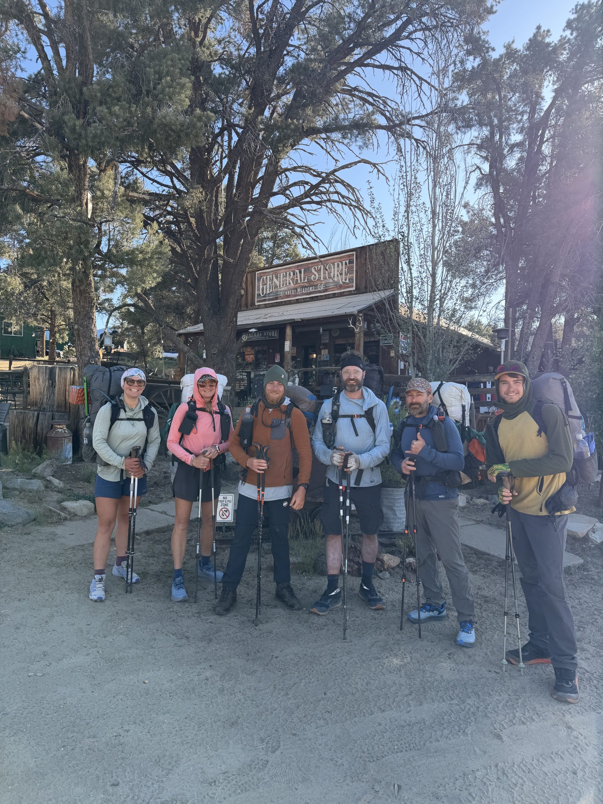
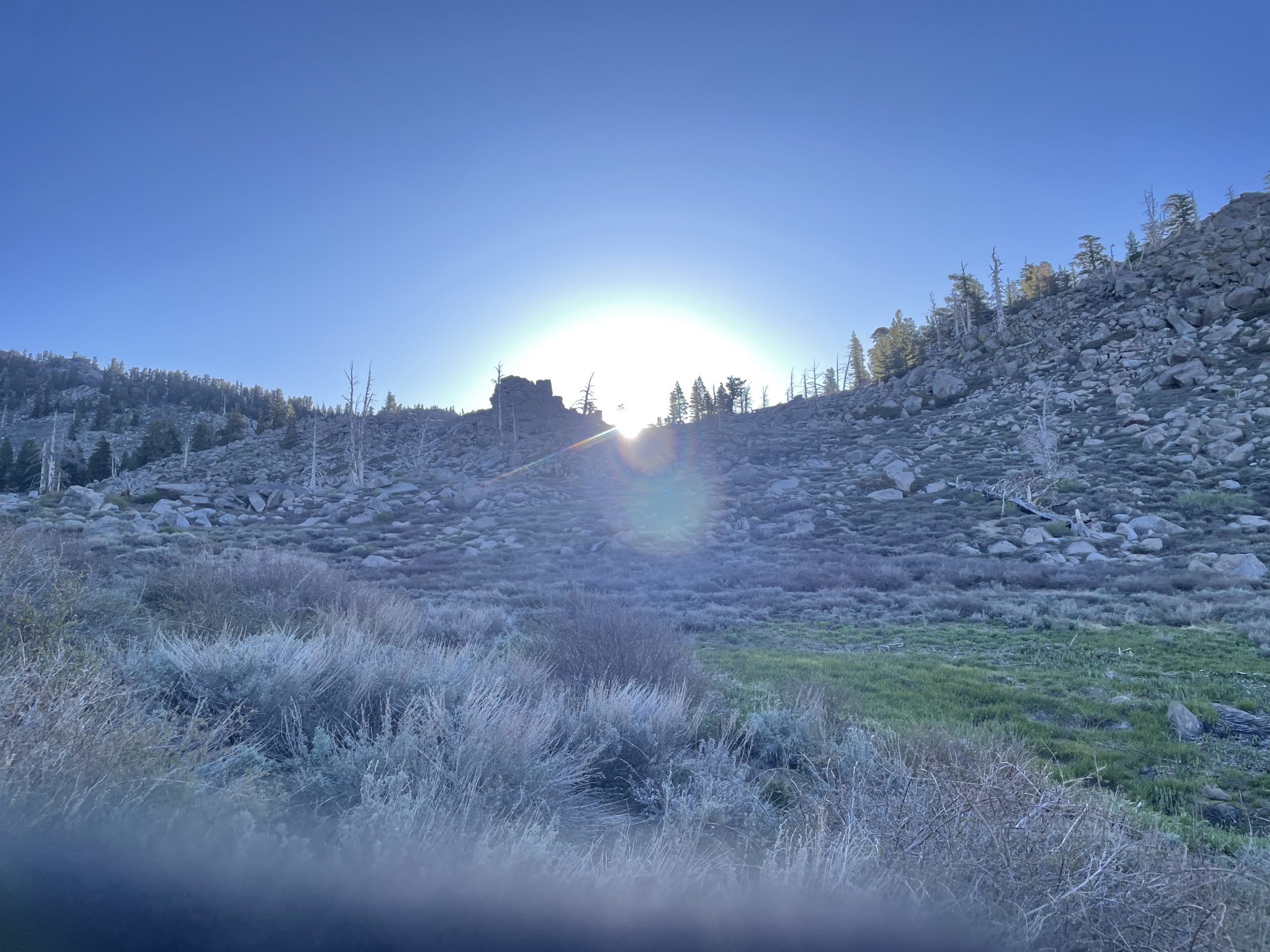
With super fresh legs and seven days’ worth of food packed neatly into our bear cans, we officially left the comforts of base camp at 8:00 a.m. Our team (Cupid, Ghost, Olive Oil, Pistol, NoCaffeine, and I) left with a final pack weight of 32 pounds for NoCaffeine and 35 for me. There was a buzz of nervous energy in the air; Some of us were openly anxious, and I think most of us harbored at least a little apprehension about what awaited us. But under a bright, absolutely cloudless blue sky and warm 60° sun, we set out for a 19-mile day.
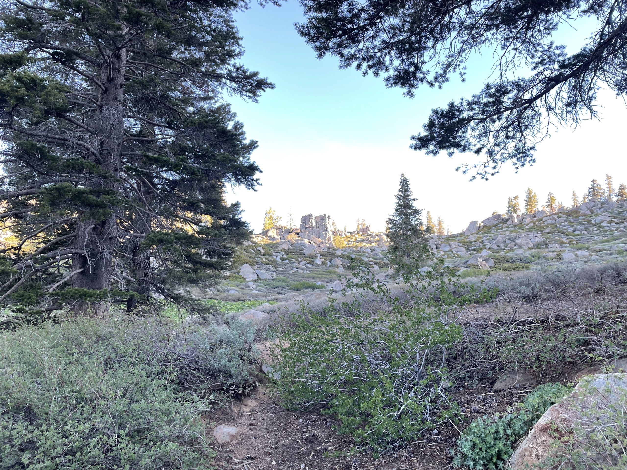
As expected, the landscape began to change, leaving the desert behind, except for the soft, deep sand that was still under our feet. We entered Cow Creek Canyon, where open meadows of green grass and dappled brush stretched as far as the eye could see, and happily rejoined the South Fork Kern River.
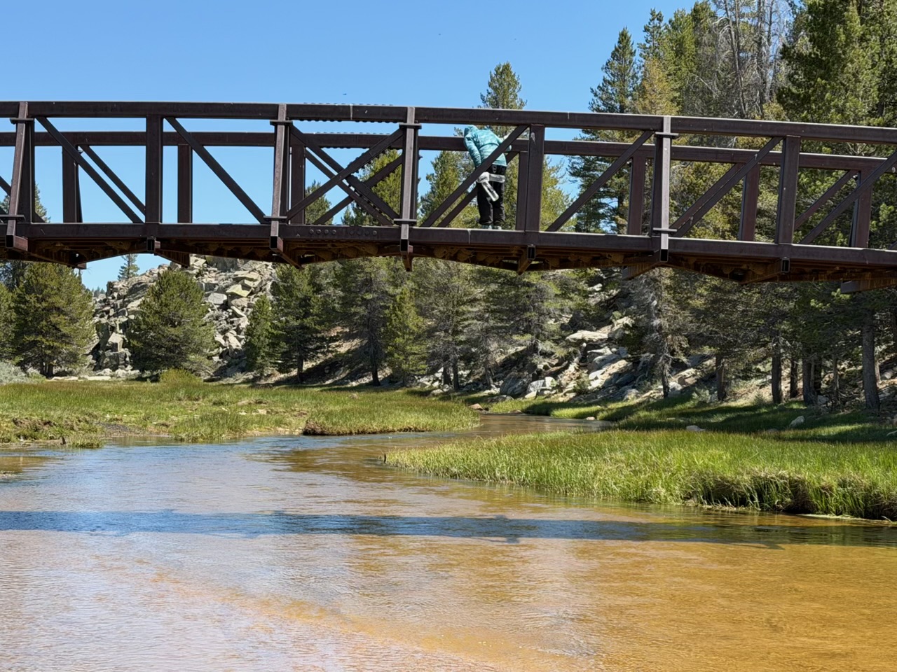
Later we crossed the most beautiful trestle bridge, which curved upward over the water and was filled with hundreds of swallows nesting underneath. On the other side, we all took off our shoes to wash our legs and cool our feet in the cold, refreshing water. Cupid was the only one brave enough to take the full step, while the rest of us completely chickened out.
With only four and a half miles to go, we laced up our shoes and headed back to the trail, drawn by the promise of the trees we’d been eyeing for miles. Water was abundant here; Since we only had to carry one liter at a time, the lack of water weight definitely made up for our heavy food jars, a trade-off we were more than happy to make.
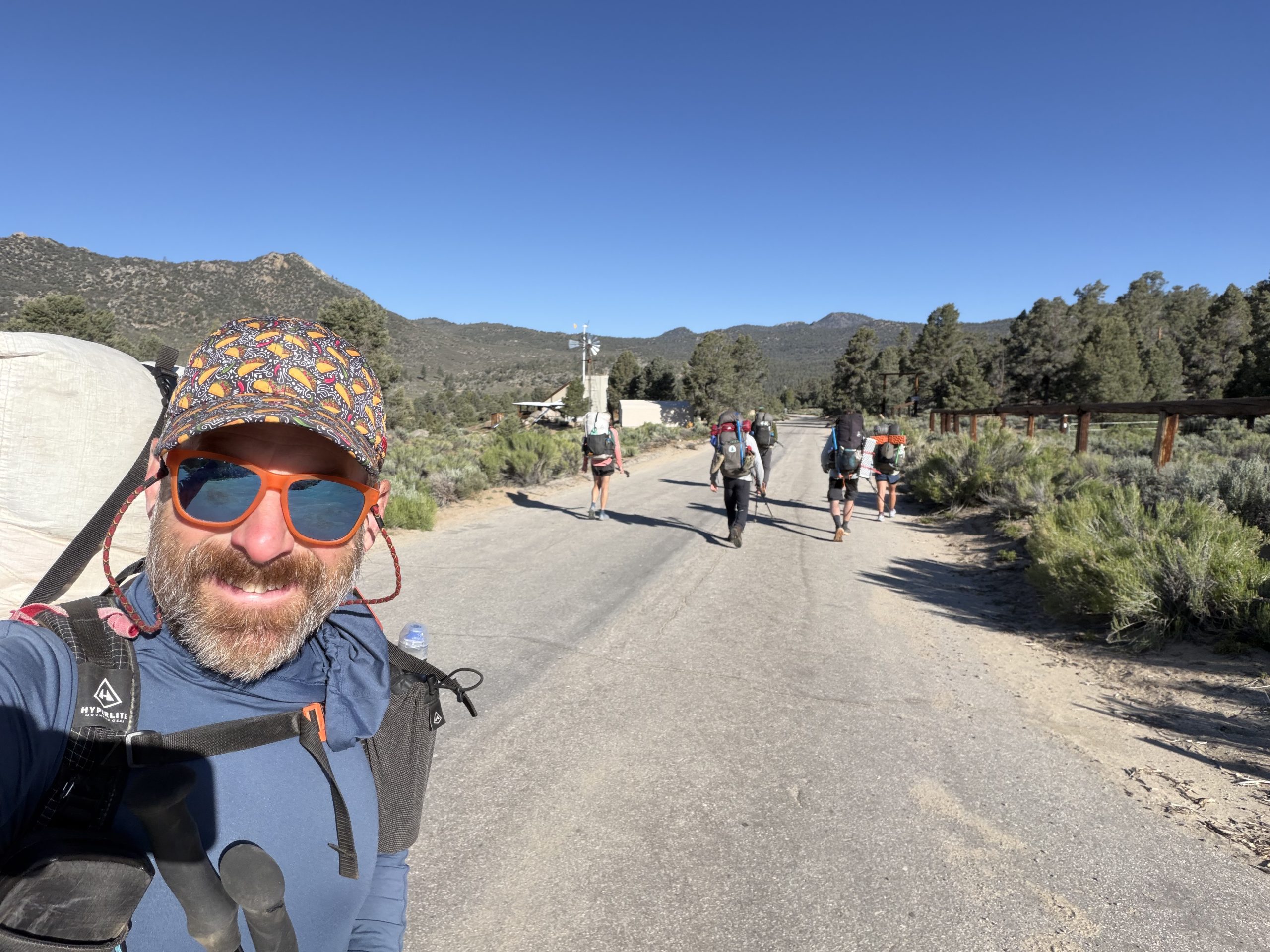
Although our group is made up of fast hikers, we each maintain our own pace. We start the morning together, “do our own hike” during the day, take breaks when we feel like it, and then meet up at camp at the end of the day.
This is exactly how it happened at the base of Olancha Pass. After a full 21 mile day, we stopped for the night, set up our tents, and had dinner together. Having always walked with just the two of us, being part of a group was a completely new and really fun experience. The kilometers flew by and there was never a lack of laughter, thanks entirely to Pistol and Cupid.
By 6:45 pm, the cool evening air had rushed in, causing us to climb into the tent to shelter under our quilts. Knowing it was going to be a frigid night, we put on everything we had: bag liners, mid layers, gloves, extra socks, buffs, and winter hats. With temperatures expected to drop below freezing, we slept with our water filter safely stored inside my bag and kept our thoughts positive, hoping for a warm night’s sleep.
At just over 9,000 feet, the morning sky cleared early. NoCaffeine braved the frigid temperatures to retrieve the bear canisters we had stashed at camp the night before and bring them back to the tent so we could begin our routine. Over a hot latte and a cookie, we began packing for another 21-mile day. It was 31°F and the only thing keeping us warm was the breakneck pace of packing our suitcases.
Our fingers and toes were the first to freeze, but we decided it wasn’t worth the effort to get our HotHands out. Typically, an hour into the walk, the body wakes up, blood begins to flow, and the layers begin to peel.
As we ascended to 10,800 feet, we entered what was easily the most beautiful section of the trail yet. Piles of snow covered the landscape, forcing us to cross them to stay on track. Fortunately, the snow was thick enough for us to cross without making holes: that frustrating experience when the crust suddenly gives way and you sink up to your knees or even your waist. It was all very manageable and although we generally don’t like snow, it was a spectacular sight to see.
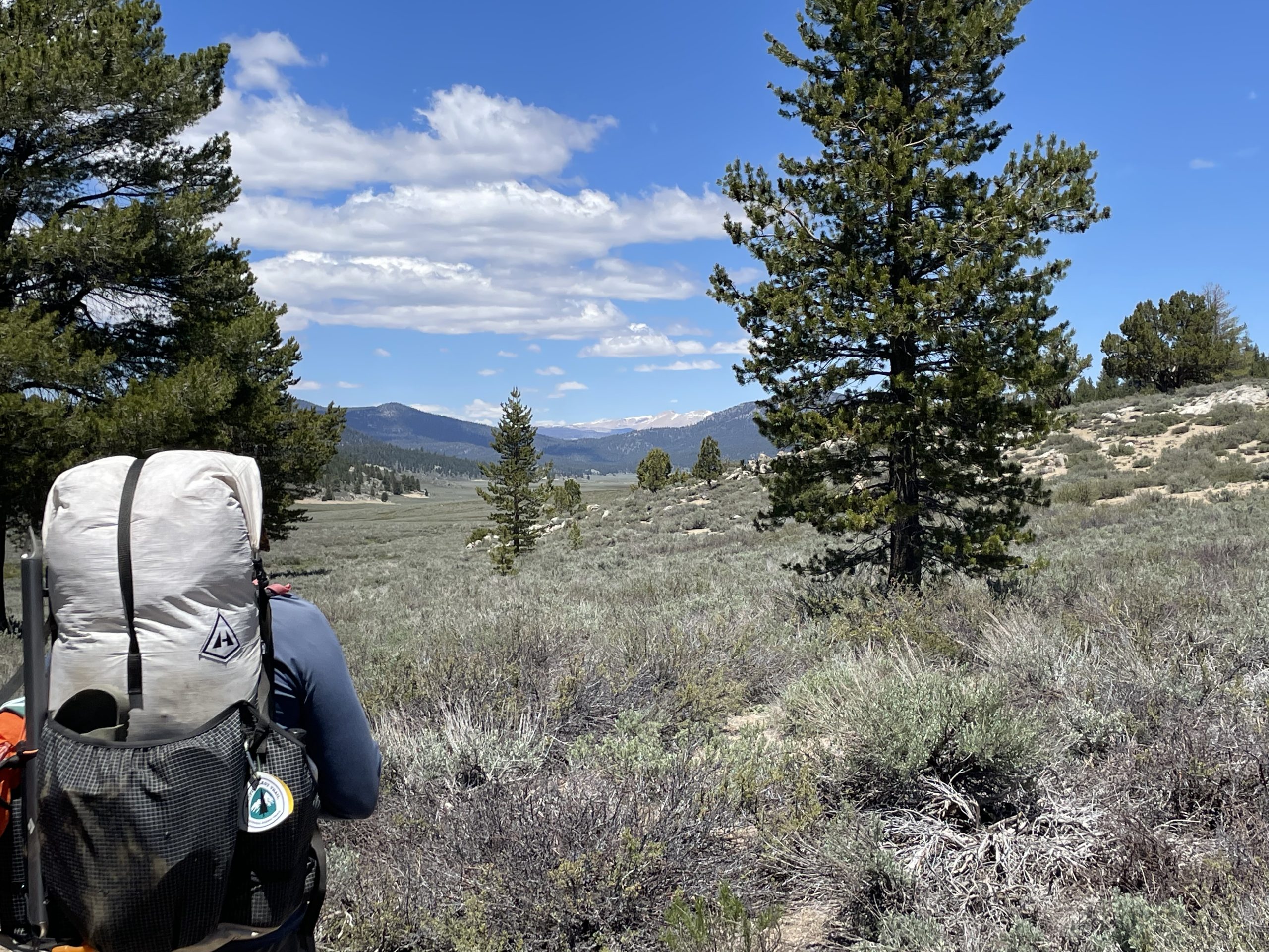
Unfortunately we are still walking on deep sand, which we thought we had left behind in the desert. But if we look closer at the landscape, it makes sense: the mountains here are mostly huge rocky outcrops, like giant rock piles. As those rocks erode over time due to climate, they break down into the very sand we walk on. It means a lot more work for the legs, especially on the climbs.
In the distance, we can make out the jagged profiles of the snow-capped peaks, using Peak Finder. While we won’t be traversing those specific mountains, keeping them in our sights makes every step worth it as we get closer to getting our first view of Mount Whitney.
With the sun now bright and beautiful, and a sky as blue as the ocean, we reached our 7.5 mile mark and did a quick wardrobe change. Starting the morning in shorts under our waterproof pants made the transition quick and easy. Unfortunately, at the first sign of exposed skin, the mosquitoes began to swarm, making bug spray an immediate necessity.
With the bugs kept at bay and our sunglasses on, we traveled another 2.5 miles to reach the halfway point. The terrain from there was absolutely difficult, except for some blowdowns: huge, twisted trees blown by the wind. They slowed us down from time to time as we navigated around them, but otherwise it was a nice, smooth section that allowed our bodies to get used to the new elevation.
We arrived at our first checkpoint of the day, Death Canyon Creek, marking the 10 mile point where we met up with our team for a break. From there, we tackled a five-mile climb that led to what would become the most epic part of our day. Once the trail finally leveled out, we veered off the trail for some additional views.
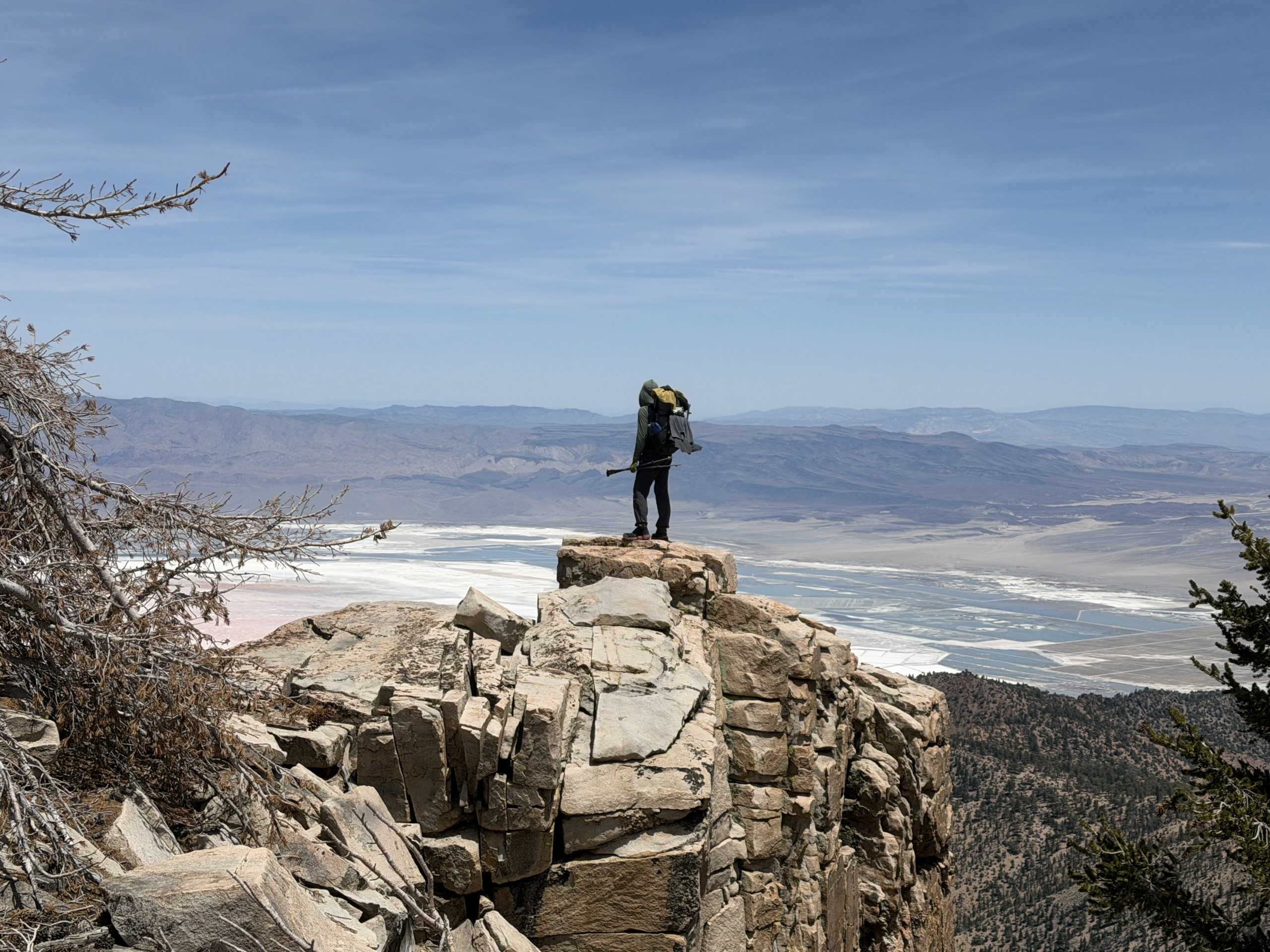
The standout was Owens Valley. Standing on a huge rock outcropping, we took pictures of Owens Lake far below: completely dry, with no water in sight, resembling a vast salt flat. High above us, military fighter planes streaked through the sky, their roar abruptly shattering the peace and tranquility the trail was meant to provide. Since we left Kennedy Meadows South, the relentless noise of airplanes has polluted the wilderness, completely drowning out the sounds of nature and forcing us to work a little harder to find true tranquility. To make matters worse, as we headed back to the PCT, a large drone was buzzing very close to us, making the whole situation seem pretty suspicious.
With only three miles left until camp, a final ‘pack up and refreshment’ break gave us that extra burst of motivation to pick up the pace and push on toward Diaz Creek. Once there, we gathered around the campfire, made dinner, and talked about, well…hiking!
TO BE CONTINUED…

:max_bytes(150000):strip_icc():format(jpeg)/Nathan-Fitzgerald-070526-f39d0a7be8b7406aa164e7bd8a5a03a4.jpg?w=238&resize=238,178&ssl=1 "Un atleta de 27 años recibe atención al final de su vida un día después de un «raro» golpe en la cabeza durante un partido de fútbol australiano")


:max_bytes(150000):strip_icc():format(jpeg)/Nathan-Fitzgerald-070526-f39d0a7be8b7406aa164e7bd8a5a03a4.jpg?w=100&resize=100,75&ssl=1 "Un atleta de 27 años recibe atención al final de su vida un día después de un «raro» golpe en la cabeza durante un partido de fútbol australiano")


