
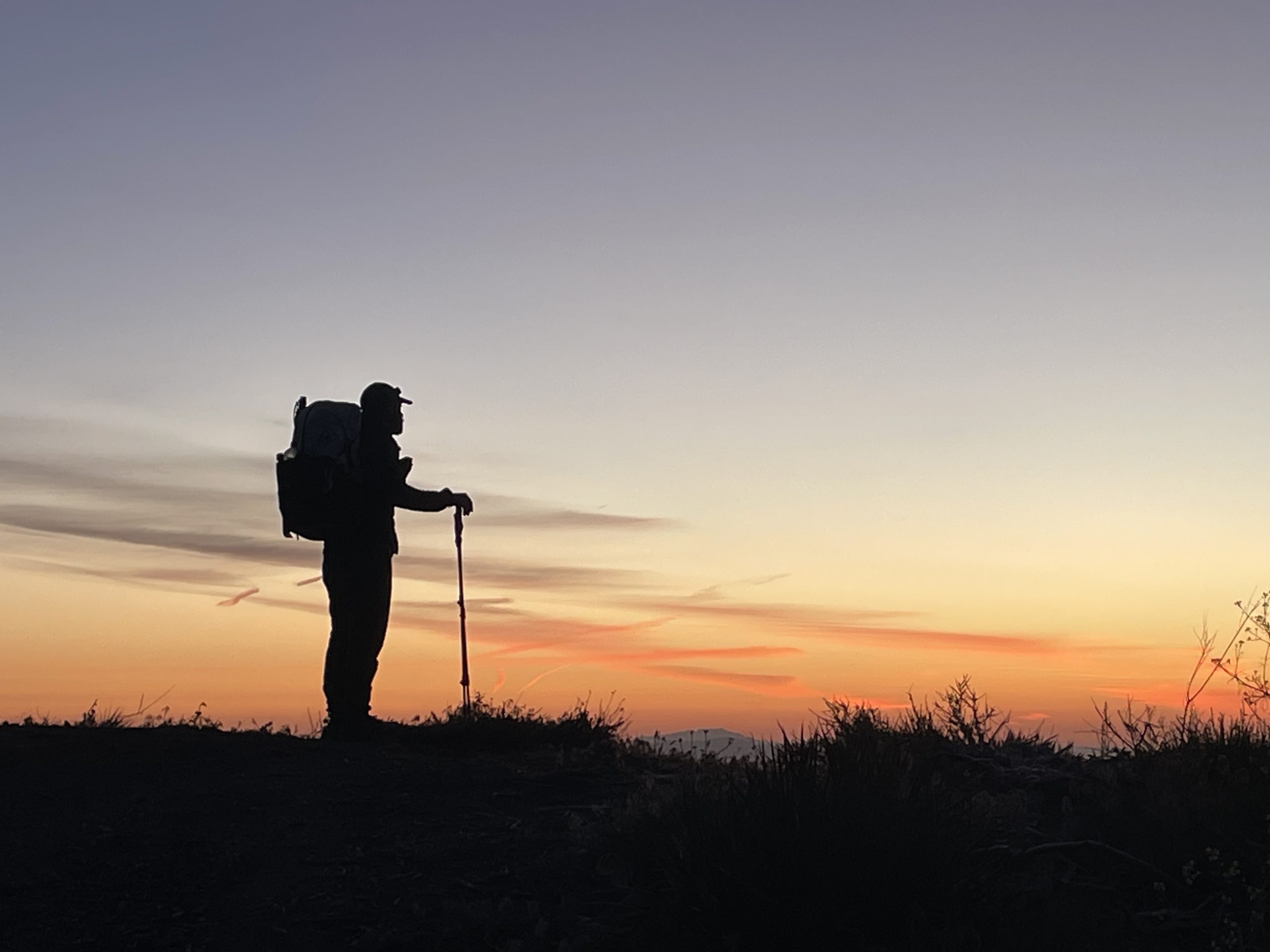
It’s always an amazing feeling to wake up before dawn and start your day before the rest of the world. You hear the birds chirping and then look down from the mountain to see that a completely different world is already awake below.
Early the next morning I woke up and, to my surprise, sat up straight when the alarm went off. Today was a zero/zero day and that was the only motivation I needed. I brushed my teeth, enjoyed those first glorious sips of coffee and put on my warm jacket.
Now fully awake and ready to get to Wrightwood, we turned on our flashlights and left our tent. The entire town of Hesperia, California, lit up like a Christmas tree. Down on the highway, the country’s busiest corridor, traffic was already bumper to bumper, a constant ribbon of white headlights and red taillights, as freight trains went about their usual business.
Despite an early start, the sun came out beautifully from all angles of the trail, making it one of the most memorable mornings we’ve had so far. Still, our legs are definitely feeling it as we begin our fourth consecutive day averaging 26 miles. We are looking forward to taking a little time off to rest our minds and bodies. After this, we won’t take another break until Tehachapi, because the trail towns are incredibly expensive. People often think that the hiking lifestyle is cheaper than living at home, but on the contrary, it is quite expensive.
With just 11 miles left to reach Wrightwood, we found ourselves cruising around the switchbacks and taking a little more time to take in the diversity of the landscape. Then again, maybe we were just stalling because we were in the last 5 miles of a massive 20-mile climb (climbing from 3,777 feet to 8,200 feet) that started yesterday. Looking to the southeast, the snow-capped peaks of the Harwood, Dawson, and Telegraph Mountains felt close enough to touch.
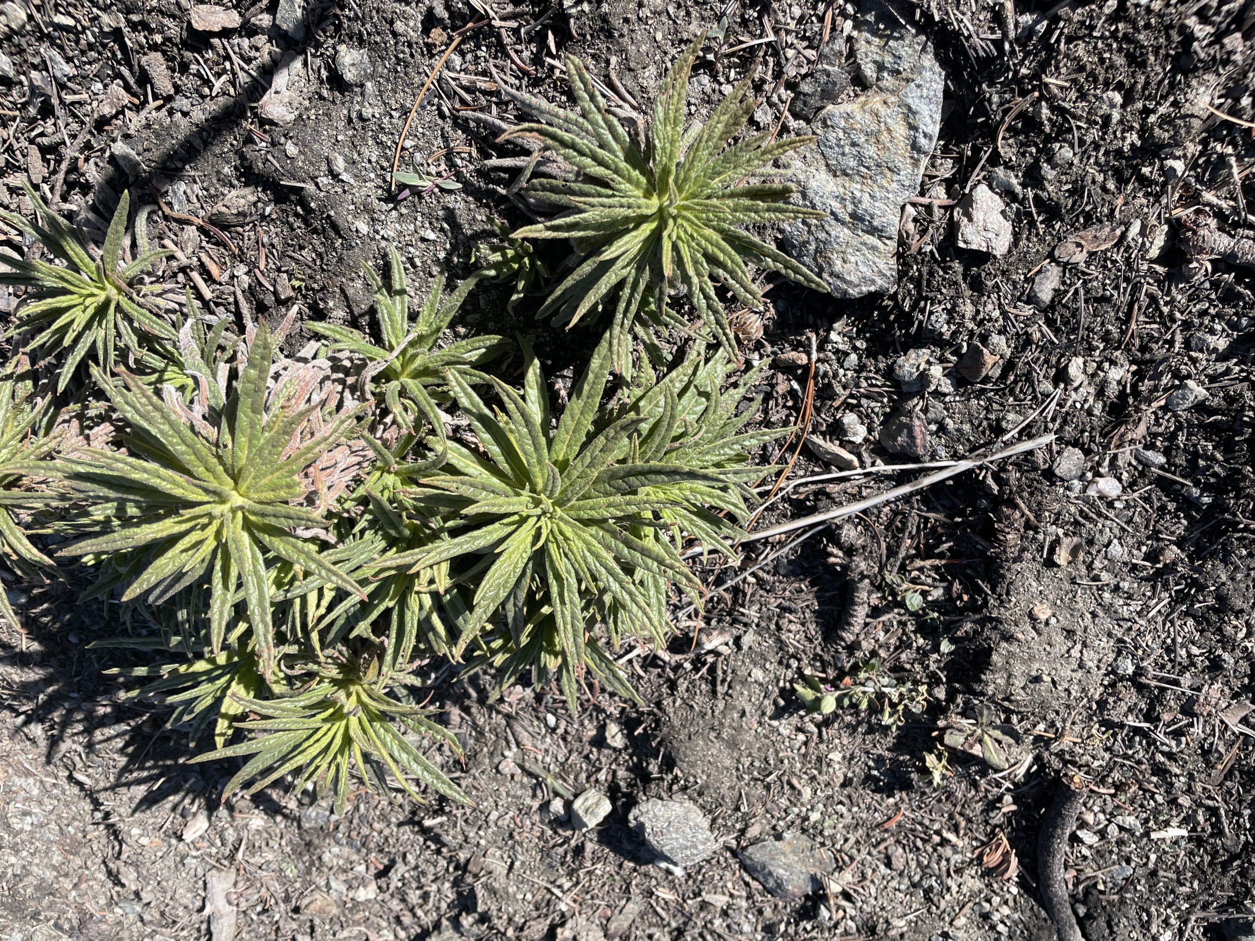
As we approached 2.2 miles into our descent, the cool shade of the towering pine trees felt incredibly refreshing. We simply cannot understand the sheer diversity of this terrain. One minute you’re under the blazing sun with nothing but sagebrush and cacti at your feet; Next, huge trees tower overhead, giving your exposed skin a welcome break from the heat and revealing rare plants visible only if you’re lucky and look.
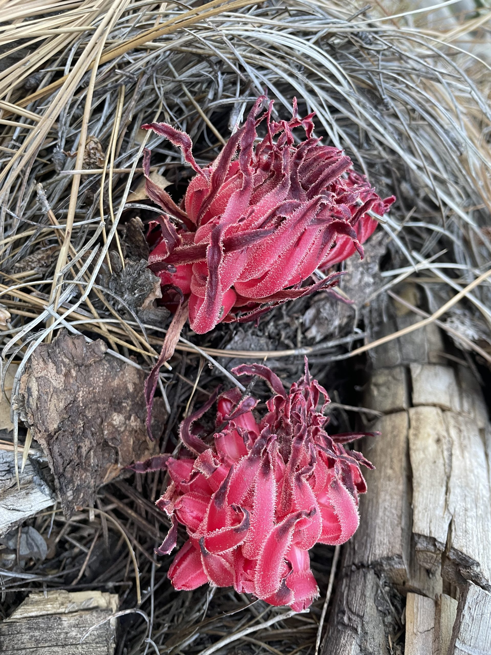
Today we saw our first snow plant. It is a rare, unusual, bright red (chlorophyll-deficient) plant native to western North America. It survives thanks to a fascinating symbiotic relationship between forest trees and fungi, extracting the essential nutrients it needs to live.
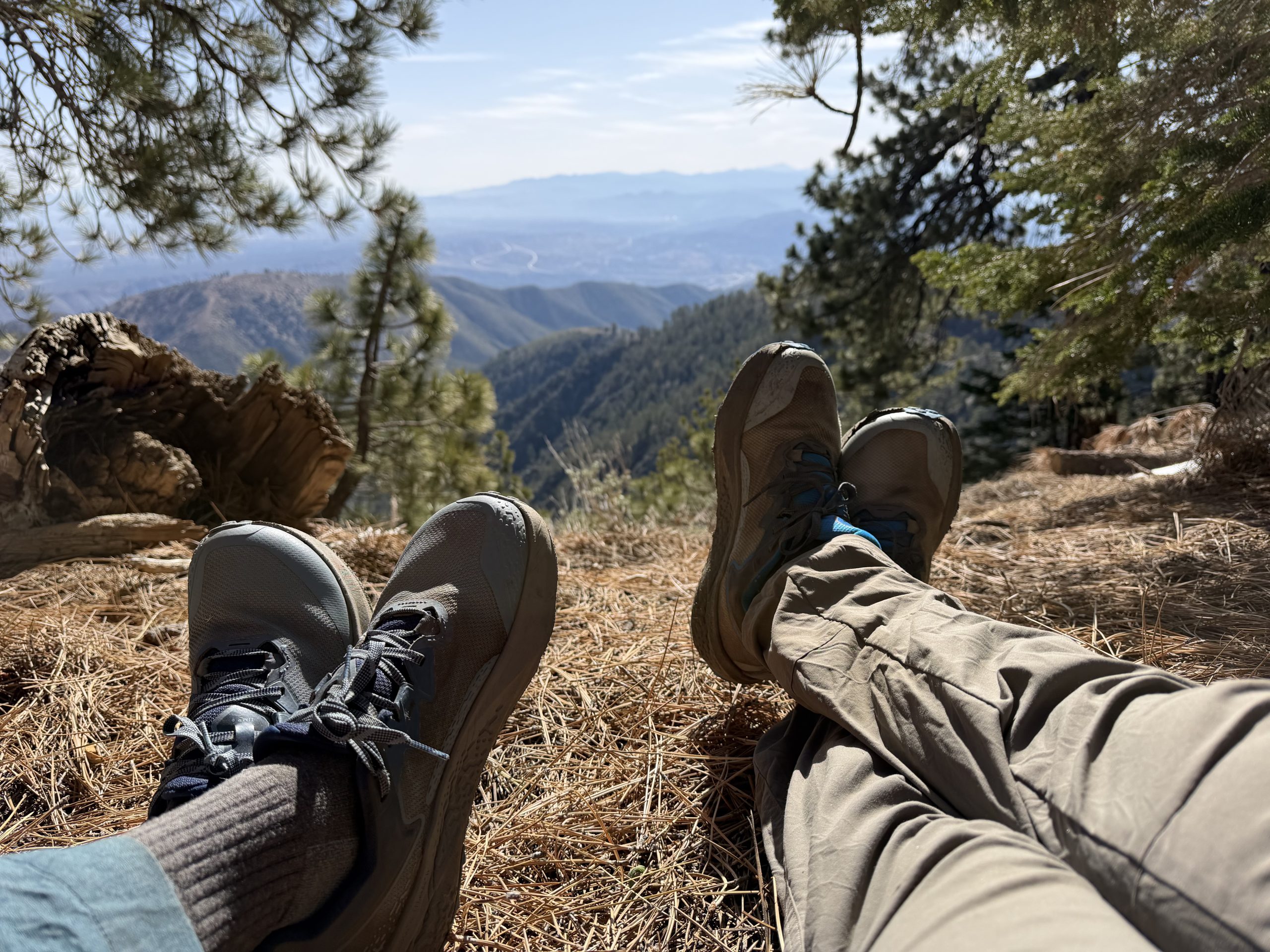
We work every day. Between putting in big miles, blogging and vlogging, it’s a constant juggling act, but we always strive to slow down, take breaks and really look around us. This is the opportunity of a lifetime and we want to remember and appreciate every step of it.
At 7,700 feet, pine needles and huge pine cones from the previous year covered the trail in rich shades of orange and brown, while patches of snow crunched under our feet. Fire-blackened logs from a recent burn dotted the mountainside. These burned trees, some with orange needles still attached to their branches, stood eerily tall, never giving up and serving as nature’s silent reminder to keep going. Soon, we approached our highest elevation yet at Mt. Baldy North Backbone, passing right along the border between the San Bernardino and Angeles National Forests.
We had been warned about the poodle bush on our first day, but we didn’t receive an official introduction until we reached the Acorn Trail. Due to a recent fire and a trail obstructed by landslides, we had to take a one-mile detour on a Forest Service road that ran parallel to the trail. Navigating through the fallen trees, we saw patches of this opportunistic plant, which uses fire to spread its seeds.
Poodle dog bush causes severe contact dermatitis if it touches the skin or anything else, including trekking poles and clothing. Although its oil is not technically poisonous, the resulting rash is usually much worse than that of poison oak. Before flowering, the leaves are long, narrow and pointed in a whorl shape, and emit a strong mint aroma that lingers in the nostrils long after you have passed them. When it finally matures, it displays showy and deceptively beautiful purple flowers.
After rejoining the PCT, we faced a ridiculously steep 0.2 mile push to reach Duffy Campground. From there, we walked a couple of miles through a badly burned area. There were very few trees left standing and those that remained seemed destined to fall before long. A logging operation was in full swing, removing dead wood to mitigate future fire risks. Instead of the forest, the grass and poodle bushes have completely taken over. It’s devastating to see, but it’s also a reminder of the reality that nothing stays the same: nature goes through cycles of destruction to open doors to new life and a new path.
A mile later, we finally reached our highest point of the day at a cluster of satellite towers. From there, the trail became a game of “choose your own adventure.” We wandered over logging remains and excavator tracks through open spaces, with no visible path and no option but to navigate strictly according to our Garmin maps.
Knowing we only had about two miles left to go, finding our way through the chaos became incredibly frustrating as we skirted the ski area towards Inspiration Point.
After an incredible “zero sandwich” (a nero, a zero, and a nero), we return to the trail right where we left off at Inspiration Point. The locals in Wrightwood are beyond friendly, incredibly helpful and a pleasure to meet.
When we arrived two days ago, our first stop was Mountain Hardware, which is anything but a hardware store. It’s the hub locals go to for just about everything: camping and hiking gear, gardening supplies, paint, and even a UPS store, all under one roof. I was able to trade in my Altra Lone Peak 6s, which had started to fall apart after just 20 miles out of Idyllwild. The staff even helped me print the return label and tape the box to send it back to REI. From there, we went to the post office to advance one of our resupply boxes, since we had a little more food than anticipated. We shipped it ahead of time to Tehachapi, where we will regroup and decide whether to use it or send it to its final destination: home.
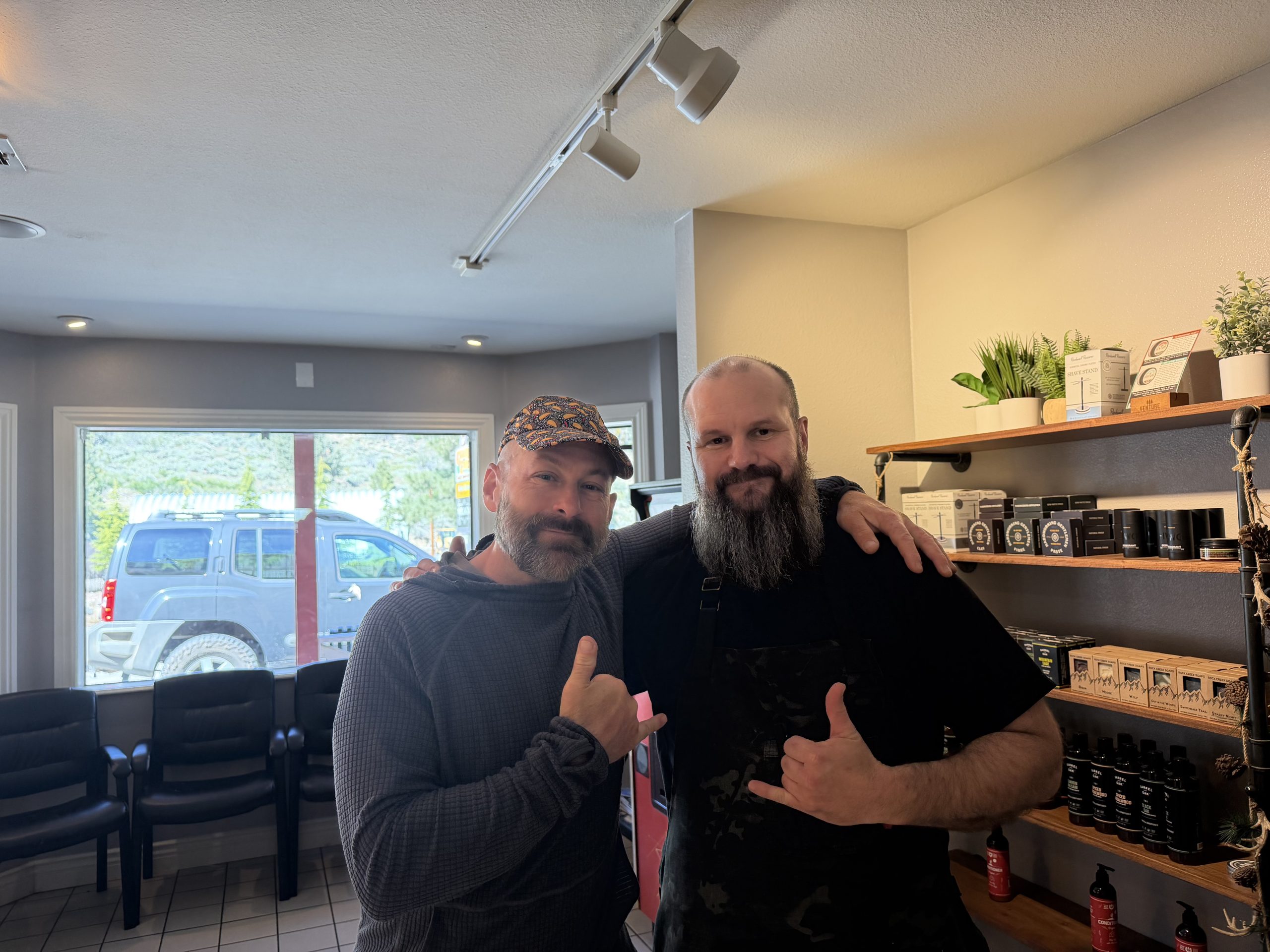
I even got the royal treatment at Big Pines Barber Shop. Thanks Jeremy! You are a true artist and you are talented at what you do. I definitely had my work cut out for me: I was starting to look like Sasquatch.
Our Airbnb was top notch, really! In all the miles from the southern terminal, this has been by far our best accommodation experience. It’s the simple things that make the difference: coffee, unscented laundry detergent, plenty of clean towels, paper towels, a spotless space, and even a sauna, which we enjoyed several times during our short stay. To top it all off, Nikki, who happened to be our neighbor across the street during our stay, quickly ushered us back to the trailhead parking lot.
Now that we’re back on the trail, we feel completely refreshed and ready to tackle Mount Baden-Powell, named after the founder of the Boy Scouts. The summit is reached via a short 0.4 mile round trip trail, which we have been looking forward to for many miles.
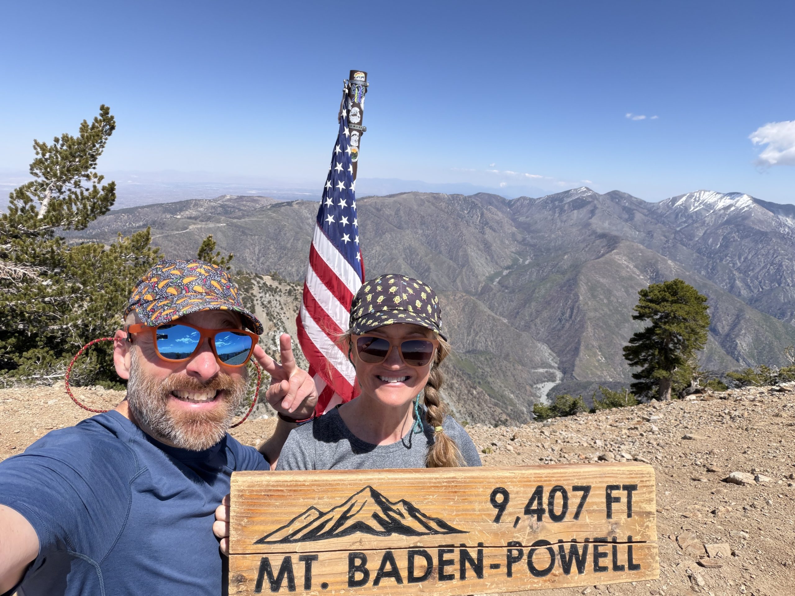
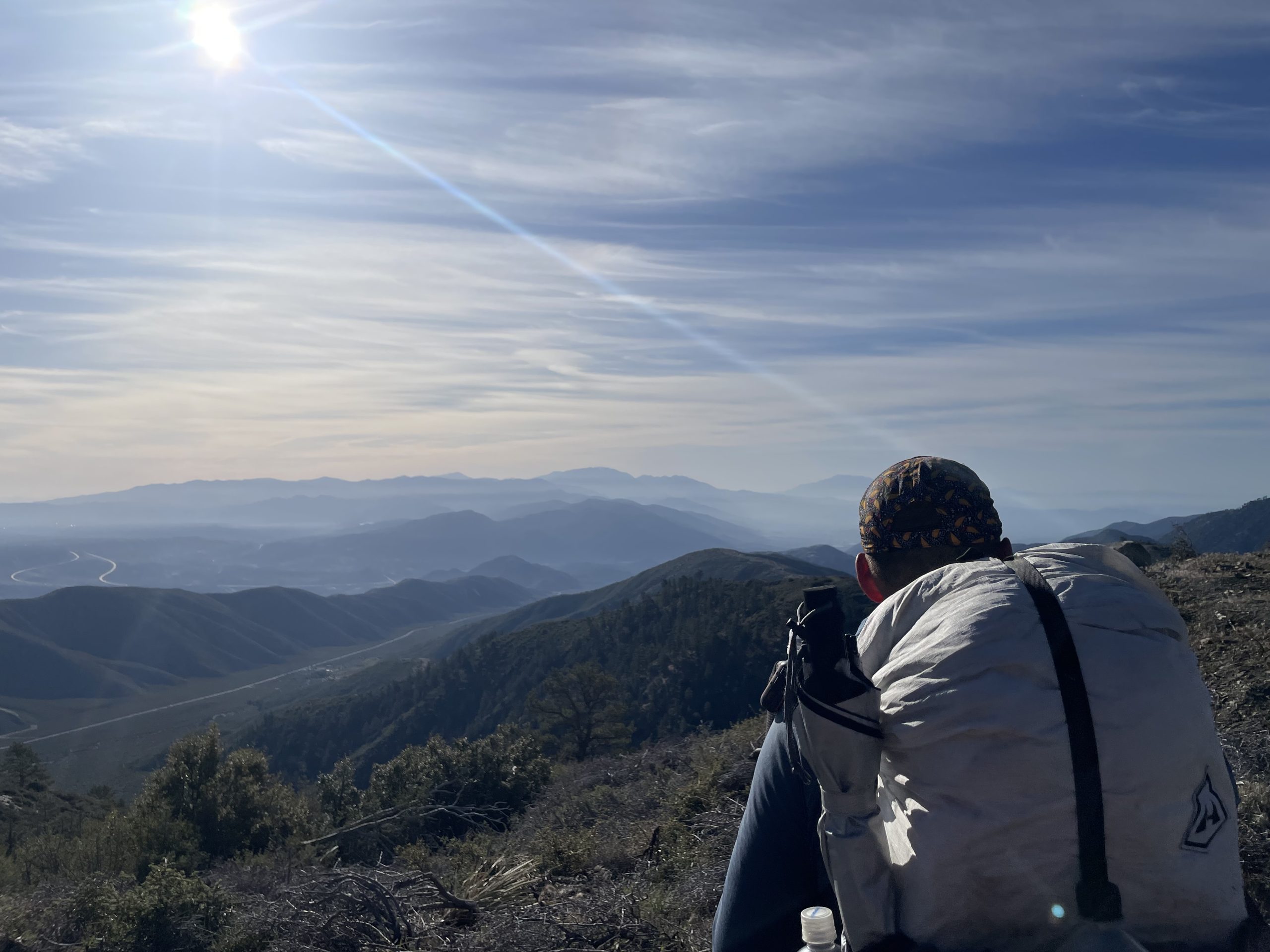
On our way, we stopped at Lamel Springs to fill up on ice cold mountain water. What a delight! The actual road to the summit was barely visible due to the massive drifts of snow covering the switchbacks, so we ended up doing a straight vertical push up the 9,407-foot peak. After a quick selfie and enjoying the panoramic views, we headed towards Mount Burnham. At just over 9,000 feet, it was really cool to bag two 9,000 footers in one day.
From there, we pushed on toward Windy Gap (which turned out not to be windy at all), leaving us just a few miles from our last water source of the day. We stopped at Little Jimmy Springs to refuel, feeling incredibly spoiled by today’s excellent water resources.
Our final stretch took us towards the Islip Saddle rest area. Along the way, the trail was literally non-existent in several sections, forcing us to go down steep ravines and back up only to reconnect with the trail. Loose rocks, quicksand, and multiple landslides made those last two kilometers to camp take much longer than expected.
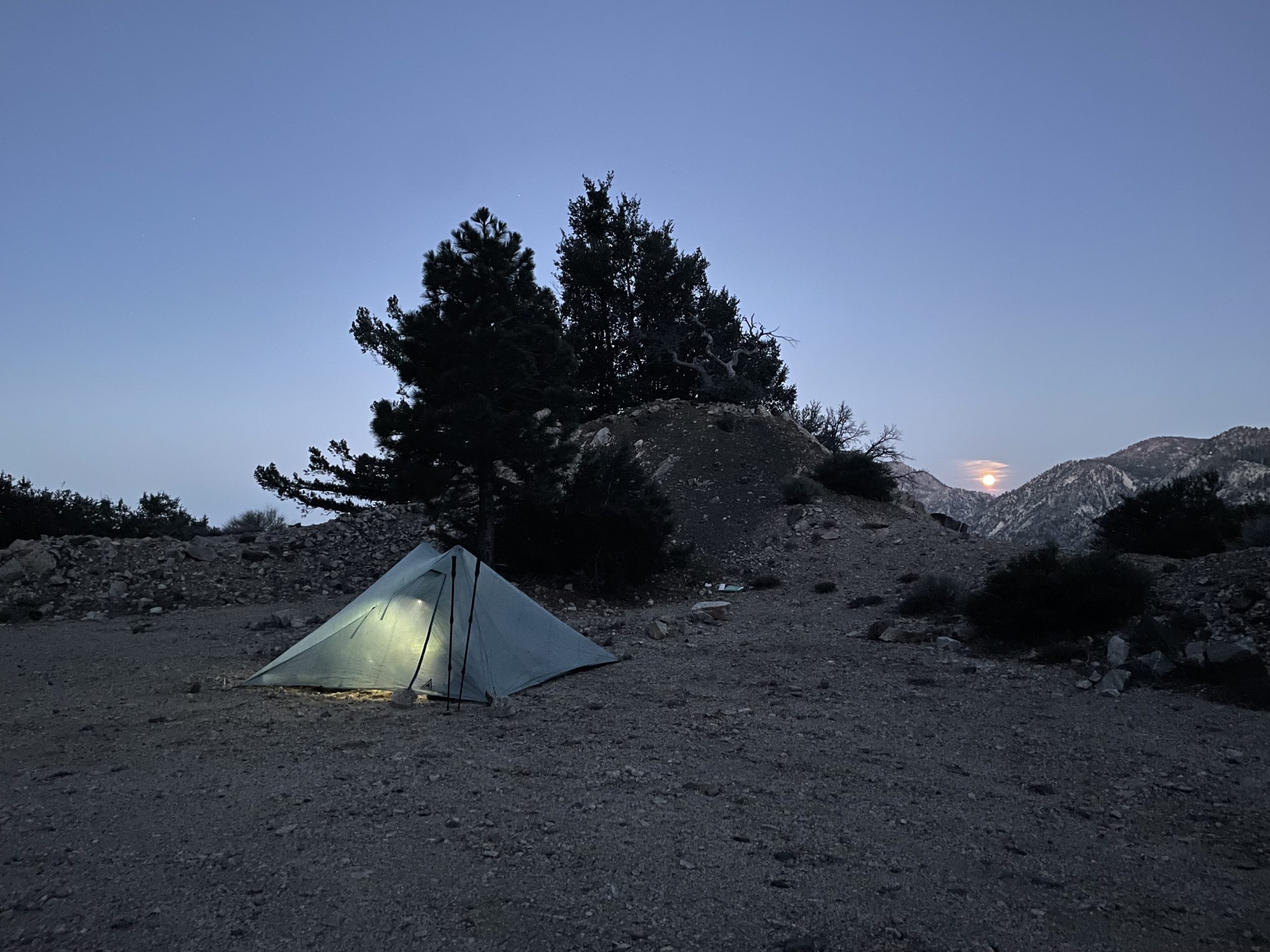
We ended up setting up our tent right on old Route 39, an abandoned highway that you can take directly to Anaheim and West Covina, the city where one of our favorite shows, Crazy Ex-Girlfriend, was set. Our campsite happened to be within a designated rockfall area. After assessing the cliffs, we felt confident that we were safe. That confidence was tested in the middle of the night, however, when we woke up, eyes wide open, to the distinct sound of distant rocks rolling down the cliff and crashing onto the road. Fortunately, we were far enough from the path of destruction that it wasn’t a concern.
In the end, both the sunset and sunrise from the old trail were incredible, and it was definitely better than setting up our tent behind the bathrooms like the other hikers did!
TO BE CONTINUED…

:max_bytes(150000):strip_icc():format(jpeg)/bernard-arnault-kids-1-e98a19c1a8124ecf91e0dfe76ad07a4a.jpg?w=238&resize=238,178&ssl=1 "Los 5 hijos de Bernard Arnault: todo sobre sus hijos y su hija")


:max_bytes(150000):strip_icc():format(jpeg)/bernard-arnault-kids-1-e98a19c1a8124ecf91e0dfe76ad07a4a.jpg?w=100&resize=100,75&ssl=1 "Los 5 hijos de Bernard Arnault: todo sobre sus hijos y su hija")


